 |
|
|
Location &
QuickFacts
|
FAA
Information Effective: |
2008-09-25 |
|
Airport
Identifier: |
8KS4 |
|
Airport
Status: |
Operational |
|
Longitude/Latitude: |
099-21-03.3750W/38-54-18.0410N
-99.350938/38.905011 (Estimated) |
|
Elevation: |
2100 ft / 640.08 m (Estimated) |
|
Land: |
34 acres |
|
From
nearest city: |
2 nautical miles NW of Hays, KS |
|
Location: |
Ellis County, KS |
|
Magnetic Variation: |
08E (1995) |
Owner & Manager
|
Ownership: |
Privately owned |
|
Owner: |
Randy Schlitter |
|
Address: |
4600 Hwy 183 Alt
Hays, KS 67601 |
|
Phone number: |
785-625-6346 |
|
Manager: |
Randy Schlitter |
|
Address: |
4600 Hwy 183 Alt
Hays, KS 67601 |
|
Phone number: |
785-625-6346 |
Airport
Operations and Facilities
|
Airport
Use: |
Private |
|
Wind
indicator: |
Yes |
|
Segmented Circle: |
No |
|
Control
Tower: |
No |
|
Sectional chart: |
Wichita |
|
Region: |
ACE - Central |
|
Boundary
ARTCC: |
ZKC - Kansas City |
|
Tie-in
FSS: |
ICT - Wichita |
|
FSS on
Airport: |
No |
|
FSS Toll
Free: |
1-800-WX-BRIEF |
|
Runway Information
Runway 17/35
|
Dimension: |
1200 x 30 ft / 365.8 x 9.1 m |
|
Surface: |
TURF, |
|
|
Runway 17
|
Runway 35
|
|
Traffic
Pattern: |
Left |
Left |
|
Obstruction: |
60 ft poles, 1800.0 ft from runway |
30 ft trees, 500.0 ft from runway |
|
Radio Navigation Aids
|
ID |
Type |
Name |
Ch |
Freq |
Var |
Dist |
|
HIL |
NDB |
Hilyn |
|
338.00 |
08E |
39.0 nm |
|
LQR |
NDB |
Larned |
|
296.00 |
08E |
43.9 nm |
|
PHG |
NDB |
Phillipsburg |
|
368.00 |
08E |
48.2 nm |
|
HYS |
VORTAC |
Hays |
041X |
110.40 |
10E |
4.9 nm |
|
HLC |
VORTAC |
Hill City |
084X |
113.70 |
08E |
46.0 nm |
Remarks
-
PRVDD MAINTAIN A
CLEAR APCH FOR A 20:1 GLIDE SLOPE & TRANSITIONAL SFC FOR 7:1 SLOPE.
Based Aircraft
|
Aircraft based
on field: |
8 |
|
Single Engine
Airplanes: |
6 |
|
Ultralights: |
2 |
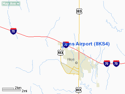
Rans Airport
Address:
Ellis County, KS
Tel:
785-625-6346
Images
and information placed above are from
http://www.airport-data.com/airport/8KS4/
We
thank them for the data!
|
General Info |
| Country |
United
States |
| State |
KANSAS
|
| FAA ID |
8KS4
|
| Latitude |
38-54-18.041N |
|
Longitude |
099-21-03.375W |
|
Elevation |
2100
feet |
| Near
City |
HAYS
|
We don't guarantee the information is fresh and accurate. The data may
be wrong or outdated.
For more up-to-date information please refer to other sources.
|
|


