 |
|
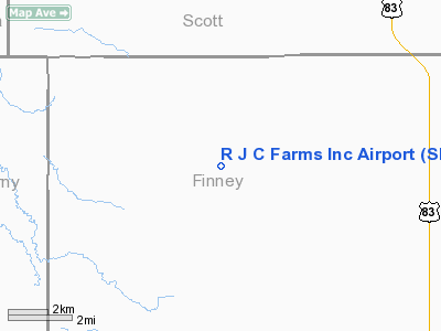
R J C Farms Incorporated Airport |
|
Location &
QuickFacts
|
FAA
Information Effective: |
2008-09-25 |
|
Airport
Identifier: |
SN55 |
|
Airport
Status: |
Operational |
|
Longitude/Latitude: |
101-00-11.5790W/38-12-55.0830N
-101.003216/38.215301 (Estimated) |
|
Elevation: |
2900 ft / 883.92 m (Estimated) |
|
Land: |
0 acres |
|
From
nearest city: |
4 nautical miles SW of Friend, KS |
|
Location: |
Finney County, KS |
|
Magnetic Variation: |
09E (1985) |
Owner & Manager
|
Ownership: |
Privately owned |
|
Owner: |
R J C Farms Inc |
|
Address: |
1605 Grandview Drive East
Garden City, KS 67846 |
|
Phone
number: |
620-275-7881 |
|
Manager: |
Skip Crist |
|
Address: |
1605 Grandview Drve East
Garden City Ks, KS 67846 |
|
Phone number: |
620-275-7881 |
Airport Operations and Facilities
|
Airport
Use: |
Private |
|
Wind
indicator: |
Yes |
|
Segmented Circle: |
No |
|
Control
Tower: |
No |
|
Landing
fee charge: |
No |
|
Sectional chart: |
Wichita |
|
Region: |
ACE - Central |
|
Boundary
ARTCC: |
ZKC - Kansas City |
|
Tie-in
FSS: |
ICT - Wichita |
|
FSS on
Airport: |
No |
|
FSS Toll
Free: |
1-800-WX-BRIEF |
|
Runway Information
Runway 17/35
|
Dimension: |
2200 x 27 ft / 670.6 x 8.2 m |
|
Surface: |
TURF, |
|
|
Runway 17
|
Runway 35
|
|
Traffic
Pattern: |
Left |
Left |
|
Radio Navigation Aids
|
ID |
Type |
Name |
Ch |
Freq |
Var |
Dist |
|
TQK |
NDB |
Scott City |
|
256.00 |
08E |
16.8 nm |
|
GC |
NDB |
Pieve |
|
347.00 |
09E |
26.7 nm |
|
ULS |
NDB |
Ulysses |
|
395.00 |
09E |
41.0 nm |
|
JHN |
NDB |
Bear Creek |
|
341.00 |
10E |
49.2 nm |
|
GCK |
VORTAC |
Garden City |
080X |
113.30 |
11E |
22.1 nm |
Remarks
-
PRVDD THE APCH TO
EACH RWY IS MAINT FOR A MIN 20:1 GLIDE SLOPE, AND THE TRANSITIONAL SFC MAINT
FOR A 7:1 SLOPE.
Based Aircraft
|
Aircraft based
on field: |
1 |
|
Single Engine
Airplanes: |
1 |
R J C Farms Incorporated
Airport
Address:
Finney County, KS
Tel:
620-275-7881
Images
and information placed above are from
http://www.airport-data.com/airport/SN55/
We
thank them for the data!
|
General Info |
| Country |
United
States |
| State |
KANSAS
|
| FAA ID |
SN55
|
| Latitude |
38-12-55.083N |
|
Longitude |
101-00-11.579W |
|
Elevation |
2900
feet |
| Near
City |
FRIEND
|
We don't guarantee the information is fresh and accurate. The data may
be wrong or outdated.
For more up-to-date information please refer to other sources.
|
|


