 |
|
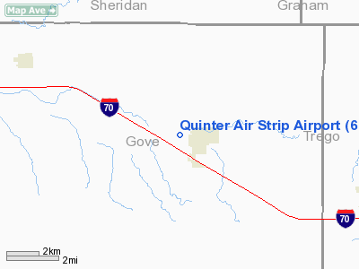
Quinter Air Strip Airport |
|
Location &
QuickFacts
|
FAA
Information Effective: |
2008-09-25 |
|
Airport
Identifier: |
6KS1 |
|
Airport
Status: |
Operational |
|
Longitude/Latitude: |
100-15-01.4800W/39-04-14.0250N
-100.250411/39.070563 (Estimated) |
|
Elevation: |
2681 ft / 817.17 m (Surveyed) |
|
Land: |
0 acres |
|
From
nearest city: |
1 nautical miles W of Quinter, KS |
|
Location: |
Gove County, KS |
|
Magnetic Variation: |
09E (1985) |
Owner & Manager
|
Ownership: |
Privately owned |
|
Owner: |
Dick Sterrett |
|
Address: |
P O Box 340
Quinter, KS 67752 |
|
Phone number: |
913-754-2117 |
|
Manager: |
Dick Sterrett |
|
Address: |
Po Box 340
Quinter, KS 67752 |
|
Phone number: |
913-754-2117 |
Airport Operations and Facilities
|
Airport Use: |
Private |
|
Wind indicator: |
Yes |
|
Segmented Circle: |
No |
|
Control Tower: |
No |
|
Sectional chart: |
Wichita |
|
Region: |
ACE - Central |
|
Boundary ARTCC: |
ZDV - Denver |
|
Tie-in FSS: |
ICT - Wichita |
|
FSS on Airport: |
No |
|
FSS Toll Free: |
1-800-WX-BRIEF |
Airport Services
|
Airframe
Repair: |
NONE |
|
Power
Plant Repair: |
NONE |
|
Runway Information
Runway 18/36
|
Dimension: |
2600 x 75 ft / 792.5 x 22.9 m |
|
Surface: |
TURF, |
|
|
Runway 18
|
Runway 36
|
|
Traffic
Pattern: |
Left |
Left |
|
Radio Navigation Aids
|
ID |
Type |
Name |
Ch |
Freq |
Var |
Dist |
|
OEL |
NDB |
Oakley |
|
380.00 |
08E |
26.5 nm |
|
JDM |
NDB |
Wheatfield |
|
408.00 |
08E |
45.6 nm |
|
TQK |
NDB |
Scott City |
|
256.00 |
08E |
46.4 nm |
|
OIN |
NDB |
Oberlin |
|
341.00 |
09E |
47.5 nm |
|
HLC |
VORTAC |
Hill City |
084X |
113.70 |
08E |
11.4 nm |
|
HYS |
VORTAC |
Hays |
041X |
110.40 |
10E |
47.4 nm |
Remarks
-
LGTD TWR 100 FT
AGL, 200 FT SOUTH, 200 FT EAST OF RY 18.
Based Aircraft
|
Aircraft based
on field: |
4 |
|
Single Engine
Airplanes: |
4 |
Quinter Air Strip Airport
Address:
Gove County, KS
Tel:
913-754-2117
Images
and information placed above are from
http://www.airport-data.com/airport/6KS1/
We
thank them for the data!
|
General Info |
| Country |
United
States |
| State |
KANSAS
|
| FAA ID |
6KS1
|
| Latitude |
39-04-14.025N |
|
Longitude |
100-15-01.480W |
|
Elevation |
2681
feet |
| Near
City |
QUINTER
|
We don't guarantee the information is fresh and accurate. The data may
be wrong or outdated.
For more up-to-date information please refer to other sources.
|
|


