 |
|
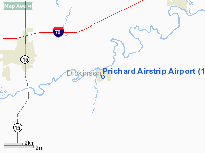
Prichard Airstrip Airport |
|
|
|
Location &
QuickFacts
|
FAA
Information Effective: |
2008-09-25 |
|
Airport
Identifier: |
1KS4 |
|
Airport
Status: |
Operational |
|
Longitude/Latitude: |
097-07-01.0620W/38-54-00.0010N
-97.116962/38.900000 (Estimated) |
|
Elevation: |
1164 ft / 354.79 m (Estimated) |
|
Land: |
69 acres |
|
From
nearest city: |
1 nautical miles S of Enterprise, KS |
|
Location: |
Dickinson County, KS |
|
Magnetic Variation: |
07E (1985) |
Owner & Manager
|
Ownership: |
Privately owned |
|
Owner: |
Guy Prichard Jr |
|
Address: |
501 S Lincoln St
Enterprise, KS 67441 |
|
Phone
number: |
785-263-8940 |
|
Manager: |
Guy Prichard Jr |
|
Address: |
501 S Lincoln St
Enterprise, KS 67441 |
|
Phone number: |
785-263-8940 |
Airport Operations and Facilities
|
Airport
Use: |
Private |
|
Wind
indicator: |
Yes |
|
Segmented Circle: |
No |
|
Control
Tower: |
No |
|
Lighting
Schedule: |
PHONE REQ
FOR LIRL RY 17/35 CALL 785-263-8182. |
|
Landing fee charge: |
No |
|
Sectional chart: |
Wichita |
|
Region: |
ACE - Central |
|
Boundary ARTCC: |
ZKC - Kansas City |
|
Tie-in FSS: |
ICT - Wichita |
|
FSS on Airport: |
No |
|
FSS Toll Free: |
1-800-WX-BRIEF |
Airport Services
|
Fuel
available: |
100LLMOGAS |
|
Airframe
Repair: |
NONE |
|
Power
Plant Repair: |
NONE |
|
Bottled
Oxygen: |
NONE |
|
Bulk
Oxygen: |
NONE |
|
Runway Information
Runway 17/35
|
Dimension: |
1900 x 55 ft / 579.1 x 16.8 m |
|
Surface: |
TURF, Good Condition |
|
Edge Lights: |
Low |
|
|
Runway 17
|
Runway 35
|
|
Traffic
Pattern: |
Right |
Left |
|
Obstruction: |
35 ft trees, 210.0 ft from runway, 85 ft right of
centerline, 6:1 slope to clear |
70 ft trees, 533.0 ft from runway, 195 ft left of
centerline, 8:1 slope to clear |
|
Radio Navigation Aids
|
ID |
Type |
Name |
Ch |
Freq |
Var |
Dist |
|
CVY |
NDB |
Cavalry |
|
314.00 |
06E |
16.9 nm |
|
HRU |
NDB |
Herington |
|
407.00 |
06E |
19.0 nm |
|
MQD |
NDB |
Mc Dowell Creek |
|
391.00 |
06E |
26.3 nm |
|
CYW |
NDB |
Clay Center |
|
362.00 |
07E |
29.0 nm |
|
MPR |
NDB |
Mc Pherson |
|
227.00 |
06E |
42.6 nm |
|
CNK |
NDB |
Concordia |
|
335.00 |
06E |
46.5 nm |
|
FRI |
VOR |
Fort Riley |
|
109.40 |
06E |
12.7 nm |
|
MHK |
VOR/DME |
Manhattan |
039X |
110.20 |
06E |
25.6 nm |
|
SLN |
VORTAC |
Salina |
118X |
117.10 |
07E |
23.6 nm |
Remarks
-
RDO CTLD MODEL
AIRPLANE ACTIVITY PERIODICALLY CONDUCTED AT THIS FACILITY MOSTLY WKENDS &
HOLS.
Based Aircraft
|
Aircraft based
on field: |
3 |
|
Single Engine
Airplanes: |
3 |
Operational Statistics
Time Period: 2001-09-24 - 2002-09-23
|
Aircraft
Operations: |
100/Week |
|
General
Aviation Local: |
96.6% |
|
General
Aviation Itinerant: |
2.9% |
|
Military: |
0.5% |
Prichard Airstrip Airport
Address:
Dickinson County, KS
Tel:
785-263-8940
Images
and information placed above are from
http://www.airport-data.com/airport/1KS4/
We
thank them for the data!
|
General Info |
| Country |
United
States |
| State |
KANSAS
|
| FAA ID |
1KS4
|
| Latitude |
38-54-00.001N |
|
Longitude |
097-07-01.062W |
|
Elevation |
1164
feet |
| Near
City |
ENTERPRISE |
We don't guarantee the information is fresh and accurate. The data may
be wrong or outdated.
For more up-to-date information please refer to other sources.
|
|


