 |
|
|
|
|
|
|
Location &
QuickFacts
|
FAA
Information Effective: |
2008-09-25 |
|
Airport
Identifier: |
39K |
|
Airport
Status: |
Operational |
|
Longitude/Latitude: |
095-41-23.9420W/38-41-31.0260N
-95.689984/38.691952 (Estimated) |
|
Elevation: |
1050 ft / 320.04 m (Estimated) |
|
Land: |
8 acres |
|
From
nearest city: |
5 nautical miles N of Lyndon, KS |
|
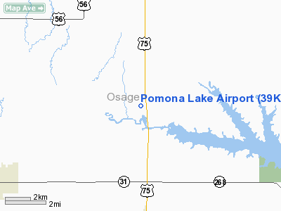
Location: |
Osage County, KS |
|
Magnetic Variation: |
06E (1985) |
Owner & Manager
|
Ownership: |
Privately owned |
|
Owner: |
Ray Cunningham |
|
Address: |
Po Box 858
Topeka, KS 66601 |
|
Phone
number: |
785-640-0961 |
|
Manager: |
Ray Cunningham |
|
Address: |
Po Box R
Topeka, KS 66614 |
|
Phone number: |
785-640-0961
OR 785-233-1688. |
Airport Operations and Facilities
|
Airport
Use: |
Open to public |
|
Wind
indicator: |
Yes |
|
Segmented Circle: |
No |
|
Control
Tower: |
No |
|
Landing
fee charge: |
No |
|
Sectional chart: |
Kansas City |
|
Region: |
ACE - Central |
|
Boundary
ARTCC: |
ZKC - Kansas City |
|
Tie-in
FSS: |
ICT - Wichita |
|
FSS on
Airport: |
No |
|
FSS Toll
Free: |
1-800-WX-BRIEF |
|
NOTAMs
Facility: |
ICT (NOTAM-d service avaliable) |
Airport Communications
Airport Services
|
Airframe
Repair: |
NONE |
|
Power
Plant Repair: |
NONE |
|
Runway Information
Runway 16/34
|
Dimension: |
2170 x 60 ft / 661.4 x 18.3 m |
|
Surface: |
TURF-GRVL, Poor Condition
LOOSE GRAVEL, ROUGH SURFACE. |
|
|
Runway 16
|
Runway 34
|
|
Traffic
Pattern: |
Left |
Left |
|
Obstruction: |
15 ft road, 185.0 ft from runway, 12:1 slope to clear |
26 ft tree, 101.0 ft from runway, 94 ft right of
centerline, 3:1 slope to clear |
|
Radio Navigation Aids
|
ID |
Type |
Name |
Ch |
Freq |
Var |
Dist |
|
UKL |
NDB |
Boyd |
|
245.00 |
05E |
23.6 nm |
|
TO |
NDB |
Biloy |
|
521.00 |
05E |
25.8 nm |
|
FOE |
TACAN |
Forbes |
053X |
|
05E |
15.4 nm |
|
OJC |
VOR/DME |
Johnson County |
077X |
113.00 |
06E |
45.6 nm |
|
TOP |
VORTAC |
Topeka |
125X |
117.80 |
05E |
27.6 nm |
|
EMP |
VORTAC |
Emporia |
075X |
112.80 |
08E |
32.0 nm |
|
FOE |
VOT |
Forbes |
|
111.00 |
|
15.6 nm |
Remarks
-
ULTRALIGHT ACTVTY
ON AND INVOF ARPT.
-
ARPT CLSD SS-SR
INDEFLY.
-
FOR TIE DOWN
BRING OWN ROPE & ANCHORS.
-
LOOSE GRAVEL ON
WEST EDGE OF RY.
Based Aircraft
|
Aircraft based
on field: |
9 |
|
Single Engine
Airplanes: |
5 |
|
Ultralights: |
4 |
Operational Statistics
Time Period: 2004-09-01 - 2005-08-31
|
Aircraft
Operations: |
25/Month |
|
General
Aviation Local: |
66.7% |
|
General
Aviation Itinerant: |
33.3% |
Pomona Lake Airport
Address:
Osage County, KS
Tel:
785-640-0961, 785-233-1688
Images
and information placed above are from
http://www.airport-data.com/airport/39K/
We
thank them for the data!
|
General Info |
| Country |
United
States |
| State |
KANSAS
|
| FAA ID |
39K
|
| Latitude |
38-41-31.026N |
|
Longitude |
095-41-23.942W |
|
Elevation |
1050
feet |
| Near
City |
LYNDON
|
We don't guarantee the information is fresh and accurate. The data may
be wrong or outdated.
For more up-to-date information please refer to other sources.
|
|


