 |
|
|
Location &
QuickFacts
|
FAA
Information Effective: |
2008-09-25 |
|
Airport
Identifier: |
2KS5 |
|
Airport
Status: |
Operational |
|
Longitude/Latitude: |
100-35-16.5480W/37-16-15.0780N
-100.587930/37.270855 (Estimated) |
|
Elevation: |
2762 ft / 841.86 m (Estimated) |
|
Land: |
80 acres |
|
From
nearest city: |
0 nautical miles NE of Plains, KS |
|
Location: |
Meade County, KS |
|
Magnetic Variation: |
09E (1985) |
Owner & Manager
|
Ownership: |
Publicly owned |
|
Owner: |
City Of Plains |
|
Address: |
Plains, KS 67869 |
|
Phone
number: |
620-563-7611 |
|
Manager: |
June Bender |
|
Address: |
City Of Plains
Plains, KS 67869 |
|
Phone number: |
620-563-7611 |
Airport Operations and Facilities
|
Airport Use: |
Private |
|
Wind indicator: |
Yes |
|
Segmented Circle: |
No |
|
Control Tower: |
No |
|
Landing fee charge: |
No |
|
Sectional chart: |
Wichita |
|
Region: |
ACE - Central |
|
Boundary ARTCC: |
ZKC - Kansas City |
|
Tie-in FSS: |
ICT - Wichita |
|
FSS on Airport: |
No |
|
FSS Toll Free: |
1-800-WX-BRIEF |
Airport Services
|
Airframe
Repair: |
NONE |
|
Power
Plant Repair: |
NONE |
|
Bottled
Oxygen: |
NONE |
|
Bulk
Oxygen: |
NONE |
|
Runway Information
Runway 02/20
|
Dimension: |
2500 x 150 ft / 762.0 x 45.7 m |
|
Surface: |
TURF, Fair Condition |
|
|
Runway 02
|
Runway 20
|
|
Traffic
Pattern: |
Left |
Left |
|
Runway End
Identifier: |
No |
No |
|
Centerline
Lights: |
No |
No |
|
Touchdown
Lights: |
No |
No |
|
Runway 08/26
|
Dimension: |
2250 x 150 ft / 685.8 x 45.7 m |
|
Surface: |
TURF, Fair Condition |
|
|
Runway 08
|
Runway 26
|
|
Traffic
Pattern: |
Left |
Left |
|
Runway End
Identifier: |
No |
No |
|
Centerline
Lights: |
No |
No |
|
Touchdown
Lights: |
No |
No |
|
Runway 17/35
|
Dimension: |
3200 x 150 ft / 975.4 x 45.7 m |
|
Surface: |
TURF, Fair Condition |
|
Edge Lights: |
Low |
|
|
Runway 17
|
Runway 35
|
|
Traffic
Pattern: |
Left |
Left |
|
Displaced
threshold: |
150.00 ft |
150.00 ft |
|
Runway End
Identifier: |
No |
No |
|
Centerline
Lights: |
No |
No |
|
Touchdown
Lights: |
No |
No |
|
Radio Navigation Aids
|
ID |
Type |
Name |
Ch |
Freq |
Var |
Dist |
|
MEJ |
NDB |
Meade |
|
389.00 |
09E |
11.0 nm |
|
GC |
NDB |
Pieve |
|
347.00 |
09E |
34.2 nm |
|
HQG |
NDB |
Hugoton |
|
365.00 |
09E |
38.2 nm |
|
ULS |
NDB |
Ulysses |
|
395.00 |
09E |
42.1 nm |
|
LBL |
VORTAC |
Liberal |
070X |
112.30 |
11E |
22.9 nm |
|
GCK |
VORTAC |
Garden City |
080X |
113.30 |
11E |
39.5 nm |
|
DDC |
VORTAC |
Dodge City |
019X |
108.20 |
08E |
44.5 nm |
Remarks
-
PRVDD APCHS TO EA
RWY END ARE MAINTD FOR A MIN 20:1 CLEAR GLIDE SLOPE; THAT A RGT TFC PATTERN IS
ESTABD TO AVOID FLT OVER GRAIN ELEVATORS TO SW. CONTINUED-THAT A SEGMENTED
CIRCLE IS INSTALLED AS A VISUAL AID TO INFORM PILOTS OF NONSTANDARD TFC
PATTERN.
Based Aircraft
|
Aircraft based
on field: |
12 |
|
Single Engine
Airplanes: |
10 |
|
Multi Engine
Airplanes: |
2 |
Operational Statistics
|
Aircraft
Operations: |
68/Week |
|
General
Aviation Local: |
71.4% |
|
General
Aviation Itinerant: |
28.6% |
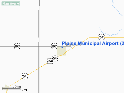
Plains Municipal Airport
Address:
Meade County, KS
Tel:
620-563-7611
Images
and information placed above are from
http://www.airport-data.com/airport/2KS5/
We
thank them for the data!
|
General Info |
| Country |
United
States |
| State |
KANSAS
|
| FAA ID |
2KS5
|
| Latitude |
37-16-15.078N |
|
Longitude |
100-35-16.548W |
|
Elevation |
2762
feet |
| Near
City |
PLAINS
|
We don't guarantee the information is fresh and accurate. The data may
be wrong or outdated.
For more up-to-date information please refer to other sources.
|
|


