 |
|
|
Location &
QuickFacts
|
FAA
Information Effective: |
2008-09-25 |
|
Airport
Identifier: |
8KS7 |
|
Airport
Status: |
Operational |
|
Longitude/Latitude: |
094-38-42.8420W/38-43-59.0340N
-94.645234/38.733065 (Estimated) |
|
Elevation: |
1072 ft / 326.75 m (Estimated) |
|
Land: |
140 acres |
|
From
nearest city: |
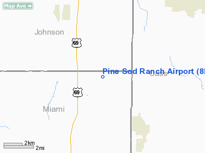
2 nautical miles SW of Stilwell, KS |
|
Location: |
Miami County, KS |
|
Magnetic Variation: |
05E (1985) |
Owner & Manager
|
Ownership: |
Privately owned |
|
Owner: |
Patrick J. Svoboda |
|
Address: |
Rr 1
Bucyrus, KS 66013 |
|
Phone number: |
913-897-2882 |
|
Manager: |
Patrick J. Svoboda |
|
Address: |
Rr 1
Bucyrus, KS 66013 |
|
Phone number: |
913-897-2882 |
Airport
Operations and Facilities
|
Airport
Use: |
Private |
|
Segmented Circle: |
No |
|
Control
Tower: |
No |
|
Sectional chart: |
Kansas City |
|
Region: |
ACE - Central |
|
Boundary
ARTCC: |
ZKC - Kansas City |
|
Tie-in
FSS: |
ICT - Wichita |
|
FSS on
Airport: |
No |
|
FSS Toll
Free: |
1-800-WX-BRIEF |
|
Runway Information
Runway 01/19
|
Dimension: |
1800 x 80 ft / 548.6 x 24.4 m |
|
Surface: |
TURF, |
|
|
Runway 01
|
Runway 19
|
|
Traffic
Pattern: |
Left |
Left |
|
Obstruction: |
20 ft trees, 50.0 ft from runway |
50 ft trees, 10.0 ft from runway |
|
Radio Navigation Aids
|
ID |
Type |
Name |
Ch |
Freq |
Var |
Dist |
|
LXT |
NDB |
Lesumit |
|
263.00 |
04E |
18.7 nm |
|
GQ |
NDB |
Norge |
|
517.00 |
05E |
19.7 nm |
|
GKB |
NDB |
Norge |
|
517.00 |
05E |
19.7 nm |
|
DO |
NDB |
Dotte |
|
359.00 |
05E |
29.7 nm |
|
GPH |
NDB |
Mosby |
|
284.00 |
03E |
40.1 nm |
|
FOE |
TACAN |
Forbes |
053X |
|
05E |
49.3 nm |
|
OJC |
VOR/DME |
Johnson County |
077X |
113.00 |
06E |
7.8 nm |
|
RIS |
VOR/DME |
Riverside |
051X |
111.40 |
05E |
23.4 nm |
|
BUM |
VORTAC |
Butler |
106X |
115.90 |
07E |
28.7 nm |
|
ANX |
VORTAC |
Napoleon |
087X |
114.00 |
07E |
32.5 nm |
|
MCI |
VORTAC |
Kansas City |
079Y |
113.25 |
05E |
33.5 nm |
|
TOP |
VORTAC |
Topeka |
125X |
117.80 |
05E |
48.7 nm |
|
MKC |
VOT |
Kansas City Downtown |
|
108.60 |
|
23.6 nm |
|
FOE |
VOT |
Forbes |
|
111.00 |
|
49.6 nm |
Remarks
-
PRVDD CLEAR 20:1
GLIDE SLOPE SFC/7:1 TRANSITIONAL SFC APCH PATH.
Based Aircraft
|
Aircraft based
on field: |
2 |
|
Single Engine
Airplanes: |
2 |
Pine Sod Ranch Airport
Address:
Miami County, KS
Tel:
913-897-2882
Images
and information placed above are from
http://www.airport-data.com/airport/8KS7/
We
thank them for the data!
|
General Info |
| Country |
United
States |
| State |
KANSAS
|
| FAA ID |
8KS7
|
| Latitude |
38-43-59.034N |
|
Longitude |
094-38-42.842W |
|
Elevation |
1072
feet |
| Near
City |
STILWELL
|
We don't guarantee the information is fresh and accurate. The data may
be wrong or outdated.
For more up-to-date information please refer to other sources.
|
|


