 |
|
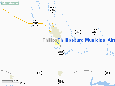
Phillipsburg Municipal Airport |
|
|
|
Location &
QuickFacts
|
FAA
Information Effective: |
2008-09-25 |
|
Airport
Identifier: |
PHG |
|
Airport
Status: |
Operational |
|
Longitude/Latitude: |
099-19-01.5710W/39-44-08.8960N
-99.317103/39.735804 (Estimated) |
|
Elevation: |
1907 ft / 581.25 m (Surveyed) |
|
Land: |
195 acres |
|
From
nearest city: |
1 nautical miles S of Phillipsburg, KS |
|
Location: |
Phillips County, KS |
|
Magnetic Variation: |
08E (1985) |
Owner & Manager
|
Ownership: |
Publicly owned |
|
Owner: |
City Of Phillipsburg |
|
Address: |
City Hall
Phillipsburg, KS 67661 |
|
Phone number: |
785-543-5424 |
|
Manager: |
Brenda Chance |
|
Address: |
Box 447
Phillipsburg, KS 67661 |
|
Phone number: |
785-543-5234
AFTER HOURS CALL 1-785-543-1941 |
Airport
Operations and Facilities
|
Airport
Use: |
Open to public |
|
Wind
indicator: |
Yes |
|
Segmented Circle: |
Yes |
|
Control
Tower: |
No |
|
Lighting
Schedule: |
DUSK-DAWN |
|
Beacon
Color: |
Clear-Green (lighted land airport) |
|
Landing
fee charge: |
No |
|
Sectional chart: |
Wichita |
|
Region: |
ACE - Central |
|
Boundary
ARTCC: |
ZDV - Denver |
|
Tie-in
FSS: |
ICT - Wichita |
|
FSS on
Airport: |
No |
|
FSS Toll
Free: |
1-800-WX-BRIEF |
|
NOTAMs
Facility: |
ICT (NOTAM-d service avaliable) |
|
Federal Agreements: |
NGY |
Airport Communications
|
CTAF: |
122.800 |
|
Unicom: |
122.800 |
Airport Services
|
Fuel
available: |
100LLA |
|
Bottled
Oxygen: |
NONE |
|
Bulk
Oxygen: |
NONE |
|
Runway Information
Runway 03/21
|
Dimension: |
2743 x 140 ft / 836.1 x 42.7 m |
|
Surface: |
TURF, |
|
|
Runway 03
|
Runway 21
|
|
Longitude: |
099-19-17.7380W |
099-18-56.8770W |
|
Latitude: |
39-44-04.1000N |
39-44-25.9010N |
|
Elevation: |
1892.00 ft |
1899.00 ft |
|
Alignment: |
36 |
127 |
|
Traffic
Pattern: |
Left |
Left |
|
Obstruction: |
, 50:1 slope to clear |
37 ft trees, 615.0 ft from runway, 79 ft left of
centerline, 16:1 slope to clear |
|
Runway 13/31
|
Dimension: |
4503 x 60 ft / 1372.5 x 18.3 m |
|
Surface: |
ASPH, Good Condition |
|
Weight Limit: |
Single wheel: 12000 lbs. |
|
Edge Lights: |
Medium |
|
|
Runway 13
|
Runway 31
|
|
Longitude: |
099-19-15.5200W |
099-18-40.6340W |
|
Latitude: |
39-44-22.8880N |
39-43-47.4660N |
|
Elevation: |
1906.00 ft |
1885.00 ft |
|
Alignment: |
127 |
127 |
|
Traffic
Pattern: |
Left |
Left |
|
Markings: |
Non-precision instrument, Good Condition |
Non-precision instrument, Good Condition |
|
VASI: |
2-light PAPI on left side |
2-box on left side |
|
Runway End
Identifier: |
Yes |
Yes |
|
Obstruction: |
16 ft road, 620.0 ft from runway, 26:1 slope to clear |
42 ft pline, 615.0 ft from runway, 220 ft right of
centerline, 9:1 slope to clear |
|
Radio Navigation Aids
|
ID |
Type |
Name |
Ch |
Freq |
Var |
Dist |
|
PHG |
NDB |
Phillipsburg |
|
368.00 |
08E |
2.2 nm |
|
NRN |
NDB |
Norton |
|
230.00 |
08E |
27.4 nm |
|
HDE |
NDB |
Holdrege |
|
396.00 |
07E |
42.8 nm |
|
TKO |
VORTAC |
Mankato |
035X |
109.80 |
10E |
49.0 nm |
Remarks
-
PUBLIC PHONE 24 HRS ACCESS.
Based Aircraft
|
Aircraft based
on field: |
8 |
|
Single Engine
Airplanes: |
7 |
|
Multi Engine
Airplanes: |
1 |
Operational Statistics
Time Period: 2006-08-16 - 2007-08-15
|
Aircraft
Operations: |
177/Week |
|
Air Taxi: |
2.2% |
|
General
Aviation Local: |
59.8% |
|
General
Aviation Itinerant: |
38.0% |
Phillipsburg Municipal Airport
Address:
Phillips County, KS
Tel:
785-543-5424, 785-543-5234
Images
and information placed above are from
http://www.airport-data.com/airport/PHG/
We
thank them for the data!
|
General Info |
| Country |
United
States |
| State |
KANSAS
|
| FAA ID |
PHG
|
| Latitude |
39-44-08.896N |
|
Longitude |
099-19-01.571W |
|
Elevation |
1907
feet |
| Near
City |
PHILLIPSBURG |
We don't guarantee the information is fresh and accurate. The data may
be wrong or outdated.
For more up-to-date information please refer to other sources.
|
|


