 |
|
|
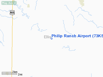
Location &
QuickFacts
|
FAA
Information Effective: |
2008-09-25 |
|
Airport
Identifier: |
73KS |
|
Airport
Status: |
Operational |
|
Longitude/Latitude: |
099-13-16.3590W/38-46-50.0430N
-99.221211/38.780568 (Estimated) |
|
Elevation: |
1923 ft / 586.13 m (Estimated) |
|
Land: |
800 acres |
|
From
nearest city: |
8 nautical miles SE of Hays, KS |
|
Location: |
Wichita County, KS |
|
Magnetic Variation: |
08E (1985) |
Owner & Manager
|
Ownership: |
Privately owned |
|
Owner: |
Douglas Philip |
|
Address: |
677-300th Ave.
Hays, KS 67601 |
|
Phone number: |
913-625-5026 |
|
Manager: |
Douglas Philip |
|
Address: |
677-300th Ave.
Hays, KS 67601 |
|
Phone number: |
913-625-5026 |
Airport
Operations and Facilities
|
Airport
Use: |
Private |
|
Wind
indicator: |
Yes |
|
Segmented Circle: |
No |
|
Control
Tower: |
No |
|
Sectional chart: |
Wichita |
|
Region: |
ACE - Central |
|
Boundary
ARTCC: |
ZKC - Kansas City |
|
Tie-in
FSS: |
ICT - Wichita |
|
FSS Toll
Free: |
1-800-WX-BRIEF |
|
Runway Information
Runway 04/22
|
Dimension: |
1385 x 144 ft / 422.1 x 43.9 m |
|
Surface: |
TURF, |
|
|
Runway 04
|
Runway 22
|
|
Traffic
Pattern: |
Left |
Left |
|
Runway 14/32
|
Dimension: |
2046 x 144 ft / 623.6 x 43.9 m |
|
Surface: |
TURF, |
|
|
Runway 14
|
Runway 32
|
|
Traffic
Pattern: |
Left |
Left |
|
Runway 18/36
|
Dimension: |
1685 x 144 ft / 513.6 x 43.9 m |
|
Surface: |
TURF, |
|
|
Runway 18
|
Runway 36
|
|
Traffic
Pattern: |
Left |
Left |
|
Radio Navigation Aids
|
ID |
Type |
Name |
Ch |
Freq |
Var |
Dist |
|
HIL |
NDB |
Hilyn |
|
338.00 |
08E |
29.4 nm |
|
LQR |
NDB |
Larned |
|
296.00 |
08E |
35.2 nm |
|
HYS |
VORTAC |
Hays |
041X |
110.40 |
10E |
4.8 nm |
Remarks
-
PROVIDED APCH TO
EACH RUNWAY IS MAINTAINED FOR A MINIMUM 20:1 GLIDE SLOPE AND TRANSITIONAL
SURFACE MAINTAINED FOR A 7:1 SLOPE AND THAT ALL USERS NOTIFIED THAT CATTLE AND
HORSES MAY BE ON RUNWAYS.
Based Aircraft
|
Aircraft based
on field: |
2 |
|
Single Engine
Airplanes: |
1 |
|
Ultralights: |
1 |
Philip Ranch Airport
Address:
Wichita County, KS
Tel:
913-625-5026
Images
and information placed above are from
http://www.airport-data.com/airport/73KS/
We
thank them for the data!
|
General Info |
| Country |
United
States |
| State |
KANSAS
|
| FAA ID |
73KS
|
| Latitude |
38-46-50.043N |
|
Longitude |
099-13-16.359W |
|
Elevation |
1923
feet |
| Near
City |
HAYS
|
We don't guarantee the information is fresh and accurate. The data may
be wrong or outdated.
For more up-to-date information please refer to other sources.
|
|


