 |
|
|
|
|
|
|
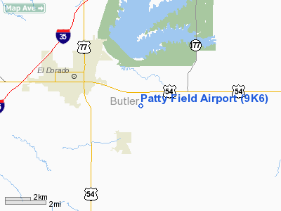
Location &
QuickFacts
|
FAA
Information Effective: |
2008-09-25 |
|
Airport
Identifier: |
9K6 |
|
Airport
Status: |
Operational |
|
Longitude/Latitude: |
096-47-56.5000W/37-48-01.6000N
-96.799028/37.800444 (Estimated) |
|
Elevation: |
1385 ft / 422.15 m (Estimated) |
|
Land: |
50 acres |
|
From
nearest city: |
3 nautical miles SE of El Dorado, KS |
|
Location: |
Butler County, KS |
|
Magnetic Variation: |
06E (1985) |
Owner & Manager
|
Ownership: |
Privately owned |
|
Owner: |
Brent A. Patty |
|
Address: |
1761 Se Bluestem Road
El Dorado, KS 67042 |
|
Phone
number: |
316-321-9192 |
|
Manager: |
Brent A. Patty |
|
Address: |
1761 Se Bluestem Road
El Dorado, KS 67042 |
|
Phone number: |
316-321-9192 |
Airport Operations and Facilities
|
Airport
Use: |
Open to public |
|
Wind
indicator: |
Yes |
|
Segmented Circle: |
No |
|
Control
Tower: |
No |
|
Landing
fee charge: |
No |
|
Sectional chart: |
Kansas City |
|
Region: |
ACE - Central |
|
Boundary
ARTCC: |
ZKC - Kansas City |
|
Tie-in
FSS: |
ICT - Wichita |
|
FSS on
Airport: |
No |
|
FSS Toll
Free: |
1-800-WX-BRIEF |
|
NOTAMs
Facility: |
ICT (NOTAM-d service avaliable) |
Airport Communications
Airport Services
|
Airframe
Repair: |
MAJOR |
|
Power
Plant Repair: |
MAJOR |
|
Bottled
Oxygen: |
NONE |
|
Bulk
Oxygen: |
NONE |
|
Runway Information
Runway 18/36
|
Dimension: |
1800 x 60 ft / 548.6 x 18.3 m |
|
Surface: |
TURF, Good Condition |
|
|
Runway 18
|
Runway 36
|
|
Traffic
Pattern: |
Left |
Left |
|
Obstruction: |
4 ft fence |
4 ft fence, 0.0 ft from runway |
|
Radio Navigation Aids
|
ID |
Type |
Name |
Ch |
Freq |
Var |
Dist |
|
EQA |
NDB |
El Dorado |
|
383.00 |
05E |
1.5 nm |
|
EWK |
NDB |
Newton |
|
281.00 |
06E |
27.5 nm |
|
IC |
NDB |
Piche |
|
332.00 |
07E |
34.0 nm |
|
EGT |
NDB |
Wellington |
|
414.00 |
07E |
40.2 nm |
|
IAB |
TACAN |
Mc Connell |
112X |
|
07E |
24.8 nm |
|
ICT |
VORTAC |
Wichita |
085X |
113.80 |
07E |
37.4 nm |
|
EMP |
VORTAC |
Emporia |
075X |
112.80 |
08E |
43.0 nm |
|
ICT |
VOT |
Wichita |
|
114.00 |
|
31.7 nm |
Remarks
-
WATER TOWER 1/4 MILE NE.
-
RY 18 HAS TREES
AT THLD 30 FT RIGHT & LEFT OF CNTRLN.
-
EXISTED PRIOR TO 1959.
Based Aircraft
|
Aircraft based
on field: |
2 |
|
Single Engine
Airplanes: |
2 |
Operational Statistics
Time Period: 2007-06-05 - 2008-06-03
|
Aircraft
Operations: |
13/Week |
|
General
Aviation Local: |
92.3% |
|
General
Aviation Itinerant: |
7.7% |
Patty Field Airport
Address:
Butler County, KS
Tel:
316-321-9192
Images
and information placed above are from
http://www.airport-data.com/airport/9K6/
We
thank them for the data!
|
General Info |
| Country |
United
States |
| State |
KANSAS
|
| FAA ID |
9K6
|
| Latitude |
37-48-00.065N |
|
Longitude |
096-47-01.099W |
|
Elevation |
1385
feet |
| Near
City |
EL
DORADO |
We don't guarantee the information is fresh and accurate. The data may
be wrong or outdated.
For more up-to-date information please refer to other sources.
|
|


