 |
|
|
Location &
QuickFacts
|
FAA
Information Effective: |
2008-09-25 |
|
Airport
Identifier: |
66KS |
|
Airport
Status: |
Operational |
|
Longitude/Latitude: |
095-52-20.0000W/37-09-50.0000N
-95.872222/37.163889 (Estimated) |
|
Elevation: |
880 ft / 268.22 m (Estimated) |
|
Land: |
0 acres |
|
From
nearest city: |
8 nautical miles SW of Independence, KS |
|
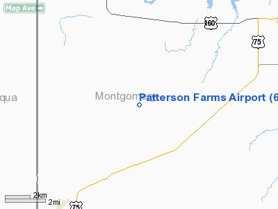
Location: |
Montgomery County, KS |
|
Magnetic Variation: |
05E (1995) |
Owner & Manager
|
Ownership: |
Privately owned |
|
Owner: |
Mike Patterson |
|
Address: |
Rr 3 Box 410
Independence, KS 67301 |
|
Phone number: |
316-627-2261 |
|
Manager: |
Mike Patterson |
|
Address: |
Rr3 Box 410
Independence, KS 67301 |
|
Phone number: |
316-627-2261 |
Airport
Operations and Facilities
|
Airport
Use: |
Private |
|
Wind
indicator: |
Yes |
|
Segmented Circle: |
No |
|
Control
Tower: |
No |
|
Sectional chart: |
Kansas City |
|
Region: |
ACE - Central |
|
Boundary
ARTCC: |
ZKC - Kansas City |
|
Tie-in
FSS: |
ICT - Wichita |
|
FSS on
Airport: |
No |
|
FSS Toll
Free: |
1-800-WX-BRIEF |
|
Runway Information
Runway 17/35
|
Dimension: |
2640 x 150 ft / 804.7 x 45.7 m |
|
Surface: |
TURF, |
|
|
Runway 17
|
Runway 35
|
|
Traffic
Pattern: |
Right |
Left |
|
Radio Navigation Aids
|
ID |
Type |
Name |
Ch |
Freq |
Var |
Dist |
|
CFV |
NDB |
Coffeyville |
|
212.00 |
05E |
15.0 nm |
|
PPF |
NDB |
Parsons |
|
258.00 |
06E |
20.3 nm |
|
MSB |
NDB |
Monarch |
|
410.00 |
04E |
43.6 nm |
|
BVO |
VOR/DME |
Bartlesville |
126X |
117.90 |
08E |
21.0 nm |
|
CNU |
VOR/DME |
Chanute |
029X |
109.20 |
05E |
30.8 nm |
|
OSW |
VORTAC |
Oswego |
123X |
117.60 |
08E |
32.0 nm |
Remarks
-
PRVDD ALL TFC
PATTERNS ARE W OF RY; MAINTAIN A CLEAR 20:1 APCH & 7:1 TRANSITIONAL SFC.
Based Aircraft
|
Aircraft based
on field: |
2 |
|
Single Engine
Airplanes: |
2 |
Patterson Farms Airport
Address:
Montgomery County, KS
Tel:
316-627-2261
Images
and information placed above are from
http://www.airport-data.com/airport/66KS/
We
thank them for the data!
|
General Info |
| Country |
United
States |
| State |
KANSAS
|
| FAA ID |
66KS
|
| Latitude |
37-09-50.000N |
|
Longitude |
095-52-20.000W |
|
Elevation |
880 feet
|
| Near
City |
INDEPENDENCE |
We don't guarantee the information is fresh and accurate. The data may
be wrong or outdated.
For more up-to-date information please refer to other sources.
|
|


