 |
|
|
|
|
|
|
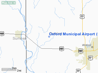
Location &
QuickFacts
|
FAA
Information Effective: |
2008-09-25 |
|
Airport
Identifier: |
55K |
|
Airport
Status: |
Operational |
|
Longitude/Latitude: |
097-05-29.1390W/37-16-11.0890N
-97.091428/37.269747 (Estimated) |
|
Elevation: |
1189 ft / 362.41 m (Estimated) |
|
Land: |
640 acres |
|
From
nearest city: |
4 nautical miles E of Oxford, KS |
|
Location: |
Cowley County, KS |
|
Magnetic Variation: |
07E (1985) |
Owner & Manager
|
Ownership: |
Publicly owned |
|
Owner: |
City Of Oxford |
|
Address: |
115 S. Summer
Oxford, KS 67119 |
|
Phone
number: |
620-455-2223 |
|
Manager: |
Justin Shepherd |
|
Address: |
City Of Oxford, 115 S. Summer
Oxford, KS 67119 |
|
Phone number: |
620-455-2223 |
Airport Operations and Facilities
|
Airport
Use: |
Open to public |
|
Wind
indicator: |
Yes |
|
Segmented Circle: |
No |
|
Control
Tower: |
No |
|
Landing
fee charge: |
No |
|
Sectional chart: |
Wichita |
|
Region: |
ACE - Central |
|
Boundary
ARTCC: |
ZKC - Kansas City |
|
Tie-in
FSS: |
ICT - Wichita |
|
FSS on
Airport: |
No |
|
FSS Toll
Free: |
1-800-WX-BRIEF |
|
NOTAMs
Facility: |
ICT (NOTAM-d service avaliable) |
|
Federal Agreements: |
P |
Airport Communications
Airport Services
|
Airframe
Repair: |
NONE |
|
Bottled
Oxygen: |
NONE |
|
Bulk
Oxygen: |
NONE |
|
Runway Information
Runway 17/35
|
Dimension: |
3380 x 60 ft / 1030.2 x 18.3 m |
|
Surface: |
ASPH, Good Condition |
|
|
Runway 17
|
Runway 35
|
|
Traffic
Pattern: |
Left |
Left |
|
Markings: |
Basic, Good Condition |
Basic, Good Condition |
|
Radio Navigation Aids
|
ID |
Type |
Name |
Ch |
Freq |
Var |
Dist |
|
EGT |
NDB |
Wellington |
|
414.00 |
07E |
14.6 nm |
|
IC |
NDB |
Piche |
|
332.00 |
07E |
25.4 nm |
|
PN |
NDB |
Ponca |
|
515.00 |
05E |
26.7 nm |
|
EQA |
NDB |
El Dorado |
|
383.00 |
05E |
33.3 nm |
|
EWK |
NDB |
Newton |
|
281.00 |
06E |
48.5 nm |
|
IAB |
TACAN |
Mc Connell |
112X |
|
07E |
22.8 nm |
|
PER |
VORTAC |
Pioneer |
079X |
113.20 |
06E |
31.6 nm |
|
ICT |
VORTAC |
Wichita |
085X |
113.80 |
07E |
37.0 nm |
|
ICT |
VOT |
Wichita |
|
114.00 |
|
27.4 nm |
Remarks
Based Aircraft
|
Aircraft based
on field: |
5 |
|
Single Engine
Airplanes: |
5 |
Operational Statistics
Time Period: 2006-06-09 - 2007-06-08
|
Aircraft
Operations: |
49/Week |
|
General
Aviation Local: |
60.0% |
|
General
Aviation Itinerant: |
40.0% |
Oxford Municipal Airport
Address:
Cowley County, KS
Tel:
620-455-2223
Images
and information placed above are from
http://www.airport-data.com/airport/55K/
We
thank them for the data!
|
General Info |
| Country |
United
States |
| State |
KANSAS
|
| FAA ID |
55K
|
| Latitude |
37-16-11.089N |
|
Longitude |
097-05-29.139W |
|
Elevation |
1189
feet |
| Near
City |
OXFORD
|
We don't guarantee the information is fresh and accurate. The data may
be wrong or outdated.
For more up-to-date information please refer to other sources.
|
|


