 |
|
|
|
|
|
|
Location &
QuickFacts
|
FAA
Information Effective: |
2008-09-25 |
|
Airport
Identifier: |
K67 |
|
Airport
Status: |
Operational |
|
Longitude/Latitude: |
095-02-29.1000W/37-09-33.1000N
-95.041417/37.159194 (Estimated) |
|
Elevation: |
830 ft / 252.98 m (Surveyed) |
|
Land: |
27 acres |
|
From
nearest city: |
3 nautical miles E of Oswego, KS |
|
Location: |
Cherokee County, KS |
|
Magnetic Variation: |
05E (1985) |
Owner & Manager
|
Ownership: |
Publicly owned |
|
Owner: |
City Of Oswego |
|
Address: |
703 5th St
Oswego, KS 67356 |
|
Phone number: |
620-795-4433 |
|
Manager: |
Cheri Peine
CITY CLERK. |
|
Address: |
Po Box 210
Oswego, KS 67356 |
|
Phone number: |
620-795-4433 |
Airport
Operations and Facilities
|
Airport
Use: |
Open to public |
|
Wind
indicator: |
Yes |
|
Segmented Circle: |
No |
|
Control
Tower: |
No |
|
Lighting
Schedule: |
DUSK-DAWN |
|
Beacon
Color: |
Clear-Green (lighted land airport) |
|
Landing
fee charge: |
No |
|
Sectional chart: |
Kansas City |
|
Region: |
ACE - Central |
|
Boundary
ARTCC: |
ZKC - Kansas City |
|
Tie-in
FSS: |
ICT - Wichita |
|
FSS on
Airport: |
No |
|
FSS Toll
Free: |
1-800-WX-BRIEF |
|
NOTAMs
Facility: |
ICT (NOTAM-d service avaliable) |
|
Federal Agreements: |
NY1 |
Airport Communications
Airport Services
|
Bottled
Oxygen: |
NONE |
|
Bulk
Oxygen: |
NONE |
|
Runway Information
Runway 17/35
|
Dimension: |
2500 x 50 ft / 762.0 x 15.2 m |
|
Surface: |
ASPH, Good Condition |
|
Edge Lights: |
Low |
|
|
Runway 17
|
Runway 35
|
|
Longitude: |
095-02-29.1400W |
095-02-29.0200W |
|
Latitude: |
37-09-45.5100N |
37-09-20.7900N |
|
Traffic
Pattern: |
Left |
Left |
|
Markings: |
Basic, Fair Condition |
Basic, Fair Condition |
|
Obstruction: |
55 ft trees, 779.0 ft from runway, 40 ft left of
centerline, 11:1 slope to clear |
4 ft fence, 220.0 ft from runway, 90 ft left of
centerline, 5:1 slope to clear
12FT TREE 100FT FROM RYEND, 100FT L&R |
|
Radio Navigation Aids
|
ID |
Type |
Name |
Ch |
Freq |
Var |
Dist |
|
PTS |
NDB |
Pittsburg |
|
365.00 |
05E |
22.7 nm |
|
PPF |
NDB |
Parsons |
|
258.00 |
06E |
24.8 nm |
|
CFV |
NDB |
Coffeyville |
|
212.00 |
05E |
25.7 nm |
|
LLU |
NDB |
Spring River |
|
356.00 |
05E |
40.1 nm |
|
FSK |
NDB |
Fort Scott |
|
379.00 |
05E |
40.5 nm |
|
MSB |
NDB |
Monarch |
|
410.00 |
04E |
42.0 nm |
|
EOS |
VOR/DME |
Neosho |
120X |
117.30 |
07E |
34.8 nm |
|
CNU |
VOR/DME |
Chanute |
029X |
109.20 |
05E |
38.5 nm |
|
OSW |
VORTAC |
Oswego |
123X |
117.60 |
08E |
7.8 nm |
Remarks
-
AMMUNITION PLANT
BLASTING 10 MILES NW OF ARPT; SFC TO 3200 FT; MON-FRI 0645-1630.
-
PUBLIC PHONE.
-
WILDLIFE ON & INVOF ARPT.
Based Aircraft
|
Aircraft based
on field: |
8 |
|
Single Engine
Airplanes: |
4 |
|
Multi Engine
Airplanes: |
4 |
Operational Statistics
Time Period: 2006-09-16 - 2007-09-15
|
Aircraft
Operations: |
12/Week |
|
General
Aviation Local: |
70.0% |
|
General
Aviation Itinerant: |
30.0% |
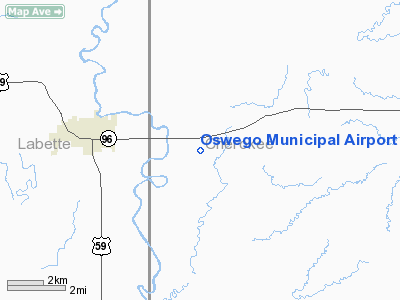
Oswego Municipal Airport
Address:
Cherokee County, KS
Tel:
620-795-4433
Images
and information placed above are from
http://www.airport-data.com/airport/K67/
We
thank them for the data!
|
General Info |
| Country |
United
States |
| State |
KANSAS
|
| FAA ID |
K67
|
| Latitude |
37-09-35.232N |
|
Longitude |
095-02-32.864W |
|
Elevation |
830 feet
|
| Near
City |
OSWEGO
|
We don't guarantee the information is fresh and accurate. The data may
be wrong or outdated.
For more up-to-date information please refer to other sources.
|
|


