 |
|
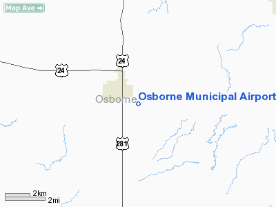
Osborne Municipal Airport |
|
|
|
Location &
QuickFacts
|
FAA
Information Effective: |
2008-09-25 |
|
Airport
Identifier: |
K75 |
|
Airport
Status: |
Operational |
|
Longitude/Latitude: |
098-40-46.2590W/39-25-45.0370N
-98.679516/39.429177 (Estimated) |
|
Elevation: |
1565 ft / 477.01 m (Estimated) |
|
Land: |
144 acres |
|
From
nearest city: |
1 nautical miles SE of Osborne, KS |
|
Location: |
Osborne County, KS |
|
Magnetic Variation: |
08E (1985) |
Owner & Manager
|
Ownership: |
Publicly owned |
|
Owner: |
City Of Osborne |
|
Address: |
City Hall
Osborne, KS 67473 |
|
Phone number: |
785-346-5611 |
|
Manager: |
Perry Curry, Airport Manager |
|
Address: |
City Hall
Osborne, KS 67473 |
|
Phone number: |
785-346-2926 |
Airport
Operations and Facilities
|
Airport
Use: |
Open to public |
|
Wind
indicator: |
Yes
A TETRAHEDRON IS ALSO AVBL FOR WIND DIRECTION. |
|
Segmented Circle: |
No |
|
Control
Tower: |
No |
|
Lighting
Schedule: |
DUSK-DAWN |
|
Beacon
Color: |
Clear-Green (lighted land airport) |
|
Landing
fee charge: |
No |
|
Sectional chart: |
Wichita |
|
Region: |
ACE - Central |
|
Boundary
ARTCC: |
ZKC - Kansas City |
|
Tie-in
FSS: |
ICT - Wichita |
|
FSS on
Airport: |
No |
|
FSS Toll
Free: |
1-800-WX-BRIEF |
|
NOTAMs
Facility: |
ICT (NOTAM-d service avaliable) |
Airport Communications
Airport Services
|
Fuel
available: |
100LL
FOR FUEL CALL 785-346-2926 OR 346-2290 |
|
Bottled
Oxygen: |
NONE |
|
Bulk
Oxygen: |
NONE |
|
Runway Information
Runway 02/20
|
Dimension: |
4000 x 60 ft / 1219.2 x 18.3 m |
|
Surface: |
ASPH, Good Condition |
|
Edge Lights: |
Medium
RY END LIGHT ARE GREEN ONLY. |
|
|
Runway 02
|
Runway 20
|
|
Traffic
Pattern: |
Left |
Left |
|
Markings: |
Numbers only, Fair Condition
MARKED WITH A 100 FT DSPLCD THLD. |
Numbers only, Fair Condition
MARKED WITH A 180 FT DSPLCD THLD. |
|
Displaced
threshold: |
100.00 ft |
180.00 ft |
|
Obstruction: |
33 ft trees, 296.0 ft from runway, 2:1 slope to clear
APCH RATIO 12:1 TO DSPLCD THLD. |
15 ft road, 120.0 ft from runway
APCH RATIO 20:1 TO DSPLCD THLD.
ROAD SHOWN AS THE CONTROLLING OBSTRUCTION TO RY 20 WAS MEASURED TO BE
INSIDE OF THE PRIMARY SURFACE MAKING IT A CLOSE IN OBSTRUCTION, HAD A
DISPLACED THR.
NOT BEEN
ESTABLISHED THIS APPROACH WOULD BE 50:1. |
|
Runway 12/30
|
Dimension: |
2900 x 80 ft / 883.9 x 24.4 m |
|
Surface: |
TURF, Good Condition |
|
|
Runway 12
|
Runway 30
|
|
Traffic
Pattern: |
Left |
Left |
|
Obstruction: |
244 ft other, 3760.0 ft from runway, 8 ft right of
centerline, 15:1 slope to clear |
5 ft berm, 109.0 ft from runway, 125 ft right of
centerline, 21:1 slope to clear |
|
Radio Navigation Aids
|
ID |
Type |
Name |
Ch |
Freq |
Var |
Dist |
|
PHG |
NDB |
Phillipsburg |
|
368.00 |
08E |
32.8 nm |
|
CNK |
NDB |
Concordia |
|
335.00 |
06E |
48.3 nm |
|
TKO |
VORTAC |
Mankato |
035X |
109.80 |
10E |
29.9 nm |
|
HYS |
VORTAC |
Hays |
041X |
110.40 |
10E |
44.7 nm |
Remarks
-
PUBLIC TELEPHONE AVAILABLE.
-
PROVIDED THE
APPROACH TO EACH RWY IS MAINTAINED FOR A MINIMUM 20:1 GLIDE SLOPE AND THE
TRANSITIONAL SURFACE BE MAINTAINED FOR A 7:1 SLOPE.
Based Aircraft
|
Aircraft based
on field: |
10 |
|
Single Engine
Airplanes: |
7 |
|
Ultralights: |
3 |
Operational Statistics
Time Period: 2006-08-20 - 2007-08-19
|
Aircraft
Operations: |
114/Week |
|
Air Taxi: |
11.8% |
|
General
Aviation Local: |
60.9% |
|
General
Aviation Itinerant: |
27.1% |
|
Military: |
0.2% |
Osborne Municipal Airport
Address:
Osborne County, KS
Tel:
785-346-5611, 785-346-2926
Images
and information placed above are from
http://www.airport-data.com/airport/K75/
We
thank them for the data!
|
General Info |
| Country |
United
States |
| State |
KANSAS
|
| FAA ID |
K75
|
| Latitude |
39-25-45.037N |
|
Longitude |
098-40-46.259W |
|
Elevation |
1565
feet |
| Near
City |
OSBORNE
|
We don't guarantee the information is fresh and accurate. The data may
be wrong or outdated.
For more up-to-date information please refer to other sources.
|
|


