 |
|
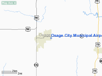
Osage City Municipal Airport |
|
|
|
Location &
QuickFacts
|
FAA
Information Effective: |
2008-09-25 |
|
Airport
Identifier: |
53K |
|
Airport
Status: |
Operational |
|
Longitude/Latitude: |
095-48-06.4500W/38-38-03.7750N
-95.801792/38.634382 (Estimated) |
|
Elevation: |
1105 ft / 336.80 m (Estimated) |
|
Land: |
20 acres |
|
From
nearest city: |
1 nautical miles E of Osage City, KS |
|
Location: |
Osage County, KS |
|
Magnetic Variation: |
06E (1985) |
Owner & Manager
|
Ownership: |
Publicly owned |
|
Owner: |
City Of Osage |
|
Address: |
5th & Main St
Osage City, KS 66523 |
|
Phone
number: |
785-528-3714 |
|
Manager: |
Brian Silcott |
|
Address: |
Po Box 250
Osage City, KS 66523 |
|
Phone number: |
785-528-3714 |
Airport Operations and Facilities
|
Airport
Use: |
Open to public |
|
Wind
indicator: |
Yes |
|
Segmented Circle: |
No |
|
Control
Tower: |
No |
|
Lighting
Schedule: |
DUSK-DAWN |
|
Beacon
Color: |
Clear-Green (lighted land airport) |
|
Landing
fee charge: |
No |
|
Sectional chart: |
Kansas City |
|
Region: |
ACE - Central |
|
Boundary
ARTCC: |
ZKC - Kansas City |
|
Tie-in
FSS: |
ICT - Wichita |
|
FSS on
Airport: |
No |
|
FSS Toll
Free: |
1-800-WX-BRIEF |
|
NOTAMs
Facility: |
ICT (NOTAM-d service avaliable) |
|
Federal Agreements: |
N |
Airport Communications
Airport Services
|
Fuel
available: |
100LLMOGAS
FUEL AVBL 24 HRS WITH PRIOR ARRANGEMENTS; CALL 785-224-4000 TO SET UP
ACCOUNT. |
|
Bottled
Oxygen: |
NONE |
|
Bulk
Oxygen: |
NONE |
|
Runway Information
Runway 17/35
|
Dimension: |
2560 x 40 ft / 780.3 x 12.2 m |
|
Surface: |
ASPH, Good Condition |
|
Edge Lights: |
Non-standard lighting system
RWY END LTS RED, NO SPLIT LENSE; DSPLCD THLD LTS GREEN, NO SPLIT LENSE. |
|
|
Runway 17
|
Runway 35
|
|
Longitude: |
095-48-30.9500W |
095-48-30.9500W |
|
Latitude: |
38-38-12.6800N |
38-37-47.3800N |
|
Elevation: |
1092.00 ft |
1105.00 ft |
|
Alignment: |
127 |
0 |
|
Traffic
Pattern: |
Left |
Left |
|
Markings: |
Basic, Good Condition |
Basic, Good Condition |
|
Displaced
threshold: |
215.00 ft |
252.00 ft |
|
Obstruction: |
36 ft tree, 252.0 ft from runway, 48 ft left of
centerline, 1:1 slope to clear
RWY 17 APCH RATIO 12:1 FM DSPLCD THLD TO +30 POLE.
RWY 17 +15 ROAD 50 FT FM RWY END; +30 POLE 150 FT FM RWY END 120 FT L OF
CNTRLN. |
, 50:1 slope to clear
RWY 35 APCH RATIO 8:1 FM DSPLCD THLD TO +38 TREE 117 FT R OF CNTRLN.
RWY 35 +15 ROAD 27 FT FM RWY END. |
|
Radio Navigation Aids
|
ID |
Type |
Name |
Ch |
Freq |
Var |
Dist |
|
UKL |
NDB |
Boyd |
|
245.00 |
05E |
20.5 nm |
|
TO |
NDB |
Biloy |
|
521.00 |
05E |
29.7 nm |
|
HRU |
NDB |
Herington |
|
407.00 |
06E |
47.5 nm |
|
MQD |
NDB |
Mc Dowell Creek |
|
391.00 |
06E |
48.4 nm |
|
FOE |
TACAN |
Forbes |
053X |
|
05E |
19.9 nm |
|
EMP |
VORTAC |
Emporia |
075X |
112.80 |
08E |
26.0 nm |
|
TOP |
VORTAC |
Topeka |
125X |
117.80 |
05E |
32.4 nm |
|
FOE |
VOT |
Forbes |
|
111.00 |
|
20.1 nm |
Remarks
-
PAJA ACTIVITIES SAT & SUN.
-
+15 RD 55 FT E OF
RWY.
-
+61 TREES 750 FT
N OF AER 17.
Based Aircraft
|
Aircraft based
on field: |
12 |
|
Single Engine
Airplanes: |
12 |
Operational Statistics
Time Period: 2005-11-01 - 2006-10-31
|
Aircraft
Operations: |
39/Week |
|
General
Aviation Local: |
75.0% |
|
General
Aviation Itinerant: |
25.0% |
Osage City Municipal Airport
Address:
Osage County, KS
Tel:
785-528-3714
Images
and information placed above are from
http://www.airport-data.com/airport/53K/
We
thank them for the data!
|
General Info |
| Country |
United
States |
| State |
KANSAS
|
| FAA ID |
53K
|
| Latitude |
38-38-00.032N |
|
Longitude |
095-48-30.953W |
|
Elevation |
1105
feet |
| Near
City |
OSAGE
CITY |
We don't guarantee the information is fresh and accurate. The data may
be wrong or outdated.
For more up-to-date information please refer to other sources.
|
|


