 |
|
|
|
|
Location &
QuickFacts
|
FAA
Information Effective: |
2008-09-25 |
|
Airport
Identifier: |
49K |
|
Airport
Status: |
Operational |
|
Longitude/Latitude: |
097-50-01.1940W/37-27-20.0660N
-97.833665/37.455574 (Estimated) |
|
Elevation: |
1494 ft / 455.37 m (Surveyed) |
|
Land: |
10 acres |
|
From
nearest city: |
1 nautical miles E of Norwich, KS |
|
Location: |
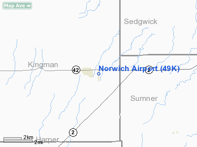
Kingman County, KS |
|
Magnetic Variation: |
07E (1985) |
Owner & Manager
|
Ownership: |
Publicly owned |
|
Owner: |
City Of Norwich |
|
Address: |
City Hall
Norwich, KS 67118 |
|
Phone number: |
620-478-2278 |
|
Manager: |
Monte Vavra |
|
Address: |
City Hall
Norwich, KS 67118 |
|
Phone number: |
620-532-6846 |
Airport
Operations and Facilities
|
Airport
Use: |
Open to public |
|
Wind
indicator: |
Yes |
|
Segmented Circle: |
No |
|
Control
Tower: |
No |
|
Lighting
Schedule: |
DUSK-DAWN |
|
Landing
fee charge: |
No |
|
Sectional chart: |
Wichita |
|
Region: |
ACE - Central |
|
Boundary
ARTCC: |
ZKC - Kansas City |
|
Tie-in
FSS: |
ICT - Wichita |
|
FSS on
Airport: |
No |
|
FSS Toll
Free: |
1-800-WX-BRIEF |
|
NOTAMs
Facility: |
ICT (NOTAM-d service avaliable) |
Airport Communications
Airport Services
|
Runway Information
Runway 17/35
|
Dimension: |
3230 x 80 ft / 984.5 x 24.4 m |
|
Surface: |
TURF, Good Condition |
|
Edge Lights: |
Non-standard lighting system
NSTD LIRL RY 17/35, INCORRECT SPACING. |
|
|
Runway 17
|
Runway 35
|
|
Traffic
Pattern: |
Left |
Left |
|
Displaced
threshold: |
0.00 ft |
180.00 ft |
|
Obstruction: |
20 ft pline, 660.0 ft from runway, 33:1 slope to clear |
26 ft rr, 340.0 ft from runway, 13:1 slope to clear
APCH RATIO 20:1 FM DSPLCD THLD. |
|
Radio Navigation Aids
|
ID |
Type |
Name |
Ch |
Freq |
Var |
Dist |
|
IC |
NDB |
Piche |
|
332.00 |
07E |
19.5 nm |
|
EGT |
NDB |
Wellington |
|
414.00 |
07E |
22.6 nm |
|
EWK |
NDB |
Newton |
|
281.00 |
06E |
45.2 nm |
|
PTT |
NDB |
Pratt |
|
356.00 |
07E |
46.4 nm |
|
IAB |
TACAN |
Mc Connell |
112X |
|
07E |
28.7 nm |
|
HUT |
VOR/DME |
Hutchinson |
115X |
116.80 |
09E |
32.9 nm |
|
ICT |
VORTAC |
Wichita |
085X |
113.80 |
07E |
21.1 nm |
|
ANY |
VORTAC |
Anthony |
076X |
112.90 |
07E |
24.0 nm |
|
ICT |
VOT |
Wichita |
|
114.00 |
|
22.0 nm |
Remarks
-
IRRIGATION PUMP
AND FUEL TANK 75' LEFT OF CNTRLN.
RW 17 150' S. OF THR.
Based Aircraft
|
Aircraft based
on field: |
8 |
|
Single Engine
Airplanes: |
6 |
|
Ultralights: |
2 |
Operational Statistics
Time Period: 2006-01-19 - 2007-01-18
|
Aircraft
Operations: |
10/Week |
|
General
Aviation Local: |
85.1% |
|
General
Aviation Itinerant: |
14.9% |
Norwich Airport
Address:
Kingman County, KS
Tel:
620-478-2278, 620-532-6846
Images
and information placed above are from
http://www.airport-data.com/airport/49K/
We
thank them for the data!
|
General Info |
| Country |
United
States |
| State |
KANSAS
|
| FAA ID |
49K
|
| Latitude |
37-27-20.066N |
|
Longitude |
097-50-01.194W |
|
Elevation |
1494
feet |
| Near
City |
NORWICH
|
We don't guarantee the information is fresh and accurate. The data may
be wrong or outdated.
For more up-to-date information please refer to other sources.
|
|


