|
 |
|
||||
|
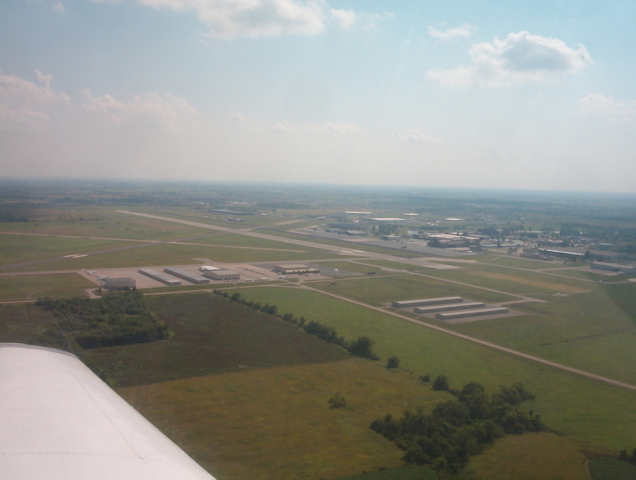
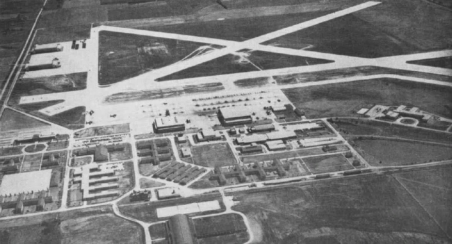
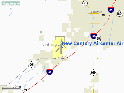
FAA diagram: New Century AirCenter New Century AirCenter (IATA: JCI, ICAO: KIXD, FAA LID: IXD), formerly known as Naval Air Station Olathe, Flatley Field and Johnson County Industrial Airport, is a general aviation airport located four miles (6 km) southwest of the central business district of Olathe, a city in Johnson County, Kansas, United States. Although most U.S. airports use the same three-letter location identifier for the FAA and IATA, New Century AirCenter is assigned IXD by the FAA and JCI by the IATA (which assigned IXD to Bamrauli Airport in Allahabad, India). The airport's ICAO identifier is KIXD. The airportâs codes were derived from its name of Johnson County Industrial Airport. The county originally sought the âINDâ designation for its âindustrialâ name but that identifier went to Indianapolis International Airport. The county then sought an âIJCâ code based on the Johnson County name but that was rejected as too similar to the OJC code of the neighboring Johnson County Executive Airport (which was an auxiliary field for the Naval Station Olathe). The airport wound up with the closest available industrial code "IXD." The previous FAA code for Naval Air Station Olathe was NUU and the ICAO code KNUU. HistoryThe airport opened as Naval Air Station Olathe on October 1, 1942 and was referred locally as the Gardner, Kansas Navy Base because it was to be used for the Naval Air Transport Service (NATS) and Naval Air Primary Training Command (NAPTC) which had been operating out of Fairfax Airport. Future astronaut John Glenn was in the first class to be trained at the base and he was to make his first solo flight in a military plane from the base. Glenn described the airport in its early days:
After World War II NAS Olathe was used for flight operations by units of the Naval Air Reserve and Marine Air Reserve, as well as a naval air technical training center for active duty enlisted personnel. During the Korean War, NAS Olathe-based Naval Reserve Fighter Squadron 774 (VF 774) was recalled to active duty for two years, including six months of action aboard USS Boxer (CV-21). NAS Olathe's runways were lengthened in 1951 to accept the first jets, North American FJ-1 Furys, to be based at NAS Olathe. By 1954, a Jet Transition Training Unit (JTTU) was established at Olathe for propeller pilots transitioning to jet aircraft. F4D Skyray fighters later operated at NAS Olathe by Naval Air Reserve and Marine Air Reserve squadrons until 1966. From 1950 to 1955, the Air Force Reserve's 442d Troop Carrier Wing was temporarily based at NAS Olathe prior to its relocation to Grandview Airport, Missouri, later renamed Richards-Gebaur AFB. In 1959, NAS Olathe was also used as a site for the U.S. Army's Nike-Hercules Missile program. World War II hero, then-Captain, later Vice Admiral James H. Flatley, Jr., commanded NAS Olathe for about a year. The base was to be renamed NAS Olathe (Flately Field) for him in 1962. For over 20 years, Naval Air Reservists from across the Midwst honed their skills and maintained their readiness with squadrons and support units at NAS Olathe. However, budgetary pressures of the Vietnam War forced NAS Olathe to close. The base was decommissioned on October 29, 1969 and the air station was officially closed in July 1970 with the understanding that the Navy could retain thirteen buildings for non-flying Naval Reserve aviation programs as Naval Air Reserve Center Olathe. The airport was acquired by Johnson County in 1973 and renamed Johnson County Industrial Airport to reflect a new mission of being an industrial park (including the Fred Allenbrand Criminal Justice Complex for Johnson County). On September 28, 1994 the name was changed to New Century AirCenter so as not to minimize its aviation component. In 1995, the Base Realignment and Closure Commission (BRAC) voted to close NAVAIRESCEN Olathe and consolidate its units and functions at other Naval Air Reserve activities, with all Navy activities ceasing in 1996. The base was featured in a segment on the A&E Network entitled âHaunted Americaâ in which it is claimed the base is the site of paranormal activity after a pilot crashed into an aircraft hangar next to the airport control tower in the 1950s. According to the report: security guards hear voices, whistles, footsteps on the floor and on overhead catwalks. Locks refuse to stay locked and doors open and close without wind or human intervention and an occasional apparition makes an appearance. Facilities and aircraft
New Century Aircenter Airport covers an area of 2,600 acres (1,052 ha) which contains two runways:
For 12-month period ending December 31, 2006, the airport had 58,114 aircraft operations, an average of 159 per day: 55% transient general aviation (32,150), 39% local general aviation (22,697), 4% air taxi (2,179) and 2% military (1,088). There are 130 aircraft based at this airport: 73% single engine (95), 21% multi engine (27), 6% jet aircraft (8) and 12% military (16). The above content comes from Wikipedia and is published under free licenses – click here to read more.
Runway Information Runway 04/22
Runway 18/36
Radio Navigation Aids
Remarks
Based Aircraft
Operational Statistics Time Period: 2006-01-01 - 2006-12-31
New Century Aircenter Airport Address: Johnson County, KS Tel: 913-715-6000 Images
and information placed above are from We thank them for the data!
We don't guarantee the information is fresh and accurate. The data may
be wrong or outdated.
|
|||||||||||||||||||||||||||||||||||||||||||||||||||||||||||||||||||||||||||||||||||||||||||||||||||||||||||||||||||||||||||||||||||||||||||||||||||||||||||||||||||||||||||||||||||||||||||||||||||||||||||||||||||||||||||||||||||||||||||||||||||||||||||||||||||||||||||||||||||||||||||||||||||||||||||||||||||||||||||||||||||||||||||||||||||||||||||||||||||||||||||||||||||||||||||||||||||||||||||||||||||||||||||||||||||||||||||||

 |
|
Copyright 2004-2026 © by Airports-Worldwide.com, Vyshenskoho st. 36, Lviv 79010, Ukraine Legal Disclaimer |