 |
|
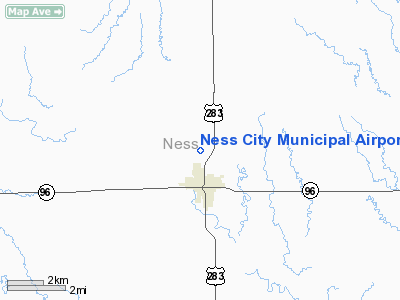
Ness City Municipal Airport |
|
|
|
Location &
QuickFacts
|
FAA
Information Effective: |
2008-09-25 |
|
Airport
Identifier: |
48K |
|
Airport
Status: |
Operational |
|
Longitude/Latitude: |
099-54-29.0400W/38-28-15.9700N
-99.908067/38.471103 (Estimated) |
|
Elevation: |
2308 ft / 703.48 m (Surveyed) |
|
Land: |
14 acres |
|
From
nearest city: |
1 nautical miles N of Ness City, KS |
|
Location: |
Ness County, KS |
|
Magnetic Variation: |
08E (1990) |
Owner & Manager
|
Ownership: |
Publicly owned |
|
Owner: |
City Of Ness City |
|
Address: |
Box 419
Ness City, KS 67560 |
|
Phone
number: |
785-798-2229 |
|
Manager: |
Eddie Wassinger |
|
Address: |
City Bldg
Ness City, KS 67560 |
|
Phone number: |
785-798-5355 |
Airport Operations and Facilities
|
Airport
Use: |
Open to public |
|
Wind
indicator: |
Yes |
|
Segmented Circle: |
No |
|
Control
Tower: |
No |
|
Lighting
Schedule: |
DUSK-DAWN |
|
Beacon
Color: |
Clear-Green (lighted land airport) |
|
Landing
fee charge: |
No |
|
Sectional chart: |
Wichita |
|
Region: |
ACE - Central |
|
Boundary
ARTCC: |
ZKC - Kansas City |
|
Tie-in
FSS: |
ICT - Wichita |
|
FSS on
Airport: |
No |
|
FSS Toll
Free: |
1-800-WX-BRIEF |
|
NOTAMs
Facility: |
ICT (NOTAM-d service avaliable) |
|
Federal Agreements: |
N |
Airport Communications
Airport Services
|
Airframe
Repair: |
NONE |
|
Power
Plant Repair: |
NONE |
|
Runway Information
Runway 17/35
|
Dimension: |
3156 x 48 ft / 961.9 x 14.6 m |
|
Surface: |
ASPH, Fair Condition |
|
Edge Lights: |
Low |
|
|
Runway 17
|
Runway 35
|
|
Longitude: |
099-54-29.0640W |
099-54-29.0080W |
|
Latitude: |
38-28-31.5610N |
38-28-00.3710N |
|
Elevation: |
2308.00 ft |
2281.00 ft |
|
Alignment: |
127 |
127 |
|
Traffic
Pattern: |
Left |
Left |
|
Markings: |
Basic, Fair Condition |
Basic, Fair Condition |
|
Obstruction: |
41 ft pline, 1500.0 ft from runway, 31:1 slope to clear |
28 ft bldg, 200.0 ft from runway, 50 ft left of
centerline |
|
Radio Navigation Aids
|
ID |
Type |
Name |
Ch |
Freq |
Var |
Dist |
|
LQR |
NDB |
Larned |
|
296.00 |
08E |
41.9 nm |
|
TQK |
NDB |
Scott City |
|
256.00 |
08E |
46.1 nm |
|
HIL |
NDB |
Hilyn |
|
338.00 |
08E |
47.8 nm |
|
HYS |
VORTAC |
Hays |
041X |
110.40 |
10E |
37.3 nm |
|
DDC |
VORTAC |
Dodge City |
019X |
108.20 |
08E |
37.6 nm |
|
HLC |
VORTAC |
Hill City |
084X |
113.70 |
08E |
49.6 nm |
Remarks
-
PUBLIC PHONE AVBL
785-798-2702.
-
RY EDGES & TWYS SOFT.
-
RY 35 APCH IS
OBSTRUCTED BY BLDGS L & R OF CNTRLN, A LGTD WINDSOCK & ROTG BCN ATOP A HANGAR
L OF RY CNTRLN.
-
PROVIDED A CLEAR
APPROACH TO EACH RWY IS MAINTAINED FOR A MINIMUM 20:1 GLIDE SLOPE AND THE
TRANSITIONAL SURFACE IS MAINTAINED FOR A 7:1 SLOPE.
Based Aircraft
|
Aircraft based
on field: |
5 |
|
Single Engine
Airplanes: |
5 |
Operational Statistics
Time Period: 2005-08-30 - 2006-08-29
|
Aircraft
Operations: |
77/Week |
|
General
Aviation Local: |
75.0% |
|
General
Aviation Itinerant: |
25.0% |
Ness City Municipal Airport
Address:
Ness County, KS
Tel:
785-798-2229,
785-798-5355
Images
and information placed above are from
http://www.airport-data.com/airport/48K/
We
thank them for the data!
|
General Info |
| Country |
United
States |
| State |
KANSAS
|
| FAA ID |
48K
|
| Latitude |
38-28-15.970N |
|
Longitude |
099-54-29.040W |
|
Elevation |
2308
feet |
| Near
City |
NESS
CITY |
We don't guarantee the information is fresh and accurate. The data may
be wrong or outdated.
For more up-to-date information please refer to other sources.
|
|


