 |
|
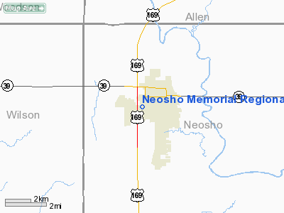
Neosho Memorial Regional Hospital Heliport |
|
Location &
QuickFacts
|
FAA
Information Effective: |
2008-09-25 |
|
Airport
Identifier: |
89KS |
|
Airport
Status: |
Operational |
|
Longitude/Latitude: |
095-28-23.9300W/37-40-30.1700N
-95.473314/37.675047 (Estimated) |
|
Elevation: |
988 ft / 301.14 m (Estimated) |
|
Land: |
0 acres |
|
From
nearest city: |
0 nautical miles N of Chanute, KS |
|
Location: |
Neosho County, KS |
|
Magnetic Variation: |
05E (1995) |
Owner & Manager
|
Ownership: |
Publicly owned |
|
Owner: |
Neosho County |
|
Address: |
629 S. Plummer; P.o. Box 426
Chanute, KS 66720-0426 |
|
Phone
number: |
620-431-4000 |
|
Manager: |
Murray Brown |
|
Address: |
629 S. Plummer; P.o. Box 426
Chanute, KS 66720-0426 |
|
Phone number: |
620-431-4000 |
Airport Operations and Facilities
|
Airport
Use: |
Private
MEDICAL USE. |
|
Segmented Circle: |
No |
|
Control
Tower: |
No |
|
Region: |
ACE - Central |
|
Boundary
ARTCC: |
ZKC - Kansas City |
|
Tie-in
FSS: |
ICT - Wichita |
|
FSS Toll
Free: |
1-800-WX-BRIEF |
|
Runway Information
Helipad H1
|
Dimension: |
20 x 20 ft / 6.1 x 6.1 m |
|
Surface: |
CONC, |
|
|
Runway H1
|
Runway
|
|
Traffic
Pattern: |
Left |
Left |
|
Radio Navigation Aids
|
ID |
Type |
Name |
Ch |
Freq |
Var |
Dist |
|
MSB |
NDB |
Monarch |
|
410.00 |
04E |
7.5 nm |
|
PPF |
NDB |
Parsons |
|
258.00 |
06E |
20.3 nm |
|
FSK |
NDB |
Fort Scott |
|
379.00 |
05E |
34.4 nm |
|
CFV |
NDB |
Coffeyville |
|
212.00 |
05E |
35.3 nm |
|
PTS |
NDB |
Pittsburg |
|
365.00 |
05E |
38.2 nm |
|
UKL |
NDB |
Boyd |
|
245.00 |
05E |
39.3 nm |
|
CNU |
VOR/DME |
Chanute |
029X |
109.20 |
05E |
6.4 nm |
|
OSW |
VORTAC |
Oswego |
123X |
117.60 |
08E |
33.7 nm |
|
EMP |
VORTAC |
Emporia |
075X |
112.80 |
08E |
48.6 nm |
Remarks
-
SEE AIRSPACE CASE
98-ACE-204-NRA.
Neosho Memorial Regional Hospital
Heliport
Address:
Neosho County, KS
Tel:
620-431-4000
Images
and information placed above are from
http://www.airport-data.com/airport/89KS/
We
thank them for the data!
|
General Info |
| Country |
United
States |
| State |
KANSAS
|
| FAA ID |
89KS
|
| Latitude |
37-40-30.170N |
|
Longitude |
095-28-23.930W |
|
Elevation |
988 feet
|
| Near
City |
CHANUTE
|
We don't guarantee the information is fresh and accurate. The data may
be wrong or outdated.
For more up-to-date information please refer to other sources.
|
|


