 |
|
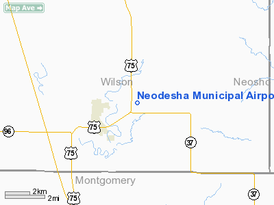
Neodesha Municipal Airport |
|
|
|
Location &
QuickFacts
|
FAA
Information Effective: |
2008-09-25 |
|
Airport
Identifier: |
2K7 |
|
Airport
Status: |
Operational |
|
Longitude/Latitude: |
095-38-46.0280W/37-26-07.3120N
-95.646119/37.435364 (Estimated) |
|
Elevation: |
841 ft / 256.34 m (Surveyed) |
|
Land: |
190 acres |
|
From
nearest city: |
2 nautical miles NE of Neodesha, KS |
|
Location: |
Wilson County, KS |
|
Magnetic Variation: |
06E (1985) |
Owner & Manager
|
Ownership: |
Publicly owned |
|
Owner: |
City Of Neodesha |
|
Address: |
Po Box 336
Neodesha, KS 66757 |
|
Phone
number: |
620-325-2828 |
|
Manager: |
Jerry Lour
ALTERNATE CONTACT: BRENT WHEELER - (620) 325-2831 |
|
Address: |
Po Box 336
Neodesha, KS 66757 |
|
Phone number: |
620-325-2750
EVENING CALL 620-325-5186. |
Airport
Operations and Facilities
|
Airport
Use: |
Open to public |
|
Wind
indicator: |
Yes |
|
Segmented Circle: |
Yes |
|
Control
Tower: |
No |
|
Lighting
Schedule: |
DUSK-DAWN |
|
Beacon
Color: |
Clear-Green (lighted land airport) |
|
Landing
fee charge: |
No |
|
Sectional chart: |
Kansas City |
|
Region: |
ACE - Central |
|
Boundary
ARTCC: |
ZKC - Kansas City |
|
Tie-in
FSS: |
ICT - Wichita |
|
FSS on
Airport: |
No |
|
FSS Toll
Free: |
1-800-WX-BRIEF |
|
NOTAMs
Facility: |
ICT (NOTAM-d service avaliable) |
|
Federal Agreements: |
1 |
Airport Communications
|
CTAF: |
122.800 |
|
Unicom: |
122.800 |
Airport Services
|
Bottled
Oxygen: |
NONE |
|
Bulk
Oxygen: |
NONE |
|
Runway Information
Runway 02/20
|
Dimension: |
2998 x 46 ft / 913.8 x 14.0 m |
|
Surface: |
ASPH, Good Condition
RY WAVY. |
|
Weight Limit: |
Single wheel: 11000 lbs. |
|
Edge Lights: |
Non-standard lighting system
NSTD LIRL; ALL CLEAR LENSES. |
|
|
Runway 02
|
Runway 20
|
|
Longitude: |
095-38-58.9740W |
095-38-41.1250W |
|
Latitude: |
37-25-51.9460N |
37-26-17.9450N |
|
Elevation: |
822.00 ft |
841.00 ft |
|
Alignment: |
29 |
127 |
|
Traffic
Pattern: |
Left |
Left |
|
Markings: |
Numbers only, Fair Condition |
Numbers only, Fair Condition |
|
Obstruction: |
68 ft trees, 860.0 ft from runway, 240 ft right of
centerline, 9:1 slope to clear
11 FT TREE 185 FT FM RY END, 15FT L. |
4 ft fence, 245.0 ft from runway, 11:1 slope to clear |
|
Runway 15/33
|
Dimension: |
2050 x 45 ft / 624.8 x 13.7 m |
|
Surface: |
TURF, Good Condition
RY WAVY. |
|
|
Runway 15
|
Runway 33
|
|
Longitude: |
095-38-45.4290W |
095-38-34.9280W |
|
Latitude: |
37-26-20.2110N |
37-26-01.2120N |
|
Elevation: |
840.00 ft |
825.00 ft |
|
Traffic
Pattern: |
Left |
Left |
|
Obstruction: |
4 ft fence, 20.0 ft from runway, 5:1 slope to clear |
19 ft tree, 37.0 ft from runway, 125 ft right of
centerline, 2:1 slope to clear |
|
Radio Navigation Aids
|
ID |
Type |
Name |
Ch |
Freq |
Var |
Dist |
|
PPF |
NDB |
Parsons |
|
258.00 |
06E |
8.8 nm |
|
CFV |
NDB |
Coffeyville |
|
212.00 |
05E |
20.9 nm |
|
MSB |
NDB |
Monarch |
|
410.00 |
04E |
24.1 nm |
|
PTS |
NDB |
Pittsburg |
|
365.00 |
05E |
43.9 nm |
|
FSK |
NDB |
Fort Scott |
|
379.00 |
05E |
47.2 nm |
|
CNU |
VOR/DME |
Chanute |
029X |
109.20 |
05E |
11.7 nm |
|
BVO |
VOR/DME |
Bartlesville |
126X |
117.90 |
08E |
40.3 nm |
|
OSW |
VORTAC |
Oswego |
123X |
117.60 |
08E |
27.0 nm |
Remarks
-
ULTRALIGHT
ACTIVITY ON AND INVOF ARPT.
-
WILDLIFE ON & INVOF ARPT.
-
ESTABLISHED PRIOR TO 1959.
Based Aircraft
|
Aircraft based
on field: |
2 |
|
Single Engine
Airplanes: |
2 |
Operational Statistics
Time Period: 2006-09-11 - 2007-09-10
|
Aircraft
Operations: |
24/Week |
|
Air Taxi: |
1.6% |
|
General
Aviation Local: |
65.6% |
|
General
Aviation Itinerant: |
32.8% |
Neodesha Municipal Airport
Address:
Wilson County, KS
Tel:
620-325-2828,
620-325-2750
Images
and information placed above are from
http://www.airport-data.com/airport/2K7/
We
thank them for the data!
|
General Info |
| Country |
United
States |
| State |
KANSAS
|
| FAA ID |
2K7
|
| Latitude |
37-26-07.312N |
|
Longitude |
095-38-46.028W |
|
Elevation |
841 feet
|
| Near
City |
NEODESHA
|
We don't guarantee the information is fresh and accurate. The data may
be wrong or outdated.
For more up-to-date information please refer to other sources.
|
|


