 |
|
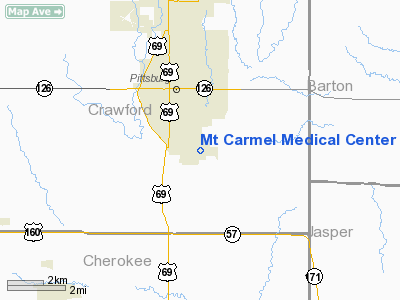
Mt Carmel Medical Center Heliport |
|
|
|
Location &
QuickFacts
|
FAA
Information Effective: |
2008-09-25 |
|
Airport
Identifier: |
SN50 |
|
Airport
Status: |
Operational |
|
Longitude/Latitude: |
094-41-06.8510W/37-22-49.1860N
-94.685236/37.380329 (Estimated) |
|
Elevation: |
915 ft / 278.89 m (Estimated) |
|
Land: |
0 acres |
|
From
nearest city: |
2 nautical miles SE of Pittsburg, KS |
|
Location: |
Crawford County, KS |
|
Magnetic Variation: |
05E (1990) |
Owner & Manager
|
Ownership: |
Privately owned |
|
Owner: |
Mt. Carmel Medical Center |
|
Address: |
1102 East Centennial
Pittsburg, KS 66762 |
|
Phone number: |
316-232-0369 |
|
Manager: |
Gary Falcetto |
|
Address: |
1102 East Centennial
Pittsburg, KS 66762 |
|
Phone number: |
316-232-0369 |
Airport
Operations and Facilities
|
Airport
Use: |
Private
MEDICAL USE. |
|
Wind
indicator: |
Yes |
|
Segmented Circle: |
No |
|
Control
Tower: |
No |
|
Lighting
Schedule: |
DUSK-DAWN
FOR PERIMETER LGTS CALL 316-232-0369. |
|
Beacon
Color: |
Clear-Green-Yellow (heliport) |
|
Sectional chart: |
Kansas City |
|
Region: |
ACE - Central |
|
Boundary
ARTCC: |
ZKC - Kansas City |
|
Tie-in
FSS: |
ICT - Wichita |
|
FSS Toll
Free: |
1-800-WX-BRIEF |
|
Runway Information
Helipad H1
|
Dimension: |
40 x 40 ft / 12.2 x 12.2 m |
|
Surface: |
CONC, |
|
|
Runway H1
|
Runway
|
|
Traffic
Pattern: |
Left |
Left |
|
Radio Navigation Aids
|
ID |
Type |
Name |
Ch |
Freq |
Var |
Dist |
|
PTS |
NDB |
Pittsburg |
|
365.00 |
05E |
4.2 nm |
|
LLU |
NDB |
Spring River |
|
356.00 |
05E |
19.0 nm |
|
FSK |
NDB |
Fort Scott |
|
379.00 |
05E |
25.3 nm |
|
EAD |
NDB |
Nevada |
|
209.00 |
06E |
34.0 nm |
|
PPF |
NDB |
Parsons |
|
258.00 |
06E |
39.4 nm |
|
MSB |
NDB |
Monarch |
|
410.00 |
04E |
42.6 nm |
|
CFV |
NDB |
Coffeyville |
|
212.00 |
05E |
45.8 nm |
|
EOS |
VOR/DME |
Neosho |
120X |
117.30 |
07E |
34.5 nm |
|
CNU |
VOR/DME |
Chanute |
029X |
109.20 |
05E |
45.8 nm |
|
OSW |
VORTAC |
Oswego |
123X |
117.60 |
08E |
28.2 nm |
Remarks
-
OWNER DESIRES
HELIPORT NOT BE CHARTED.
-
PRVDD APCH/DEP
FOR A 8:1 GLIDE SLOPE & A 2:1 TRANSITIONAL SLOPE.
Mt Carmel Medical Center Heliport
Address:
Crawford County, KS
Tel:
316-232-0369
Images
and information placed above are from
http://www.airport-data.com/airport/SN50/
We
thank them for the data!
|
General Info |
| Country |
United
States |
| State |
KANSAS
|
| FAA ID |
SN50
|
| Latitude |
37-22-49.186N |
|
Longitude |
094-41-06.851W |
|
Elevation |
915 feet
|
| Near
City |
PITTSBURG |
We don't guarantee the information is fresh and accurate. The data may
be wrong or outdated.
For more up-to-date information please refer to other sources.
|
|


