 |
|
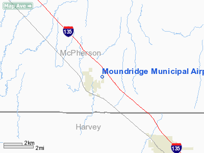
Moundridge Municipal Airport |
|
|
|
Location &
QuickFacts
|
FAA
Information Effective: |
2008-09-25 |
|
Airport
Identifier: |
47K |
|
Airport
Status: |
Operational |
|
Longitude/Latitude: |
097-30-09.8100W/38-12-32.7300N
-97.502725/38.209092 (Estimated) |
|
Elevation: |
1489 ft / 453.85 m (Surveyed) |
|
Land: |
58 acres |
|
From
nearest city: |
1 nautical miles E of Moundridge, KS |
|
Location: |
Mc Pherson County, KS |
|
Magnetic Variation: |
07E (1985) |
Owner & Manager
|
Ownership: |
Publicly owned |
|
Owner: |
City Of Moundridge |
|
Address: |
225 South Christian Avenue
Moundridge, KS 67107 |
|
Phone
number: |
620-345-2661 |
|
Manager: |
Ron Huxman |
|
Address: |
225 South Christian Avenue
Moundridge, KS 67107 |
|
Phone number: |
620 345 2661
RON HUXMAN HOME 620-345 6466 |
Airport
Operations and Facilities
|
Airport
Use: |
Open to public |
|
Wind
indicator: |
Yes |
|
Segmented Circle: |
No |
|
Control
Tower: |
No |
|
Lighting
Schedule: |
DUSK-DAWN |
|
Beacon
Color: |
Clear-Green (lighted land airport) |
|
Landing
fee charge: |
No |
|
Sectional chart: |
Wichita |
|
Region: |
ACE - Central |
|
Boundary
ARTCC: |
ZKC - Kansas City |
|
Tie-in
FSS: |
ICT - Wichita |
|
FSS on
Airport: |
No |
|
FSS Toll
Free: |
1-800-WX-BRIEF |
|
NOTAMs
Facility: |
ICT (NOTAM-d service avaliable) |
Airport Communications
Airport Services
|
Fuel
available: |
100LLMOGAS
SELF SERVE FUEL AVBL BY CREDIT CARD. |
|
Airframe
Repair: |
NONE |
|
Power
Plant Repair: |
NONE |
|
Runway Information
Runway 17/35
|
Dimension: |
3405 x 50 ft / 1037.8 x 15.2 m |
|
Surface: |
ASPH, Good Condition |
|
Edge Lights: |
Low |
|
|
Runway 17
|
Runway 35
|
|
Longitude: |
097-30-09.7800W |
097-30-09.8400W |
|
Latitude: |
38-12-49.5600N |
38-12-15.9000N |
|
Elevation: |
1489.00 ft |
1488.00 ft |
|
Alignment: |
127 |
0 |
|
Traffic
Pattern: |
Left |
Left |
|
Markings: |
Non-precision instrument, Good Condition |
Non-precision instrument, Good Condition |
|
Obstruction: |
15 ft road, 670.0 ft from runway, 290 ft left of
centerline, 31:1 slope to clear |
16 ft road, 525.0 ft from runway, 20:1 slope to clear |
|
Radio Navigation Aids
|
ID |
Type |
Name |
Ch |
Freq |
Var |
Dist |
|
MPR |
NDB |
Mc Pherson |
|
227.00 |
06E |
12.1 nm |
|
EWK |
NDB |
Newton |
|
281.00 |
06E |
13.9 nm |
|
LYO |
NDB |
Lyons |
|
386.00 |
06E |
35.2 nm |
|
IC |
NDB |
Piche |
|
332.00 |
07E |
38.0 nm |
|
EQA |
NDB |
El Dorado |
|
383.00 |
05E |
41.5 nm |
|
HRU |
NDB |
Herington |
|
407.00 |
06E |
43.6 nm |
|
IAB |
TACAN |
Mc Connell |
112X |
|
07E |
37.0 nm |
|
HUT |
VOR/DME |
Hutchinson |
115X |
116.80 |
09E |
24.1 nm |
|
ICT |
VORTAC |
Wichita |
085X |
113.80 |
07E |
28.1 nm |
|
SLN |
VORTAC |
Salina |
118X |
117.10 |
07E |
43.4 nm |
|
ICT |
VOT |
Wichita |
|
114.00 |
|
34.6 nm |
Remarks
-
PHONE AVBL 24 HRS.
-
TWY & TIEDOWN AREAS SOFT.
-
PROVIDED APCH TO
EACH RWY IS MAINTAINED FOR A MIN 20:1 GLIDE SLOPE AND THE TRANSITIONAL SURFACE
BE MAINTAINED FOR A 7:1 SLOPE.
Based Aircraft
|
Aircraft based
on field: |
14 |
|
Single Engine
Airplanes: |
14 |
Operational Statistics
Time Period: 2007-07-26 - 2008-07-24
|
Aircraft
Operations: |
185/Week |
|
General
Aviation Local: |
41.7% |
|
General
Aviation Itinerant: |
57.3% |
|
Military: |
1.0% |
Moundridge Municipal Airport
Address:
Mc Pherson County, KS
Tel:
620-345-2661
Images
and information placed above are from
http://www.airport-data.com/airport/47K/
We
thank them for the data!
|
General Info |
| Country |
United
States |
| State |
KANSAS
|
| FAA ID |
47K
|
| Latitude |
38-12-25.033N |
|
Longitude |
097-30-11.141W |
|
Elevation |
1490
feet |
| Near
City |
MOUNDRIDGE |
We don't guarantee the information is fresh and accurate. The data may
be wrong or outdated.
For more up-to-date information please refer to other sources.
|
|


