 |
|
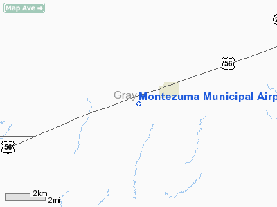
Montezuma Municipal Airport |
|
Location &
QuickFacts
|
FAA
Information Effective: |
2008-09-25 |
|
Airport
Identifier: |
K17 |
|
Airport
Status: |
Operational |
|
Longitude/Latitude: |
100-28-12.5000W/37-35-08.4000N
-100.470139/37.585667 (Estimated) |
|
Elevation: |
2780 ft / 847.34 m (Estimated) |
|
Land: |
20 acres |
|
From
nearest city: |
2 nautical miles SW of Montezuma, KS |
|
Location: |
Gray County, KS |
|
Magnetic Variation: |
08E (1995) |
Owner & Manager
|
Ownership: |
Publicly owned |
|
Owner: |
City Of Montezuma |
|
Address: |
Box 378
Montezuma, KS 67867 |
|
Phone number: |
620-846-2267 |
|
Manager: |
Dwight Watson |
|
Address: |
Box 378
Montezuma, KS 67867 |
|
Phone number: |
620-846-0001 |
Airport
Operations and Facilities
|
Airport
Use: |
Open to public |
|
Wind
indicator: |
Yes |
|
Segmented Circle: |
No |
|
Control
Tower: |
No |
|
Sectional chart: |
Wichita |
|
Region: |
ACE - Central |
|
Boundary
ARTCC: |
ZKC - Kansas City |
|
Tie-in
FSS: |
ICT - Wichita |
|
FSS on
Airport: |
No |
|
FSS Toll
Free: |
1-800-WX-BRIEF |
|
NOTAMs
Facility: |
ICT (NOTAM-d service avaliable) |
Airport Communications
|
Runway Information
Runway 17/35
|
Dimension: |
4000 x 120 ft / 1219.2 x 36.6 m |
|
Surface: |
TURF-DIRT, Fair Condition
ROUGH & UNEVEN. |
|
|
Runway 17
|
Runway 35
|
|
Longitude: |
100-28-12.3800W |
100-28-12.5400W |
|
Latitude: |
37-35-28.1700N |
37-34-48.6100N |
|
Traffic
Pattern: |
Left |
Left |
|
Displaced
threshold: |
700.00 ft
DSPLCD THLD MARKED WITH CONCRETE SLABS. |
0.00 ft |
|
Obstruction: |
35 ft pline
APCH RATIO 20:1 TO DSPLCD THLD. |
36 ft pline, 1250.0 ft from runway, 34:1 slope to clear |
|
Radio Navigation Aids
|
ID |
Type |
Name |
Ch |
Freq |
Var |
Dist |
|
MEJ |
NDB |
Meade |
|
389.00 |
09E |
18.9 nm |
|
GC |
NDB |
Pieve |
|
347.00 |
09E |
19.0 nm |
|
ULS |
NDB |
Ulysses |
|
395.00 |
09E |
42.8 nm |
|
GCK |
VORTAC |
Garden City |
080X |
113.30 |
11E |
23.4 nm |
|
DDC |
VORTAC |
Dodge City |
019X |
108.20 |
08E |
27.2 nm |
|
LBL |
VORTAC |
Liberal |
070X |
112.30 |
11E |
40.4 nm |
Remarks
-
+6 FT IRRIGATION
ENGINE/PUMP LCTD ON RY 17/35 WEST EDGE NEAR WINDSOCK.
-
(TWO) +4 FT
NATURAL GAS RISERS LCTD ON RY 17/35 WEST EDGE.
-
PROVIDED MAINTAIN
CLEAR 20:1 APCH AND 7:1 TRANSITIONAL SURFACE.
Based Aircraft
|
Aircraft based
on field: |
3 |
|
Single Engine
Airplanes: |
3 |
Operational Statistics
Time Period: 2005-06-14 - 2006-06-13
|
Aircraft
Operations: |
20/Week |
|
General
Aviation Local: |
90.0% |
|
General
Aviation Itinerant: |
10.0% |
Montezuma Municipal Airport
Address:
Gray County, KS
Tel:
620-846-2267, 620-846-0001
Images
and information placed above are from
http://www.airport-data.com/airport/K17/
We
thank them for the data!
|
General Info |
| Country |
United
States |
| State |
KANSAS
|
| FAA ID |
K17
|
| Latitude |
37-35-23.000N |
|
Longitude |
100-28-10.000W |
|
Elevation |
2780
feet |
| Near
City |
MONTEZUMA |
We don't guarantee the information is fresh and accurate. The data may
be wrong or outdated.
For more up-to-date information please refer to other sources.
|
|


