 |
|
|
Location &
QuickFacts
|
FAA
Information Effective: |
2008-09-25 |
|
Airport
Identifier: |
0KS7 |
|
Airport
Status: |
Operational |
|
Longitude/Latitude: |
097-53-11.1930W/37-41-34.0480N
-97.886443/37.692791 (Estimated) |
|
Elevation: |
1450 ft / 441.96 m (Estimated) |
|
Land: |
0 acres |
|
From
nearest city: |
10 nautical miles NW of Cheney, KS |
|
Location: |
Kingman County, KS |
|
Magnetic Variation: |
07E (1985) |
Owner & Manager
|
Ownership: |
Privately owned |
|
Owner: |
Edward & Leo Saurenman |
|
Address: |
Rr 2 Box 186a
Cheney, KANSAS 67025 |
|
Phone
number: |
316-297-4411 |
|
Manager: |
Edward & Leo Saurenman |
|
Address: |
Rr 2 Box 186a
Cheney, KANSAS 67025 |
|
Phone number: |
316-297-4411 |
Airport Operations and Facilities
|
Airport Use: |
Private |
|
Segmented Circle: |
No |
|
Control Tower: |
No |
|
Sectional chart: |
Wichita |
|
Region: |
ACE - Central |
|
Boundary ARTCC: |
ZKC - Kansas City |
|
Tie-in FSS: |
ICT - Wichita |
|
FSS Toll Free: |
1-800-WX-BRIEF |
Airport Services
|
Runway Information
Runway 18/36
|
Dimension: |
2000 x 75 ft / 609.6 x 22.9 m |
|
Surface: |
TURF, |
|
|
Runway 18
|
Runway 36
|
|
Traffic
Pattern: |
Left |
Left |
|
Radio Navigation Aids
|
ID |
Type |
Name |
Ch |
Freq |
Var |
Dist |
|
IC |
NDB |
Piche |
|
332.00 |
07E |
21.6 nm |
|
EGT |
NDB |
Wellington |
|
414.00 |
07E |
32.4 nm |
|
EWK |
NDB |
Newton |
|
281.00 |
06E |
36.7 nm |
|
MPR |
NDB |
Mc Pherson |
|
227.00 |
06E |
40.5 nm |
|
PTT |
NDB |
Pratt |
|
356.00 |
07E |
41.0 nm |
|
LYO |
NDB |
Lyons |
|
386.00 |
06E |
42.5 nm |
|
IAB |
TACAN |
Mc Connell |
112X |
|
07E |
29.7 nm |
|
HUT |
VOR/DME |
Hutchinson |
115X |
116.80 |
09E |
18.4 nm |
|
ICT |
VORTAC |
Wichita |
085X |
113.80 |
07E |
14.7 nm |
|
ANY |
VORTAC |
Anthony |
076X |
112.90 |
07E |
34.8 nm |
|
ICT |
VOT |
Wichita |
|
114.00 |
|
21.8 nm |
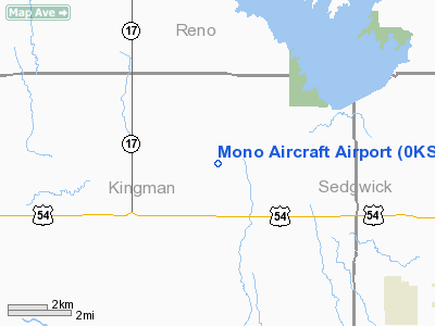
Mono Aircraft Airport
Address:
Kingman County, KS
Tel:
316-297-4411
Images
and information placed above are from
http://www.airport-data.com/airport/0KS7/
We
thank them for the data!
|
General Info |
| Country |
United
States |
| State |
KANSAS
|
| FAA ID |
0KS7
|
| Latitude |
37-41-34.048N |
|
Longitude |
097-53-11.193W |
|
Elevation |
1450
feet |
| Near
City |
CHENEY
|
We don't guarantee the information is fresh and accurate. The data may
be wrong or outdated.
For more up-to-date information please refer to other sources.
|
|


