 |
|
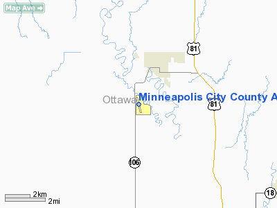
Minneapolis City County Airport |
|
Location &
QuickFacts
|
FAA
Information Effective: |
2008-09-25 |
|
Airport
Identifier: |
45K |
|
Airport
Status: |
Operational |
|
Longitude/Latitude: |
097-43-14.1320W/39-05-41.0020N
-97.720592/39.094723 (Estimated) |
|
Elevation: |
1245 ft / 379.48 m (Estimated) |
|
Land: |
29 acres |
|
From
nearest city: |
2 nautical miles SW of Minneapolis, KS |
|
Location: |
Ottawa County, KS |
|
Magnetic Variation: |
07E (1985) |
Owner & Manager
|
Ownership: |
Publicly owned |
|
Owner: |
City Ofminneapolis |
|
Address: |
218 N. Rock St.
Minneapolis, KS 67467 |
|
Phone number: |
785-392-2176 |
|
Manager: |
Pat Donovan |
|
Address: |
Box 42
Minneapolis, KS 67467 |
|
Phone number: |
785-392-3300 |
Airport
Operations and Facilities
|
Airport
Use: |
Open to public |
|
Wind
indicator: |
Yes |
|
Segmented Circle: |
No |
|
Control
Tower: |
No |
|
Landing
fee charge: |
No |
|
Sectional chart: |
Wichita |
|
Region: |
ACE - Central |
|
Boundary
ARTCC: |
ZKC - Kansas City |
|
Tie-in
FSS: |
ICT - Wichita |
|
FSS on
Airport: |
No |
|
FSS Toll
Free: |
1-800-WX-BRIEF |
|
NOTAMs
Facility: |
ICT (NOTAM-d service avaliable) |
Airport Communications
|
Runway Information
Runway 16/34
|
Dimension: |
3970 x 20 ft / 1210.1 x 6.1 m |
|
Surface: |
ASPH, Good Condition |
|
|
Runway 16
|
Runway 34
|
|
Traffic
Pattern: |
Left |
Left |
|
Markings: |
Numbers only, Good Condition |
Numbers only, Good Condition |
|
Obstruction: |
58 ft trees, 904.0 ft from runway, 166 ft left of
centerline, 12:1 slope to clear |
65 ft trees, 1150.0 ft from runway, 250 ft left of
centerline, 17:1 slope to clear
RWY 34 NUMEROUS SHRUBS AND SMALL TREES 10' +,123' FROM RWY END 27' LT. |
|
Radio Navigation Aids
|
ID |
Type |
Name |
Ch |
Freq |
Var |
Dist |
|
CNK |
NDB |
Concordia |
|
335.00 |
06E |
27.8 nm |
|
CYW |
NDB |
Clay Center |
|
362.00 |
07E |
31.2 nm |
|
RPB |
NDB |
Republican |
|
414.00 |
07E |
43.3 nm |
|
CVY |
NDB |
Cavalry |
|
314.00 |
06E |
43.4 nm |
|
MPR |
NDB |
Mc Pherson |
|
227.00 |
06E |
44.9 nm |
|
HRU |
NDB |
Herington |
|
407.00 |
06E |
48.9 nm |
|
FRI |
VOR |
Fort Riley |
|
109.40 |
06E |
40.8 nm |
|
MHK |
VOR/DME |
Manhattan |
039X |
110.20 |
06E |
49.1 nm |
|
SLN |
VORTAC |
Salina |
118X |
117.10 |
07E |
11.2 nm |
|
TKO |
VORTAC |
Mankato |
035X |
109.80 |
10E |
49.6 nm |
Remarks
-
ARPT OPERATES
DAYLIGHT HRS ONLY.
-
DEER ON & INVOF ARPT.
-
PRVDD THE APCH TO
EA RWY IS MAINTD FOR A MIN 20:1 GS AND TRANSITIONAL SFC MAINTD FOR A 7:1
SLOPE.
Based Aircraft
|
Aircraft based
on field: |
2 |
|
Single Engine
Airplanes: |
2 |
Operational Statistics
Time Period: 2007-05-22 - 2008-05-20
|
Aircraft
Operations: |
212/Week |
|
General
Aviation Local: |
54.5% |
|
General
Aviation Itinerant: |
45.5% |
Minneapolis City County Airport
Address:
Ottawa County, KS
Tel:
785-392-2176, 785-392-3300
Images
and information placed above are from
http://www.airport-data.com/airport/45K/
We
thank them for the data!
|
General Info |
| Country |
United
States |
| State |
KANSAS
|
| FAA ID |
45K
|
| Latitude |
39-05-41.002N |
|
Longitude |
097-43-14.132W |
|
Elevation |
1245
feet |
| Near
City |
MINNEAPOLIS |
We don't guarantee the information is fresh and accurate. The data may
be wrong or outdated.
For more up-to-date information please refer to other sources.
|
|


