 |
|
|
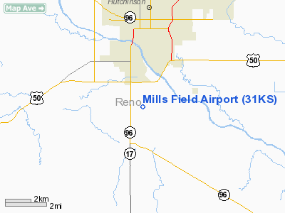
Location &
QuickFacts
|
FAA
Information Effective: |
2008-09-25 |
|
Airport
Identifier: |
31KS |
|
Airport
Status: |
Operational |
|
Longitude/Latitude: |
097-55-46.1880W/37-59-45.0420N
-97.929497/37.995845 (Estimated) |
|
Elevation: |
1520 ft / 463.30 m (Estimated) |
|
Land: |
240 acres |
|
From
nearest city: |
2 nautical miles S of South Hutchinson, KS |
|
Location: |
Reno County, KS |
|
Magnetic Variation: |
07E (1985) |
Owner & Manager
|
Ownership: |
Privately owned |
|
Owner: |
Larry Doskocil |
|
Address: |
5101 S Mc New Rd
Hutchinson, KS 67501 |
|
Phone number: |
620-662-0033 |
|
Address: |
|
Airport Operations and Facilities
|
Airport
Use: |
Private |
|
Wind
indicator: |
Yes |
|
Segmented Circle: |
No |
|
Control
Tower: |
No |
|
Landing
fee charge: |
No |
|
Sectional chart: |
Wichita |
|
Region: |
ACE - Central |
|
Boundary
ARTCC: |
ZKC - Kansas City |
|
Tie-in
FSS: |
ICT - Wichita |
|
FSS on
Airport: |
No |
|
FSS Toll
Free: |
1-800-WX-BRIEF |
|
Runway Information
Runway 17/35
|
Dimension: |
2300 x 75 ft / 701.0 x 22.9 m |
|
Surface: |
TURF, |
|
|
Runway 17
|
Runway 35
|
|
Traffic
Pattern: |
Left |
Left |
|
Radio Navigation Aids
|
ID |
Type |
Name |
Ch |
Freq |
Var |
Dist |
|
MPR |
NDB |
Mc Pherson |
|
227.00 |
06E |
24.1 nm |
|
LYO |
NDB |
Lyons |
|
386.00 |
06E |
25.4 nm |
|
EWK |
NDB |
Newton |
|
281.00 |
06E |
31.3 nm |
|
IC |
NDB |
Piche |
|
332.00 |
07E |
33.7 nm |
|
PTT |
NDB |
Pratt |
|
356.00 |
07E |
42.1 nm |
|
EGT |
NDB |
Wellington |
|
414.00 |
07E |
47.9 nm |
|
IAB |
TACAN |
Mc Connell |
112X |
|
07E |
38.6 nm |
|
HUT |
VOR/DME |
Hutchinson |
115X |
116.80 |
09E |
0.2 nm |
|
ICT |
VORTAC |
Wichita |
085X |
113.80 |
07E |
22.3 nm |
|
ICT |
VOT |
Wichita |
|
114.00 |
|
31.9 nm |
Remarks
-
PROVIDED A 20:1
GLIDE SLOPE AND A 7:1 TRANSITIONAL SLOPE ARE MAINTAINED.
Based Aircraft
|
Aircraft based
on field: |
3 |
|
Single Engine
Airplanes: |
3 |
Mills Field Airport
Address:
Reno County, KS
Tel:
620-662-0033
Images
and information placed above are from
http://www.airport-data.com/airport/31KS/
We
thank them for the data!
|
General Info |
| Country |
United
States |
| State |
KANSAS
|
| FAA ID |
31KS
|
| Latitude |
37-59-45.042N |
|
Longitude |
097-55-46.188W |
|
Elevation |
1520
feet |
| Near
City |
SOUTH
HUTCHINSON |
We don't guarantee the information is fresh and accurate. The data may
be wrong or outdated.
For more up-to-date information please refer to other sources.
|
|


