 |
|
|
|
|
|
|
Location &
QuickFacts
|
FAA
Information Effective: |
2008-09-25 |
|
Airport
Identifier: |
K81 |
|
Airport
Status: |
Operational |
|
Longitude/Latitude: |
094-55-11.7980W/38-32-25.2710N
-94.919944/38.540353 (Estimated) |
|
Elevation: |
940 ft / 286.51 m (Surveyed) |
|
Land: |
230 acres |
|
From
nearest city: |
3 nautical miles SW of Paola, KS |
|
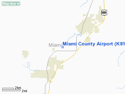
Location: |
Miami County, KS |
|
Magnetic Variation: |
03E (2000) |
Owner & Manager
|
Ownership: |
Publicly owned |
|
Owner: |
Miami County
SHANE KROLL, CO. ADMINISTRATOR. |
|
Address: |
201 S. Pearl
Paola, KS 66071 |
|
Phone number: |
913-294-3976 |
|
Manager: |
Wayne Harclerode |
|
Address: |
Box 399
Osawatomie, KS 66064 |
|
Phone number: |
913-755-2345 |
Airport
Operations and Facilities
|
Airport
Use: |
Open to public |
|
Wind
indicator: |
Yes |
|
Segmented Circle: |
Yes |
|
Control
Tower: |
No |
|
Lighting
Schedule: |
DUSK-2400
ACTVT MIRL RY 03/21 & REIL RYS 03 & /21; PAPI RYS 03 & 21 - CTAF. |
|
Beacon
Color: |
Clear-Green (lighted land airport) |
|
Landing
fee charge: |
No |
|
Sectional chart: |
Kansas City |
|
Region: |
ACE - Central |
|
Traffic
Pattern Alt: |
800 ft |
|
Boundary
ARTCC: |
ZKC - Kansas City |
|
Tie-in
FSS: |
ICT - Wichita |
|
FSS on
Airport: |
No |
|
FSS Toll
Free: |
1-800-WX-BRIEF |
|
NOTAMs
Facility: |
ICT (NOTAM-d service avaliable) |
|
Federal Agreements: |
N1 |
Airport Communications
|
CTAF: |
122.800 |
|
Unicom: |
122.800 |
Airport Services
|
Fuel
available: |
100LL
FUEL AVBL 24 HRS, AUTOMATED SELF-SERVICE, CREDIT CARD, VISA & MC ONLY. |
|
Airframe
Repair: |
MAJOR |
|
Power
Plant Repair: |
MAJOR |
|
Bottled
Oxygen: |
NONE |
|
Bulk
Oxygen: |
NONE |
|
Runway Information
Runway 03/21
|
Dimension: |
3400 x 60 ft / 1036.3 x 18.3 m |
|
Surface: |
ASPH,
ROUGH NEAR INTERSECTION WITH RY 03/21. |
|
Edge Lights: |
Medium |
|
|
Runway 03
|
Runway 21
|
|
Longitude: |
094-55-23.6300W |
094-54-57.2300W |
|
Latitude: |
38-32-14.9200N |
38-32-41.3700N |
|
Elevation: |
930.00 ft |
931.00 ft |
|
Alignment: |
38 |
127 |
|
Traffic
Pattern: |
Left |
Left |
|
Markings: |
Non-precision instrument, Good Condition |
Non-precision instrument, Good Condition |
|
Crossing
Height: |
37.00 ft |
36.00 ft |
|
VASI: |
4-light PAPI on left side |
4-light PAPI on left side |
|
Visual
Glide Angle: |
3.00° |
3.00° |
|
Runway End
Identifier: |
Yes |
Yes |
|
Obstruction: |
59 ft tree, 1634.0 ft from runway, 29 ft right of
centerline, 24:1 slope to clear |
54 ft tree, 1845.0 ft from runway, 325 ft right of
centerline, 30:1 slope to clear |
|
Runway 15/33
|
Dimension: |
1550 x 60 ft / 472.4 x 18.3 m |
|
Surface: |
TURF, Fair Condition
ROUGH NEAR INTERSECTION WITH RY 03/21. |
|
|
Runway 15
|
Runway 33
|
|
Longitude: |
094-55-19.2468W |
094-55-10.3500W |
|
Latitude: |
38-32-25.7852N |
38-32-12.1500N |
|
Elevation: |
926.00 ft |
939.00 ft |
|
Traffic
Pattern: |
Left |
Left |
|
Obstruction: |
29 ft tree, 1254.0 ft from runway, 244 ft right of
centerline, 43:1 slope to clear |
25 ft pole, 123.0 ft from runway, 92 ft right of
centerline, 4:1 slope to clear |
|
Radio Navigation Aids
|
ID |
Type |
Name |
Ch |
Freq |
Var |
Dist |
|
GQ |
NDB |
Norge |
|
517.00 |
05E |
33.7 nm |
|
GKB |
NDB |
Norge |
|
517.00 |
05E |
33.7 nm |
|
LXT |
NDB |
Lesumit |
|
263.00 |
04E |
36.0 nm |
|
UKL |
NDB |
Boyd |
|
245.00 |
05E |
40.4 nm |
|
DO |
NDB |
Dotte |
|
359.00 |
05E |
41.7 nm |
|
FSK |
NDB |
Fort Scott |
|
379.00 |
05E |
45.3 nm |
|
FOE |
TACAN |
Forbes |
053X |
|
05E |
42.5 nm |
|
OJC |
VOR/DME |
Johnson County |
077X |
113.00 |
06E |
20.0 nm |
|
RIS |
VOR/DME |
Riverside |
051X |
111.40 |
05E |
38.0 nm |
|
BUM |
VORTAC |
Butler |
106X |
115.90 |
07E |
26.0 nm |
|
MCI |
VORTAC |
Kansas City |
079Y |
113.25 |
05E |
45.6 nm |
|
TOP |
VORTAC |
Topeka |
125X |
117.80 |
05E |
46.4 nm |
|
ANX |
VORTAC |
Napoleon |
087X |
114.00 |
07E |
49.9 nm |
|
MKC |
VOT |
Kansas City Downtown |
|
108.60 |
|
38.1 nm |
|
FOE |
VOT |
Forbes |
|
111.00 |
|
42.9 nm |
Remarks
-
RY 15/33 W OF RY
03/21 CLSD INDEFLY.
-
PUBLIC PHONE AVBL.
Based Aircraft
|
Aircraft based
on field: |
20 |
|
Single Engine
Airplanes: |
20 |
Operational Statistics
Time Period: 2006-08-01 - 2007-07-31
|
Aircraft
Operations: |
193/Week |
|
General
Aviation Local: |
62.0% |
|
General
Aviation Itinerant: |
37.0% |
|
Military: |
1.0% |
Miami County Airport
Address:
Miami County, KS
Tel:
913-294-3976, 913-755-2345
Images
and information placed above are from
http://www.airport-data.com/airport/K81/
We
thank them for the data!
|
General Info |
| Country |
United
States |
| State |
KANSAS
|
| FAA ID |
K81
|
| Latitude |
38-32-15.050N |
|
Longitude |
094-55-30.871W |
|
Elevation |
945 feet
|
| Near
City |
PAOLA
|
We don't guarantee the information is fresh and accurate. The data may
be wrong or outdated.
For more up-to-date information please refer to other sources.
|
|


