 |
|
|
Location &
QuickFacts
|
FAA
Information Effective: |
2008-09-25 |
|
Airport
Identifier: |
3KS1 |
|
Airport
Status: |
Operational |
|
Longitude/Latitude: |
095-44-35.9400W/39-09-19.9940N
-95.743317/39.155554 (Estimated) |
|
Elevation: |
1080 ft / 329.18 m (Estimated) |
|
Land: |
0 acres |
|
From
nearest city: |
7 nautical miles NW of Topeka, KS |
|
Location: |
Shawnee County, KS |
|
Magnetic Variation: |
06E (1985) |
Owner & Manager
|
Ownership: |
Privately owned |
|
Owner: |
Max E. Collier |
|
Address: |
5225 Nw 62nd St
Topeka, KS 66618 |
|
Phone number: |
785-286-2951 |
|
Address: |
|
Airport Operations and Facilities
|
Airport Use: |
Private |
|
Wind indicator: |
Yes |
|
Segmented Circle: |
No |
|
Control Tower: |
No |
|
Landing fee charge: |
Yes |
|
Sectional chart: |
Kansas City |
|
Region: |
ACE - Central |
|
Boundary ARTCC: |
ZKC - Kansas City |
|
Tie-in FSS: |
ICT - Wichita |
|
FSS on Airport: |
No |
|
FSS Toll Free: |
1-800-WX-BRIEF |
Airport Services
|
Airframe
Repair: |
MAJOR |
|
Power
Plant Repair: |
MAJOR |
|
Runway Information
Runway 01/19
|
Dimension: |
2800 x 300 ft / 853.4 x 91.4 m |
|
Surface: |
TURF, |
|
|
Runway 01
|
Runway 19
|
|
Traffic
Pattern: |
Left |
Left |
|
Radio Navigation Aids
|
ID |
Type |
Name |
Ch |
Freq |
Var |
Dist |
|
TO |
NDB |
Biloy |
|
521.00 |
05E |
3.4 nm |
|
MQD |
NDB |
Mc Dowell Creek |
|
391.00 |
06E |
41.4 nm |
|
DO |
NDB |
Dotte |
|
359.00 |
05E |
46.4 nm |
|
CVY |
NDB |
Cavalry |
|
314.00 |
06E |
49.7 nm |
|
FOE |
TACAN |
Forbes |
053X |
|
05E |
13.1 nm |
|
MHK |
VOR/DME |
Manhattan |
039X |
110.20 |
06E |
43.1 nm |
|
RBA |
VOR/DME |
Robinson |
019X |
108.20 |
04E |
44.4 nm |
|
TOP |
VORTAC |
Topeka |
125X |
117.80 |
05E |
9.1 nm |
|
MCI |
VORTAC |
Kansas City |
079Y |
113.25 |
05E |
47.5 nm |
|
FOE |
VOT |
Forbes |
|
111.00 |
|
12.8 nm |
Remarks
Based Aircraft
|
Aircraft based
on field: |
35 |
|
Single Engine
Airplanes: |
30 |
|
Gliders: |
5 |
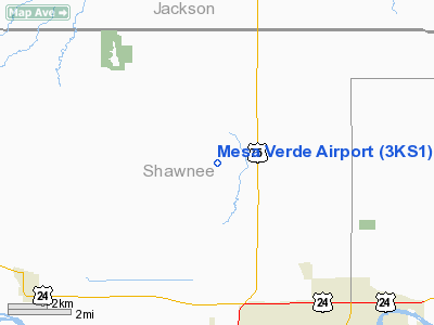
Mesa Verde Airport
Address:
Shawnee County, KS
Tel:
785-286-2951
Images
and information placed above are from
http://www.airport-data.com/airport/3KS1/
We
thank them for the data!
|
General Info |
| Country |
United
States |
| State |
KANSAS
|
| FAA ID |
3KS1
|
| Latitude |
39-09-19.994N |
|
Longitude |
095-44-35.940W |
|
Elevation |
1080
feet |
| Near
City |
TOPEKA
|
We don't guarantee the information is fresh and accurate. The data may
be wrong or outdated.
For more up-to-date information please refer to other sources.
|
|


