 |
|
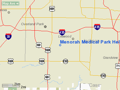
Menorah Medical Park Heliport |
|
|
|
Location &
QuickFacts
|
FAA
Information Effective: |
2008-09-25 |
|
Airport
Identifier: |
SN35 |
|
Airport
Status: |
Operational |
|
Longitude/Latitude: |
094-39-00.8500W/38-54-38.0200N
-94.650236/38.910561 (Estimated) |
|
Elevation: |
907 ft / 276.45 m (Estimated) |
|
Land: |
0 acres |
|
From
nearest city: |
0 nautical miles N of Overland Park, KS |
|
Location: |
Johnson County, KS |
|
Magnetic Variation: |
04E (1995) |
Owner & Manager
|
Ownership: |
Privately owned |
|
Owner: |
Menorah Medical Center |
|
Address: |
5721 W 119th Street
Overland Park, KS 66209 |
|
Phone
number: |
913-498-6773 |
|
Manager: |
Steven D Wilkinson |
|
Address: |
5721 W. 119th Street
Overland Park, KS 66209 |
|
Phone number: |
913-498-6773 |
Airport Operations and Facilities
|
Airport
Use: |
Private
FOR MEDICAL USE ONLY. |
|
Segmented Circle: |
No |
|
Control
Tower: |
No |
|
Lighting
Schedule: |
PHONE REQ
FOR PERIMETER LIGHTS CALL 913-498-6000. |
|
Landing
fee charge: |
No |
|
Sectional chart: |
Kansas City |
|
Region: |
ACE - Central |
|
Boundary
ARTCC: |
ZKC - Kansas City |
|
Tie-in
FSS: |
COU - Columbia |
|
FSS on
Airport: |
No |
|
FSS Toll
Free: |
1-800-WX-BRIEF |
|
Runway Information
Helipad H1
|
Dimension: |
40 x 40 ft / 12.2 x 12.2 m |
|
Surface: |
CONC, |
|
|
Runway H1
|
Runway
|
|
Traffic
Pattern: |
Left |
Left |
|
Radio Navigation Aids
|
ID |
Type |
Name |
Ch |
Freq |
Var |
Dist |
|
GQ |
NDB |
Norge |
|
517.00 |
05E |
9.1 nm |
|
GKB |
NDB |
Norge |
|
517.00 |
05E |
9.1 nm |
|
LXT |
NDB |
Lesumit |
|
263.00 |
04E |
13.4 nm |
|
DO |
NDB |
Dotte |
|
359.00 |
05E |
19.2 nm |
|
GPH |
NDB |
Mosby |
|
284.00 |
03E |
30.7 nm |
|
FOE |
TACAN |
Forbes |
053X |
|
05E |
47.3 nm |
|
OJC |
VOR/DME |
Johnson County |
077X |
113.00 |
06E |
5.8 nm |
|
RIS |
VOR/DME |
Riverside |
051X |
111.40 |
05E |
12.9 nm |
|
MCI |
VORTAC |
Kansas City |
079Y |
113.25 |
05E |
22.9 nm |
|
ANX |
VORTAC |
Napoleon |
087X |
114.00 |
07E |
26.8 nm |
|
BUM |
VORTAC |
Butler |
106X |
115.90 |
07E |
39.1 nm |
|
TOP |
VORTAC |
Topeka |
125X |
117.80 |
05E |
44.1 nm |
|
MKC |
VOT |
Kansas City Downtown |
|
108.60 |
|
13.0 nm |
|
FOE |
VOT |
Forbes |
|
111.00 |
|
47.6 nm |
Remarks
-
OWNER DESIRES
ARPT NOT BE CHARTED.
-
PRVDD
INGRESS/EGRESS 080-170 DEGS; POWER LINES & LIGHT POLES TO THE EAST ARE MKD AND
LIGHTED; PUT FENCE AROUND POD; PRVDD FIRE EQUIPMENT; MAINTAIN CLEAR 8:1 APCH/DEP
PATH; MAINTAIN CLEAR 2:1 TRANSITIONAL SURFACE.
Menorah Medical Park Heliport
Address:
Johnson County, KS
Tel:
913-498-6773
Images
and information placed above are from
http://www.airport-data.com/airport/SN35/
We
thank them for the data!
|
General Info |
| Country |
United
States |
| State |
KANSAS
|
| FAA ID |
SN35
|
| Latitude |
38-54-38.020N |
|
Longitude |
094-39-00.850W |
|
Elevation |
907 feet
|
| Near
City |
OVERLAND
PARK |
We don't guarantee the information is fresh and accurate. The data may
be wrong or outdated.
For more up-to-date information please refer to other sources.
|
|


