 |
|
|
Location &
QuickFacts
|
FAA
Information Effective: |
2008-09-25 |
|
Airport
Identifier: |
SN51 |
|
Airport
Status: |
Operational |
|
Longitude/Latitude: |
100-25-41.5080W/39-35-23.0140N
-100.428197/39.589726 (Estimated) |
|
Elevation: |
2725 ft / 830.58 m (Estimated) |
|
Land: |
3 acres |
|
From
nearest city: |
2 nautical miles S of Dresden, KS |
|
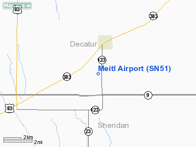
Location: |
Decatur County, KS |
|
Magnetic Variation: |
09E (1990) |
Owner & Manager
|
Ownership: |
Privately owned |
|
Owner: |
Brice Meitl |
|
Address: |
Hc 1 Box 171
Dresden, KS 67635 |
|
Phone number: |
913-475-3756 |
|
Manager: |
Brice Meitl |
|
Address: |
Hc 1 Box 171
Dresden, KS 67635 |
|
Phone number: |
913-475-3756 |
Airport
Operations and Facilities
|
Airport
Use: |
Private |
|
Wind
indicator: |
Yes |
|
Segmented Circle: |
No |
|
Control
Tower: |
No |
|
Sectional chart: |
Wichita |
|
Region: |
ACE - Central |
|
Boundary
ARTCC: |
ZDV - Denver |
|
Tie-in
FSS: |
ICT - Wichita |
|
FSS on
Airport: |
No |
|
FSS Toll
Free: |
1-800-WX-BRIEF |
|
Runway Information
Runway 13/31
|
Dimension: |
1435 x 45 ft / 437.4 x 13.7 m |
|
Surface: |
TURF, |
|
|
Runway 13
|
Runway 31
|
|
Traffic
Pattern: |
Left |
Left |
|
Radio Navigation Aids
|
ID |
Type |
Name |
Ch |
Freq |
Var |
Dist |
|
MCK |
FAN MARKER |
Mc Cook |
|
|
11E |
35.9 nm |
|
OIN |
NDB |
Oberlin |
|
341.00 |
09E |
15.3 nm |
|
JDM |
NDB |
Wheatfield |
|
408.00 |
08E |
29.1 nm |
|
NRN |
NDB |
Norton |
|
230.00 |
08E |
29.6 nm |
|
ADT |
NDB |
Atwood |
|
365.00 |
09E |
32.2 nm |
|
OEL |
NDB |
Oakley |
|
380.00 |
08E |
33.9 nm |
|
CSB |
NDB |
Harry Strunk |
|
389.00 |
08E |
44.7 nm |
|
MCK |
VOR/DME |
Mc Cook |
100X |
115.30 |
08E |
37.7 nm |
|
HLC |
VORTAC |
Hill City |
084X |
113.70 |
08E |
22.0 nm |
Remarks
-
PROVIDED APCHS
ARE MAINTAINED FOR A 20:1 SLOPE & TRANSITIONAL SURFACES FOR A 7:1 SLOPE.
Based Aircraft
|
Aircraft based
on field: |
2 |
|
Single Engine
Airplanes: |
1 |
|
Ultralights: |
1 |
Meitl Airport
Address:
Decatur County, KS
Tel:
913-475-3756
Images
and information placed above are from
http://www.airport-data.com/airport/SN51/
We
thank them for the data!
|
General Info |
| Country |
United
States |
| State |
KANSAS
|
| FAA ID |
SN51
|
| Latitude |
39-35-23.014N |
|
Longitude |
100-25-41.508W |
|
Elevation |
2725
feet |
| Near
City |
DRESDEN
|
We don't guarantee the information is fresh and accurate. The data may
be wrong or outdated.
For more up-to-date information please refer to other sources.
|
|


