 |
|
|
|
|
|
|
Location &
QuickFacts
|
FAA
Information Effective: |
2008-09-25 |
|
Airport
Identifier: |
K51 |
|
Airport
Status: |
Operational |
|
Longitude/Latitude: |
098-32-46.2930W/37-15-45.0820N
-98.546193/37.262523 (Estimated) |
|
Elevation: |
1543 ft / 470.31 m (Surveyed) |
|
Land: |
80 acres |
|
From
nearest city: |
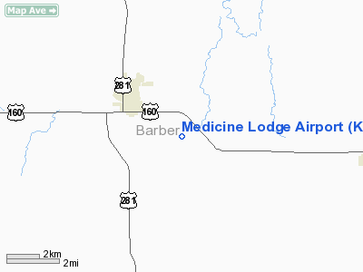
3 nautical miles SE of Medicine Lodge, KS |
|
Location: |
Barber County, KS |
|
Magnetic Variation: |
07E (1985) |
Owner & Manager
|
Ownership: |
Publicly owned |
|
Owner: |
Medicine Lodge |
|
Address: |
114 W. 1st Street
Medicine Lodge, KS 67104 |
|
Phone
number: |
620-886-3908 |
|
Manager: |
Ted Hauser |
|
Address: |
114 W 1st St.
Medicine Lodge, KS 67104 |
|
Phone number: |
620-886-3908 |
Airport Operations and Facilities
|
Airport
Use: |
Open to public |
|
Wind
indicator: |
Yes |
|
Segmented Circle: |
No |
|
Control
Tower: |
No |
|
Lighting
Schedule: |
DUSK-DAWN |
|
Landing
fee charge: |
No |
|
Sectional chart: |
Wichita |
|
Region: |
ACE - Central |
|
Boundary
ARTCC: |
ZKC - Kansas City |
|
Tie-in
FSS: |
ICT - Wichita |
|
FSS on
Airport: |
No |
|
FSS Toll
Free: |
1-800-WX-BRIEF |
|
NOTAMs
Facility: |
ICT (NOTAM-d service avaliable) |
Airport Communications
Airport Services
|
Airframe
Repair: |
NONE |
|
Power
Plant Repair: |
NONE |
|
Runway Information
Runway 01/19
|
Dimension: |
2270 x 90 ft / 691.9 x 27.4 m |
|
Surface: |
TURF, Good Condition |
|
|
Runway 01
|
Runway 19
|
|
Traffic
Pattern: |
Left |
Left |
|
Obstruction: |
12 ft trees, 15.0 ft from runway, 1:1 slope to clear |
20 ft tree, 100.0 ft from runway, 5:1 slope to clear |
|
Runway 13/31
|
Dimension: |
1690 x 80 ft / 515.1 x 24.4 m |
|
Surface: |
TURF, Good Condition |
|
|
Runway 13
|
Runway 31
|
|
Traffic
Pattern: |
Left |
Left |
|
Obstruction: |
25 ft trees, 200.0 ft from runway, 8:1 slope to clear |
6 ft fence, 0.0 ft from runway |
|
Runway 16/34
|
Dimension: |
3200 x 42 ft / 975.4 x 12.8 m |
|
Surface: |
ASPH, Good Condition |
|
Edge Lights: |
Low |
|
|
Runway 16
|
Runway 34
|
|
Traffic
Pattern: |
Left |
Left |
|
Markings: |
Nonstandard, Poor Condition
MARKINGS FADED. |
Nonstandard, Poor Condition
MARKINGS FADED. |
|
Obstruction: |
15 ft hill, 201.0 ft from runway
15 FT HILL 160-200 FT FM RY END; 25 FT TREE 50 FT R & 160 FT FM RY END. |
, 50:1 slope to clear
5 FT FENCE 160 FT FROM RY END. |
|
Radio Navigation Aids
|
ID |
Type |
Name |
Ch |
Freq |
Var |
Dist |
|
PTT |
NDB |
Pratt |
|
356.00 |
07E |
29.3 nm |
|
AVK |
NDB |
Alva |
|
203.00 |
08E |
29.7 nm |
|
ANY |
VORTAC |
Anthony |
076X |
112.90 |
07E |
19.0 nm |
Remarks
-
ULTRALIGHTS ON & INVOF ARPT.
-
EXISTED PRIOR TO 1959.
Based Aircraft
|
Aircraft based
on field: |
8 |
|
Single Engine
Airplanes: |
4 |
|
Ultralights: |
4 |
Operational Statistics
Time Period: 2007-08-15 - 2008-08-13
|
Aircraft
Operations: |
47/Week |
|
General
Aviation Local: |
50.0% |
|
General
Aviation Itinerant: |
50.0% |
Medicine Lodge Airport
Address:
Barber County, KS
Tel:
620-886-3908
Images
and information placed above are from
http://www.airport-data.com/airport/K51/
We
thank them for the data!
|
General Info |
| Country |
United
States |
| State |
KANSAS
|
| FAA ID |
K51
|
| Latitude |
37-15-45.082N |
|
Longitude |
098-32-46.293W |
|
Elevation |
1543
feet |
| Near
City |
MEDICINE
LODGE |
We don't guarantee the information is fresh and accurate. The data may
be wrong or outdated.
For more up-to-date information please refer to other sources.
|
|


