 |
|
|
|
|
|
|
Location &
QuickFacts
|
FAA
Information Effective: |
2008-09-25 |
|
Airport
Identifier: |
MPR |
|
Airport
Status: |
Operational |
|
Longitude/Latitude: |
097-41-28.7000W/38-21-08.8000N
-97.691306/38.352444 (Estimated) |
|
Elevation: |
1498 ft / 456.59 m (Surveyed) |
|
Land: |
215 acres |
|
From
nearest city: |
1 nautical miles SW of Mc Pherson, KS |
|
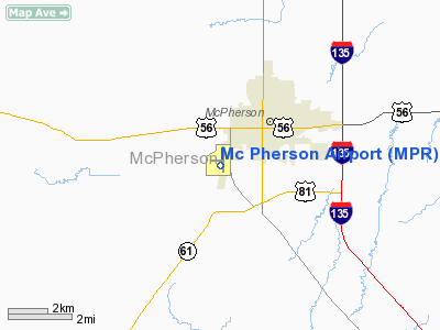
Location: |
Mc Pherson County, KS |
|
Magnetic Variation: |
06E (2000) |
Owner & Manager
|
Ownership: |
Publicly owned |
|
Owner: |
County & City Of Mc Pherson |
|
Address: |
400 East Kansas
Mc Pherson, KS 67460 |
|
Phone
number: |
620-241-2573 |
|
Manager: |
Tom Chandler |
|
Address: |
1000 S. 81 Bypass
Mc Pherson, KS 67460 |
|
Phone number: |
620-241-0684 |
Airport Operations and Facilities
|
Airport
Use: |
Open to public |
|
Wind
indicator: |
Yes |
|
Segmented Circle: |
Yes |
|
Control
Tower: |
No |
|
Lighting
Schedule: |
DUSK-DAWN
MIRL RY 18/36 PRESET ON LOW INTST TO INCREASE INTST ACTVT - CTAF. |
|
Beacon
Color: |
Clear-Green (lighted land airport) |
|
Landing
fee charge: |
No |
|
Sectional chart: |
Wichita |
|
Region: |
ACE - Central |
|
Boundary
ARTCC: |
ZKC - Kansas City |
|
Tie-in
FSS: |
ICT - Wichita |
|
FSS on
Airport: |
No |
|
FSS Toll
Free: |
1-800-WX-BRIEF |
|
NOTAMs
Facility: |
ICT (NOTAM-d service avaliable) |
|
Federal Agreements: |
NGY |
Airport Communications
|
CTAF: |
122.800 |
|
Unicom: |
122.800 |
Airport Services
|
Fuel
available: |
100LLA MOGAS
100LL IS AVBL BY USE OF CREDIT CARD. |
|
Airframe
Repair: |
MAJOR |
|
Power
Plant Repair: |
MAJOR |
|
Bottled
Oxygen: |
HIGH |
|
Bulk
Oxygen: |
NONE |
|
Runway Information
Runway 08/26
|
Dimension: |
2511 x 75 ft / 765.4 x 22.9 m |
|
Surface: |
TURF, Good Condition
PORTIONS OF TWYS & TIE DOWN AREAS ARE A COMBINATION OF CONCRETE & ASPHALT. |
|
|
Runway 08
|
Runway 26
|
|
Longitude: |
097-41-55.5160W |
097-41-23.9960W |
|
Latitude: |
38-21-17.8140N |
38-21-18.0070N |
|
Elevation: |
1494.00 ft |
1493.00 ft |
|
Alignment: |
90 |
127 |
|
Traffic
Pattern: |
Left |
Left |
|
Runway End
Identifier: |
No |
No |
|
Centerline
Lights: |
No |
No |
|
Touchdown
Lights: |
No |
No |
|
Obstruction: |
90 ft pline, 3000.0 ft from runway, 33:1 slope to clear |
54 ft pline, 1340.0 ft from runway, 24:1 slope to clear |
|
Runway 18/36
|
Dimension: |
5502 x 100 ft / 1677.0 x 30.5 m |
|
Surface: |
CONC, Good Condition
PORTIONS OF TWYS & TIE DOWN AREAS ARE A COMBINATION OF CONCRETE & ASPHALT. |
|
Weight Limit: |
Single wheel: 30000 lbs. |
|
Edge Lights: |
Medium |
|
|
Runway 18
|
Runway 36
|
|
Longitude: |
097-41-20.2906W |
097-41-27.0245W |
|
Latitude: |
38-21-31.6320N |
38-20-37.5066N |
|
Elevation: |
1494.00 ft |
1495.00 ft |
|
Alignment: |
127 |
6 |
|
Traffic
Pattern: |
Left |
Left |
|
Markings: |
Non-precision instrument, Good Condition |
Non-precision instrument, Good Condition |
|
Crossing
Height: |
40.00 ft |
40.00 ft |
|
VASI: |
2-light PAPI on left side |
2-light PAPI on left side |
|
Visual
Glide Angle: |
3.00° |
3.00° |
|
Runway End
Identifier: |
Yes |
Yes |
|
Centerline
Lights: |
No |
No |
|
Touchdown
Lights: |
No |
No |
|
Radio Navigation Aids
|
ID |
Type |
Name |
Ch |
Freq |
Var |
Dist |
|
MPR |
NDB |
Mc Pherson |
|
227.00 |
06E |
0.3 nm |
|
LYO |
NDB |
Lyons |
|
386.00 |
06E |
25.3 nm |
|
EWK |
NDB |
Newton |
|
281.00 |
06E |
26.3 nm |
|
HRU |
NDB |
Herington |
|
407.00 |
06E |
46.2 nm |
|
IC |
NDB |
Piche |
|
332.00 |
07E |
47.9 nm |
|
IAB |
TACAN |
Mc Connell |
112X |
|
07E |
48.3 nm |
|
HUT |
VOR/DME |
Hutchinson |
115X |
116.80 |
09E |
24.3 nm |
|
SLN |
VORTAC |
Salina |
118X |
117.10 |
07E |
34.6 nm |
|
ICT |
VORTAC |
Wichita |
085X |
113.80 |
07E |
36.8 nm |
|
ICT |
VOT |
Wichita |
|
114.00 |
|
44.7 nm |
Remarks
Based Aircraft
|
Aircraft based
on field: |
41 |
|
Single Engine
Airplanes: |
30 |
|
Multi Engine
Airplanes: |
4 |
|
Ultralights: |
7 |
Operational Statistics
Time Period: 2007-07-26 - 2008-07-24
|
Aircraft
Operations: |
110/Day |
|
General
Aviation Local: |
49.9% |
|
General
Aviation Itinerant: |
49.9% |
|
Military: |
0.2% |
Mc Pherson Airport
Address:
Mc Pherson County, KS
Tel:
620-241-2573,
620-241-0684
Images
and information placed above are from
http://www.airport-data.com/airport/MPR/
We
thank them for the data!
|
General Info |
| Country |
United
States |
| State |
KANSAS
|
| FAA ID |
MPR
|
| Latitude |
38-21-08.774N |
|
Longitude |
097-41-28.789W |
|
Elevation |
1497
feet |
| Near
City |
MC
PHERSON |
We don't guarantee the information is fresh and accurate. The data may
be wrong or outdated.
For more up-to-date information please refer to other sources.
|
|


