 |
|
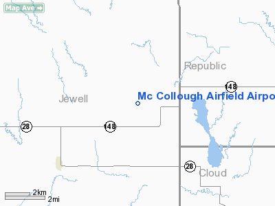
Mc Collough Airfield Airport |
|
Location &
QuickFacts
|
FAA
Information Effective: |
2008-09-25 |
|
Airport
Identifier: |
SN49 |
|
Airport
Status: |
Operational |
|
Longitude/Latitude: |
097-58-16.1600W/39-41-06.9900N
-97.971156/39.685275 (Estimated) |
|
Elevation: |
1465 ft / 446.53 m (Estimated) |
|
Land: |
50 acres |
|
From
nearest city: |
5 nautical miles NE of Randall, KS |
|
Location: |
Jewell County, KS |
|
Magnetic Variation: |
07E (1995) |
Owner & Manager
|
Ownership: |
Privately owned |
|
Owner: |
Roger R. Mccollough |
|
Address: |
2850 I Rd
Randall, KS 66963 |
|
Phone number: |
785-739-2429 |
|
Manager: |
Roger R. Mccollough |
|
Address: |
2850 I Rd
Randall, KS 66963 |
|
Phone number: |
785-739-2429 |
Airport
Operations and Facilities
|
Airport
Use: |
Private |
|
Wind
indicator: |
Yes |
|
Segmented Circle: |
No |
|
Control
Tower: |
No |
|
Sectional chart: |
Wichita |
|
Region: |
ACE - Central |
|
Boundary
ARTCC: |
ZMP - Minneapolis |
|
Tie-in
FSS: |
ICT - Wichita |
|
FSS Toll
Free: |
1-800-WX-BRIEF |
|
Runway Information
Runway 01/19
|
Dimension: |
1800 x 40 ft / 548.6 x 12.2 m |
|
Surface: |
TURF, |
|
|
Runway 01
|
Runway 19
|
|
Traffic
Pattern: |
Left |
Left |
|
Radio Navigation Aids
|
ID |
Type |
Name |
Ch |
Freq |
Var |
Dist |
|
RPB |
NDB |
Republican |
|
414.00 |
07E |
16.4 nm |
|
CNK |
NDB |
Concordia |
|
335.00 |
06E |
16.8 nm |
|
HJH |
NDB |
Hebron |
|
323.00 |
06E |
33.1 nm |
|
CYW |
NDB |
Clay Center |
|
362.00 |
07E |
41.8 nm |
|
DBX |
NDB |
Morrison |
|
212.00 |
06E |
43.2 nm |
|
FBY |
NDB |
Fairbury |
|
293.00 |
06E |
47.4 nm |
|
TKO |
VORTAC |
Mankato |
035X |
109.80 |
10E |
15.2 nm |
|
SLN |
VORTAC |
Salina |
118X |
117.10 |
07E |
48.5 nm |
Remarks
-
PRVDD CLEAR 20:1
APCH & CLEAR 7:1 TRANSITIONAL SFC.
Based Aircraft
|
Aircraft based
on field: |
1 |
|
Single Engine
Airplanes: |
1 |
Mc Collough Airfield Airport
Address:
Jewell County, KS
Tel:
785-739-2429
Images
and information placed above are from
http://www.airport-data.com/airport/SN49/
We
thank them for the data!
|
General Info |
| Country |
United
States |
| State |
KANSAS
|
| FAA ID |
SN49
|
| Latitude |
39-41-06.990N |
|
Longitude |
097-58-16.160W |
|
Elevation |
1465
feet |
| Near
City |
RANDALL
|
We don't guarantee the information is fresh and accurate. The data may
be wrong or outdated.
For more up-to-date information please refer to other sources.
|
|


