 |
|
|
Location &
QuickFacts
|
FAA
Information Effective: |
2008-09-25 |
|
Airport
Identifier: |
47KS |
|
Airport
Status: |
Operational |
|
Longitude/Latitude: |
095-16-28.0000W/38-46-14.0000N
-95.274444/38.770556 (Estimated) |
|
Elevation: |
1011 ft / 308.15 m (Estimated) |
|
Land: |
39 acres |
|
From
nearest city: |
4 nautical miles W of Baldwin City, KS |
|
Location: |
Douglas County, KS |
|
Magnetic Variation: |
04E (2000) |
Owner & Manager
|
Ownership: |
Privately owned |
|
Owner: |
George L. Maxwell |
|
Address: |
1222 N. 200 Rd
Baldwin City, KS 66006 |
|
Phone
number: |
785-594-7170 |
|
Manager: |
George L. Maxwell |
|
Address: |
1222 N. 200 Rd.
Baldwin City, KS 66006 |
|
Phone number: |
785-594-7170 |
Airport Operations and Facilities
|
Airport
Use: |
Private |
|
Segmented Circle: |
No |
|
Control
Tower: |
No |
|
Region: |
ACE - Central |
|
Boundary
ARTCC: |
ZKC - Kansas City |
|
Tie-in
FSS: |
ICT - Wichita |
|
FSS Toll
Free: |
1-800-WX-BRIEF |
|
Runway Information
Runway 17/35
|
Dimension: |
2100 x 50 ft / 640.1 x 15.2 m |
|
Surface: |
TURF, |
|
|
Runway 17
|
Runway 35
|
|
Longitude: |
095-16-29.9400W |
095-16-29.9400W |
|
Latitude: |
38-46-24.7600N |
38-46-04.0200N |
|
Elevation: |
1011.00 ft |
980.00 ft |
|
Traffic
Pattern: |
Left |
Right |
|
Displaced
threshold: |
0.00 ft |
600.00 ft
DSPLCD THLDS MKD W/ORANGE CONES. |
|
Obstruction: |
|
50 ft , 75.0 ft from runway |
|
Radio Navigation Aids
|
ID |
Type |
Name |
Ch |
Freq |
Var |
Dist |
|
TO |
NDB |
Biloy |
|
521.00 |
05E |
28.5 nm |
|
GQ |
NDB |
Norge |
|
517.00 |
05E |
33.8 nm |
|
GKB |
NDB |
Norge |
|
517.00 |
05E |
33.8 nm |
|
UKL |
NDB |
Boyd |
|
245.00 |
05E |
35.3 nm |
|
DO |
NDB |
Dotte |
|
359.00 |
05E |
36.5 nm |
|
LXT |
NDB |
Lesumit |
|
263.00 |
04E |
43.8 nm |
|
FOE |
TACAN |
Forbes |
053X |
|
05E |
21.0 nm |
|
OJC |
VOR/DME |
Johnson County |
077X |
113.00 |
06E |
25.5 nm |
|
RIS |
VOR/DME |
Riverside |
051X |
111.40 |
05E |
38.0 nm |
|
TOP |
VORTAC |
Topeka |
125X |
117.80 |
05E |
25.5 nm |
|
MCI |
VORTAC |
Kansas City |
079Y |
113.25 |
05E |
39.8 nm |
|
BUM |
VORTAC |
Butler |
106X |
115.90 |
07E |
47.6 nm |
|
EMP |
VORTAC |
Emporia |
075X |
112.80 |
08E |
49.8 nm |
|
FOE |
VOT |
Forbes |
|
111.00 |
|
21.4 nm |
|
MKC |
VOT |
Kansas City Downtown |
|
108.60 |
|
38.1 nm |
Remarks
-
ALL TFC REMAIN
EAST OF ARPT TO AVOID TFC FM OTHER PR ARPTS.
-
PRVDD CLEAR 20:1
APCHS, CLEAR 7:1 TRANSITIONAL SFC, & TFC REMAIN E OF ARPT.
Based Aircraft
|
Aircraft based
on field: |
1 |
|
Single Engine
Airplanes: |
1 |
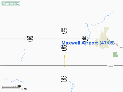
Maxwell Airport
Address:
Douglas County, KS
Tel:
785-594-7170
Images
and information placed above are from
http://www.airport-data.com/airport/47KS/
We
thank them for the data!
|
General Info |
| Country |
United
States |
| State |
KANSAS
|
| FAA ID |
47KS
|
| Latitude |
38-46-14.000N |
|
Longitude |
095-16-28.000W |
|
Elevation |
1011
feet |
| Near
City |
BALDWIN
CITY |
We don't guarantee the information is fresh and accurate. The data may
be wrong or outdated.
For more up-to-date information please refer to other sources.
|
|


