 |
|
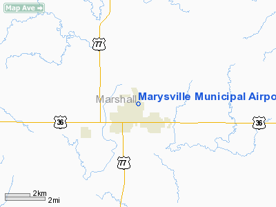
Marysville Municipal Airport |
|
|
|
Location &
QuickFacts
|
FAA
Information Effective: |
2008-09-25 |
|
Airport
Identifier: |
MYZ |
|
Airport
Status: |
Operational |
|
Longitude/Latitude: |
096-37-50.2754W/39-51-19.1560N
-96.630632/39.855321 (Estimated) |
|
Elevation: |
1283 ft / 391.06 m (Surveyed) |
|
Land: |
338 acres |
|
From
nearest city: |
1 nautical miles NE of Marysville, KS |
|
Location: |
Marshall County, KS |
|
Magnetic Variation: |
07E (1980) |
Owner & Manager
|
Ownership: |
Publicly owned |
|
Owner: |
City Of Marysville |
|
Address: |
209 N 8th St
Marysville, KS 66508 |
|
Phone
number: |
785-562-5331 |
|
Manager: |
Jeannie Thomas, City Clerk |
|
Address: |
209 N 8th St
Marysville, KS 66508 |
|
Phone number: |
785-562-5331 |
Airport Operations and Facilities
|
Airport
Use: |
Open to public |
|
Wind
indicator: |
Yes |
|
Segmented Circle: |
No |
|
Control
Tower: |
No |
|
Lighting
Schedule: |
DUSK-DAWN
ACTVT MIRL RY 15/33 - CTAF. |
|
Beacon
Color: |
Clear-Green (lighted land airport) |
|
Landing
fee charge: |
No |
|
Sectional chart: |
Kansas City |
|
Region: |
ACE - Central |
|
Boundary
ARTCC: |
ZKC - Kansas City |
|
Tie-in
FSS: |
ICT - Wichita |
|
FSS on
Airport: |
No |
|
FSS Toll
Free: |
1-800-WX-BRIEF |
|
NOTAMs
Facility: |
ICT (NOTAM-d service avaliable) |
|
Federal Agreements: |
NGY |
Airport Communications
|
CTAF: |
122.800 |
|
Unicom: |
122.800 |
Airport Services
|
Airframe
Repair: |
NONE |
|
Power
Plant Repair: |
NONE |
|
Runway Information
Runway 02/20
|
Dimension: |
2190 x 75 ft / 667.5 x 22.9 m |
|
Surface: |
TURF, Fair Condition |
|
|
Runway 02
|
Runway 20
|
|
Longitude: |
096-37-57.5700W |
096-37-41.8700W |
|
Latitude: |
39-51-02.5060N |
39-51-20.5060N |
|
Elevation: |
1276.00 ft |
1273.00 ft |
|
Alignment: |
34 |
127 |
|
Traffic
Pattern: |
Left |
Left |
|
Obstruction: |
56 ft tree, 608.0 ft from runway, 129 ft left of
centerline, 10:1 slope to clear |
11 ft brush, 300.0 ft from runway, 13 ft left of
centerline, 27:1 slope to clear |
|
Runway 15/33
|
Dimension: |
4200 x 60 ft / 1280.2 x 18.3 m |
|
Surface: |
ASPH, Good Condition |
|
Edge Lights: |
Medium |
|
|
Runway 15
|
Runway 33
|
|
Longitude: |
096-37-59.5200W |
096-37-41.6100W |
|
Latitude: |
39-51-42.7200N |
39-51-03.5700N |
|
Elevation: |
1278.00 ft |
1277.00 ft |
|
Alignment: |
127 |
127 |
|
Traffic
Pattern: |
Left |
Left |
|
Markings: |
Non-precision instrument, Good Condition |
Non-precision instrument, Good Condition |
|
Obstruction: |
, 50:1 slope to clear |
30 ft trees, 742.0 ft from runway, 292 ft left of
centerline, 18:1 slope to clear |
|
Helipad H1
|
Dimension: |
50 x 50 ft / 15.2 x 15.2 m |
|
Surface: |
CONC, Good Condition |
|
|
Runway H1
|
Runway
|
|
Traffic
Pattern: |
Left |
Left |
|
Radio Navigation Aids
|
ID |
Type |
Name |
Ch |
Freq |
Var |
Dist |
|
MYZ |
NDB |
Marysville |
|
341.00 |
06E |
0.2 nm |
|
DBX |
NDB |
Morrison |
|
212.00 |
06E |
19.8 nm |
|
HWB |
NDB |
Shaw |
|
263.00 |
06E |
25.3 nm |
|
FBY |
NDB |
Fairbury |
|
293.00 |
06E |
31.3 nm |
|
BJU |
NDB |
Big Blue |
|
248.00 |
06E |
31.7 nm |
|
CYW |
NDB |
Clay Center |
|
362.00 |
07E |
37.6 nm |
|
MQD |
NDB |
Mc Dowell Creek |
|
391.00 |
06E |
44.4 nm |
|
RPB |
NDB |
Republican |
|
414.00 |
07E |
47.5 nm |
|
HJH |
NDB |
Hebron |
|
323.00 |
06E |
47.5 nm |
|
FNB |
NDB |
Brenner |
|
404.00 |
05E |
49.9 nm |
|
BIE |
VOR |
Beatrice |
|
110.60 |
07E |
27.4 nm |
|
MHK |
VOR/DME |
Manhattan |
039X |
110.20 |
06E |
42.7 nm |
|
PWE |
VORTAC |
Pawnee City |
071X |
112.40 |
05E |
28.5 nm |
Remarks
-
RY 02/20 ROUGH AT
THE APCHS TO INTXN OF RY 15/33.
-
TV TWR +499 FT .9
MILES N OF ARPT APRX 1/4 MILE L OF AER 15.
Based Aircraft
|
Aircraft based
on field: |
5 |
|
Single Engine
Airplanes: |
5 |
Operational Statistics
Time Period: 2005-04-01 - 2006-03-31
|
Aircraft
Operations: |
154/Week |
|
General
Aviation Local: |
56.3% |
|
General
Aviation Itinerant: |
43.8% |
Marysville Municipal Airport
Address:
Marshall County, KS
Tel:
785-562-5331
Images
and information placed above are from
http://www.airport-data.com/airport/MYZ/
We
thank them for the data!
|
General Info |
| Country |
United
States |
| State |
KANSAS
|
| FAA ID |
MYZ
|
| Latitude |
39-51-19.173N |
|
Longitude |
096-37-50.284W |
|
Elevation |
1283
feet |
| Near
City |
MARYSVILLE |
We don't guarantee the information is fresh and accurate. The data may
be wrong or outdated.
For more up-to-date information please refer to other sources.
|
|


