 |
|
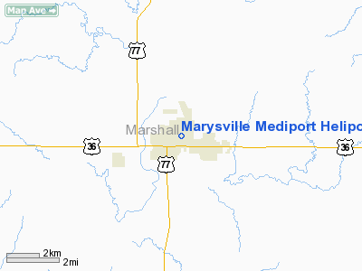
Marysville Mediport Heliport |
|
Location &
QuickFacts
|
FAA
Information Effective: |
2008-09-25 |
|
Airport
Identifier: |
SN30 |
|
Airport
Status: |
Operational |
|
Longitude/Latitude: |
096-38-06.0700W/39-50-52.0060N
-96.635019/39.847779 (Estimated) |
|
Elevation: |
1283 ft / 391.06 m (Estimated) |
|
Land: |
0 acres |
|
From
nearest city: |
0 nautical miles N of Marysville, KS |
|
Location: |
Marshall County, KS |
|
Magnetic Variation: |
06E (1990) |
Owner & Manager
|
Ownership: |
Privately owned |
|
Owner: |
Community Memorial Hospital |
|
Address: |
708 North 18th St
Marysville, KS 66508 |
|
Phone
number: |
913-562-2311 |
|
Manager: |
Leonard Sutton |
|
Address: |
708 North 18th St
Marysville, KS 66508 |
|
Phone number: |
913-562-2311 |
Airport Operations and Facilities
|
Airport
Use: |
Private
MEDICAL USE. |
|
Segmented Circle: |
No |
|
Control
Tower: |
No |
|
Lighting
Schedule: |
PHONE REQ
FOR FLOODLGTS CALL 913-562-2311. |
|
Sectional chart: |
Kansas City |
|
Region: |
ACE - Central |
|
Boundary
ARTCC: |
ZKC - Kansas City |
|
Tie-in
FSS: |
ICT - Wichita |
|
FSS Toll
Free: |
1-800-WX-BRIEF |
|
Runway Information
Helipad H1
|
Dimension: |
50 x 50 ft / 15.2 x 15.2 m |
|
Surface: |
CONC, Good Condition |
|
|
Runway H1
|
Runway
|
|
Traffic
Pattern: |
Left |
Left |
|
Radio Navigation Aids
|
ID |
Type |
Name |
Ch |
Freq |
Var |
Dist |
|
MYZ |
NDB |
Marysville |
|
341.00 |
06E |
0.3 nm |
|
DBX |
NDB |
Morrison |
|
212.00 |
06E |
19.5 nm |
|
HWB |
NDB |
Shaw |
|
263.00 |
06E |
25.7 nm |
|
FBY |
NDB |
Fairbury |
|
293.00 |
06E |
31.4 nm |
|
BJU |
NDB |
Big Blue |
|
248.00 |
06E |
32.1 nm |
|
CYW |
NDB |
Clay Center |
|
362.00 |
07E |
37.2 nm |
|
MQD |
NDB |
Mc Dowell Creek |
|
391.00 |
06E |
43.9 nm |
|
RPB |
NDB |
Republican |
|
414.00 |
07E |
47.3 nm |
|
HJH |
NDB |
Hebron |
|
323.00 |
06E |
47.5 nm |
|
CVY |
NDB |
Cavalry |
|
314.00 |
06E |
49.9 nm |
|
BIE |
VOR |
Beatrice |
|
110.60 |
07E |
27.8 nm |
|
MHK |
VOR/DME |
Manhattan |
039X |
110.20 |
06E |
42.2 nm |
|
PWE |
VORTAC |
Pawnee City |
071X |
112.40 |
05E |
29.0 nm |
Remarks
-
OWNER DESIRES
HELIPORT NOT BE CHARTED.
-
PRVDD AN APCH/DEP
FOR AN 8:1 GLIDE SLOPE & A 2:1 TRANSITIONAL SLOPE.
Marysville Mediport Heliport
Address:
Marshall County, KS
Tel:
913-562-2311
Images
and information placed above are from
http://www.airport-data.com/airport/SN30/
We
thank them for the data!
|
General Info |
| Country |
United
States |
| State |
KANSAS
|
| FAA ID |
SN30
|
| Latitude |
39-50-52.006N |
|
Longitude |
096-38-06.070W |
|
Elevation |
1283
feet |
| Near
City |
MARYSVILLE |
We don't guarantee the information is fresh and accurate. The data may
be wrong or outdated.
For more up-to-date information please refer to other sources.
|
|


