 |
|
|
Location &
QuickFacts
|
FAA
Information Effective: |
2008-09-25 |
|
Airport
Identifier: |
6KS8 |
|
Airport
Status: |
Operational |
|
Longitude/Latitude: |
096-08-46.0000W/38-23-01.0000N
-96.146111/38.383611 (Estimated) |
|
Elevation: |
1140 ft / 347.47 m (Estimated) |
|
Land: |
115 acres |
|
From
nearest city: |
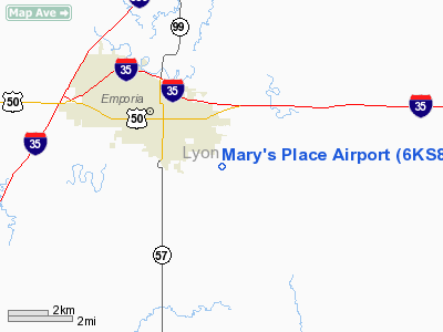
5 nautical miles SE of Emporia, KS |
|
Location: |
Lyon County, KS |
|
Magnetic Variation: |
05E (1995) |
Owner & Manager
|
Ownership: |
Privately owned |
|
Owner: |
Ted & Mary Brown |
|
Address: |
1234 Road 130
Emporia, KS 66801 |
|
Phone number: |
620-342-3111 |
|
Manager: |
Ted Brown |
|
Address: |
2109 Fairway Court
Mission, TX 78572 |
|
Phone number: |
956-584-2920 |
Airport Operations and Facilities
|
Airport Use: |
Private |
|
Wind indicator: |
Yes |
|
Segmented Circle: |
No |
|
Control Tower: |
No |
|
Sectional chart: |
Kansas City |
|
Region: |
ACE - Central |
|
Boundary ARTCC: |
ZKC - Kansas City |
|
Tie-in FSS: |
ICT - Wichita |
|
FSS on Airport: |
No |
|
FSS Toll Free: |
1-800-WX-BRIEF |
Airport
Communications
|
Runway Information
Runway 18/36
|
Dimension: |
2650 x 50 ft / 807.7 x 15.2 m |
|
Surface: |
TURF, |
|
|
Runway 18
|
Runway 36
|
|
Traffic
Pattern: |
Left |
Left |
|
Obstruction: |
|
35 ft plines, 50.0 ft from runway |
|
Radio Navigation Aids
|
ID |
Type |
Name |
Ch |
Freq |
Var |
Dist |
|
UKL |
NDB |
Boyd |
|
245.00 |
05E |
20.6 nm |
|
HRU |
NDB |
Herington |
|
407.00 |
06E |
36.4 nm |
|
EQA |
NDB |
El Dorado |
|
383.00 |
05E |
48.2 nm |
|
CVY |
NDB |
Cavalry |
|
314.00 |
06E |
49.2 nm |
|
TO |
NDB |
Biloy |
|
521.00 |
05E |
49.2 nm |
|
MQD |
NDB |
Mc Dowell Creek |
|
391.00 |
06E |
49.6 nm |
|
MSB |
NDB |
Monarch |
|
410.00 |
04E |
49.6 nm |
|
FOE |
TACAN |
Forbes |
053X |
|
05E |
40.8 nm |
|
FRI |
VOR |
Fort Riley |
|
109.40 |
06E |
48.7 nm |
|
EMP |
VORTAC |
Emporia |
075X |
112.80 |
08E |
5.6 nm |
|
FOE |
VOT |
Forbes |
|
111.00 |
|
40.9 nm |
Remarks
-
PRVDD CLEAR 20:1
GLIDE SLOPE & CLEAR 7:1 TRANSITIONAL SFC & TFC PATTERN E OF ARPT.
Based Aircraft
|
Aircraft based
on field: |
1 |
|
Single Engine
Airplanes: |
1 |
Mary's Place Airport
Address:
Lyon County, KS
Tel:
620-342-3111, 956-584-2920
Images
and information placed above are from
http://www.airport-data.com/airport/6KS8/
We
thank them for the data!
|
General Info |
| Country |
United
States |
| State |
KANSAS
|
| FAA ID |
6KS8
|
| Latitude |
38-23-01.000N |
|
Longitude |
096-08-46.000W |
|
Elevation |
1140
feet |
| Near
City |
EMPORIA
|
We don't guarantee the information is fresh and accurate. The data may
be wrong or outdated.
For more up-to-date information please refer to other sources.
|
|


