 |
|
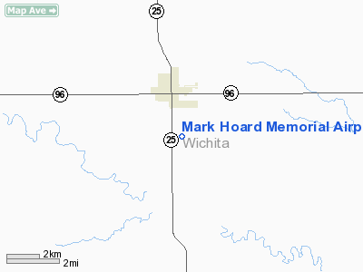
Mark Hoard Memorial Airport |
|
|
|
Location &
QuickFacts
|
FAA
Information Effective: |
2008-09-25 |
|
Airport
Identifier: |
3K7 |
|
Airport
Status: |
Operational |
|
Longitude/Latitude: |
101-21-03.1000W/38-27-28.8000N
-101.350861/38.458000 (Estimated) |
|
Elevation: |
3303 ft / 1006.75 m (Surveyed) |
|
Land: |
40 acres |
|
From
nearest city: |
2 nautical miles S of Leoti, KS |
|
Location: |
Wichita County, KS |
|
Magnetic Variation: |
09E (1985) |
Owner & Manager
|
Ownership: |
Publicly owned |
|
Owner: |
Leoti City Wichita Co |
|
Address: |
206 S 4th St, Po Box 1595
Leoti, KS 67861 |
|
Phone number: |
620-375-2731 |
|
Manager: |
Doug Mckinney |
|
Address: |
511 W. Broadway
Leoti, KS 67861 |
|
Phone number: |
620-874-0432 |
Airport
Operations and Facilities
|
Airport
Use: |
Open to public |
|
Wind
indicator: |
Yes |
|
Segmented Circle: |
No |
|
Control
Tower: |
No |
|
Lighting
Schedule: |
DUSK-DAWN
ACTVT HIRL RY 17/35 - CTAF. |
|
Beacon
Color: |
Clear-Green (lighted land airport) |
|
Landing
fee charge: |
No |
|
Sectional chart: |
Wichita |
|
Region: |
ACE - Central |
|
Boundary
ARTCC: |
ZDV - Denver |
|
Tie-in
FSS: |
ICT - Wichita |
|
FSS on
Airport: |
No |
|
FSS Toll
Free: |
1-800-WX-BRIEF |
|
NOTAMs
Facility: |
ICT (NOTAM-d service avaliable) |
|
Federal Agreements: |
N |
Airport Communications
|
CTAF: |
122.700 |
|
Unicom: |
122.700 |
Airport Services
|
Fuel
available: |
100LL
FOR FUEL CALL 620-375-2723/4950. |
|
Bottled
Oxygen: |
NONE |
|
Bulk
Oxygen: |
NONE |
|
Runway Information
Runway 08/26
|
Dimension: |
2450 x 38 ft / 746.8 x 11.6 m |
|
Surface: |
ASPH, Good Condition |
|
Edge Lights: |
Non-standard lighting system
NSTD LIRL DUE TO SPACING. |
|
|
Runway 08
|
Runway 26
|
|
Longitude: |
101-21-28.3000W |
101-20-57.4900W |
|
Latitude: |
38-27-25.2100N |
38-27-25.5000N |
|
Traffic
Pattern: |
Left |
Left |
|
Markings: |
Basic, Good Condition |
Basic, Good Condition |
|
Obstruction: |
40 ft pole, 345.0 ft from runway, 100 ft right of
centerline, 3:1 slope to clear
+21 FT HWY 100 FT FROM RWY END. |
, 50:1 slope to clear
+17 FT ROAD AT 50 FT. |
|
Runway 17/35
|
Dimension: |
4300 x 50 ft / 1310.6 x 15.2 m |
|
Surface: |
ASPH, Good Condition |
|
Edge Lights: |
High
NSTD LIRL DUE TO SPACING. |
|
|
Runway 17
|
Runway 35
|
|
Longitude: |
101-20-57.7300W |
101-20-57.2800W |
|
Latitude: |
38-27-51.9400N |
38-27-09.4300N |
|
Traffic
Pattern: |
Left |
Left |
|
Markings: |
Basic, Good Condition |
Basic, Good Condition |
|
Obstruction: |
10 ft road, 200.0 ft from runway, 50 ft left of
centerline
PRIVATE ROAD 50' LEFT. |
17 ft road, 200.0 ft from runway, 50 ft right of
centerline
+17 FT ROAD AT 10 FT. |
|
Radio Navigation Aids
|
ID |
Type |
Name |
Ch |
Freq |
Var |
Dist |
|
TQK |
NDB |
Scott City |
|
256.00 |
08E |
21.8 nm |
|
OEL |
NDB |
Oakley |
|
380.00 |
08E |
46.7 nm |
|
GC |
NDB |
Pieve |
|
347.00 |
09E |
48.0 nm |
|
GCK |
VORTAC |
Garden City |
080X |
113.30 |
11E |
43.9 nm |
Remarks
-
24 HR PUBLIC TELEPHONE AVBL
620-375-4649.
Based Aircraft
|
Aircraft based
on field: |
11 |
|
Single Engine
Airplanes: |
11 |
Operational Statistics
Time Period: 2006-08-17 - 2007-08-16
|
Aircraft
Operations: |
97/Week |
|
General
Aviation Local: |
80.0% |
|
General
Aviation Itinerant: |
20.0% |
Mark Hoard Memorial Airport
Address:
Wichita County, KS
Tel:
620-375-2731, 620-874-0432
Images
and information placed above are from
http://www.airport-data.com/airport/3K7/
We
thank them for the data!
|
General Info |
| Country |
United
States |
| State |
KANSAS
|
| FAA ID |
3K7
|
| Latitude |
38-27-25.068N |
|
Longitude |
101-21-11.578W |
|
Elevation |
3303
feet |
| Near
City |
LEOTI
|
We don't guarantee the information is fresh and accurate. The data may
be wrong or outdated.
For more up-to-date information please refer to other sources.
|
|


