 |
|
|
|
|
|
|
Location &
QuickFacts
|
FAA
Information Effective: |
2008-09-25 |
|
Airport
Identifier: |
43K |
|
Airport
Status: |
Operational |
|
Longitude/Latitude: |
096-59-30.0800W/38-20-15.0590N
-96.991689/38.337516 (Estimated) |
|
Elevation: |
1390 ft / 423.67 m (Estimated) |
|
Land: |
160 acres |
|
From
nearest city: |
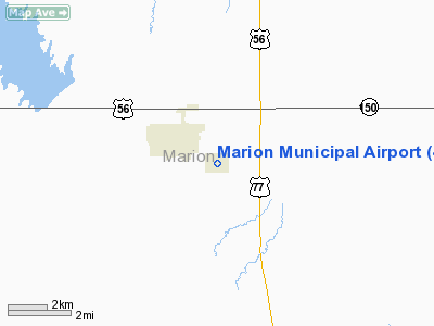
2 nautical miles SE of Marion, KS |
|
Location: |
Marion County, KS |
|
Magnetic Variation: |
07E (1985) |
Owner & Manager
|
Ownership: |
Publicly owned |
|
Owner: |
City Of Marion |
|
Address: |
208 East Santa Fe
Marion, KS 66861 |
|
Phone
number: |
620-382-3703 |
|
Manager: |
David Mayfield
MR.MAYFIELD IS CITY MGR.
OF
MARION KS. |
|
Address: |
208 East Santa Fe
Marion, KS 66861 |
|
Phone number: |
620-382-3703 |
Airport Operations and Facilities
|
Airport
Use: |
Open to public |
|
Wind
indicator: |
Yes |
|
Segmented Circle: |
No |
|
Control
Tower: |
No |
|
Lighting
Schedule: |
DUSK-DAWN |
|
Beacon
Color: |
Clear-Green (lighted land airport) |
|
Landing
fee charge: |
No |
|
Sectional chart: |
Kansas City |
|
Region: |
ACE - Central |
|
Boundary
ARTCC: |
ZKC - Kansas City |
|
Tie-in
FSS: |
ICT - Wichita |
|
FSS on
Airport: |
No |
|
FSS Toll
Free: |
1-800-WX-BRIEF |
|
NOTAMs
Facility: |
ICT (NOTAM-d service avaliable) |
Airport Communications
Airport Services
|
Fuel
available: |
100LLMOGAS |
|
Airframe
Repair: |
NONE |
|
Power
Plant Repair: |
NONE |
|
Runway Information
Runway 03/21
|
Dimension: |
2745 x 95 ft / 836.7 x 29.0 m |
|
Surface: |
TURF, Good Condition
RY 03/21 IS SLIGHTLY ROUGH.
RY 17/35 HAS EXTENSIVE CRACKING. |
|
|
Runway 03
|
Runway 21
|
|
Traffic
Pattern: |
Left |
Left |
|
Obstruction: |
4 ft fence |
22 ft pline, 735.0 ft from runway, 170 ft left of
centerline, 33:1 slope to clear |
|
Runway 13/31
|
Dimension: |
2722 x 50 ft / 829.7 x 15.2 m |
|
Surface: |
TURF, Good Condition
RY 03/21 IS SLIGHTLY ROUGH.
RY 17/35 HAS EXTENSIVE CRACKING. |
|
|
Runway 13
|
Runway 31
|
|
Traffic
Pattern: |
Left |
Left |
|
Obstruction: |
14 ft trees |
, 50:1 slope to clear |
|
Runway 17/35
|
Dimension: |
2573 x 40 ft / 784.3 x 12.2 m |
|
Surface: |
ASPH, Good Condition
RY 03/21 IS SLIGHTLY ROUGH.
RY 17/35 HAS EXTENSIVE CRACKING. |
|
Edge Lights: |
Low |
|
|
Runway 17
|
Runway 35
|
|
Traffic
Pattern: |
Left |
Left |
|
Markings: |
Numbers only, Good Condition
RWY 17 ALIGNMENT NUMBERS FADED. |
Numbers only, Good Condition
RWY 35 ALIGNMENT NUMBERS FADED. |
|
Runway 18/36
|
Dimension: |
2310 x 67 ft / 704.1 x 20.4 m |
|
Surface: |
TURF, Good Condition
RY 03/21 IS SLIGHTLY ROUGH.
RY 17/35 HAS EXTENSIVE CRACKING. |
|
|
Runway 18
|
Runway 36
|
|
Traffic
Pattern: |
Left |
Left |
|
Obstruction: |
4 ft fence, 9.0 ft from runway, 30L/ ft right of
centerline, 2:1 slope to clear |
, 50:1 slope to clear |
|
Radio Navigation Aids
|
ID |
Type |
Name |
Ch |
Freq |
Var |
Dist |
|
EWK |
NDB |
Newton |
|
281.00 |
06E |
21.1 nm |
|
HRU |
NDB |
Herington |
|
407.00 |
06E |
23.0 nm |
|
MPR |
NDB |
Mc Pherson |
|
227.00 |
06E |
32.8 nm |
|
EQA |
NDB |
El Dorado |
|
383.00 |
05E |
34.6 nm |
|
CVY |
NDB |
Cavalry |
|
314.00 |
06E |
42.4 nm |
|
MQD |
NDB |
Mc Dowell Creek |
|
391.00 |
06E |
49.9 nm |
|
IAB |
TACAN |
Mc Connell |
112X |
|
07E |
45.0 nm |
|
FRI |
VOR |
Fort Riley |
|
109.40 |
06E |
38.5 nm |
|
HUT |
VOR/DME |
Hutchinson |
115X |
116.80 |
09E |
49.0 nm |
|
EMP |
VORTAC |
Emporia |
075X |
112.80 |
08E |
40.4 nm |
|
ICT |
VORTAC |
Wichita |
085X |
113.80 |
07E |
45.3 nm |
|
SLN |
VORTAC |
Salina |
118X |
117.10 |
07E |
46.1 nm |
|
ICT |
VOT |
Wichita |
|
114.00 |
|
47.0 nm |
Based Aircraft
|
Aircraft based
on field: |
17 |
|
Single Engine
Airplanes: |
16 |
|
Ultralights: |
1 |
Operational Statistics
Time Period: 2007-07-25 - 2008-07-23
|
Aircraft
Operations: |
174/Week |
|
General
Aviation Local: |
66.5% |
|
General
Aviation Itinerant: |
33.2% |
|
Military: |
0.3% |
Marion Municipal Airport
Address:
Marion County, KS
Tel:
620-382-3703
Images
and information placed above are from
http://www.airport-data.com/airport/43K/
We
thank them for the data!
|
General Info |
| Country |
United
States |
| State |
KANSAS
|
| FAA ID |
43K
|
| Latitude |
38-20-15.059N |
|
Longitude |
096-59-30.080W |
|
Elevation |
1390
feet |
| Near
City |
MARION
|
We don't guarantee the information is fresh and accurate. The data may
be wrong or outdated.
For more up-to-date information please refer to other sources.
|
|


