|
 |
|
||||
|
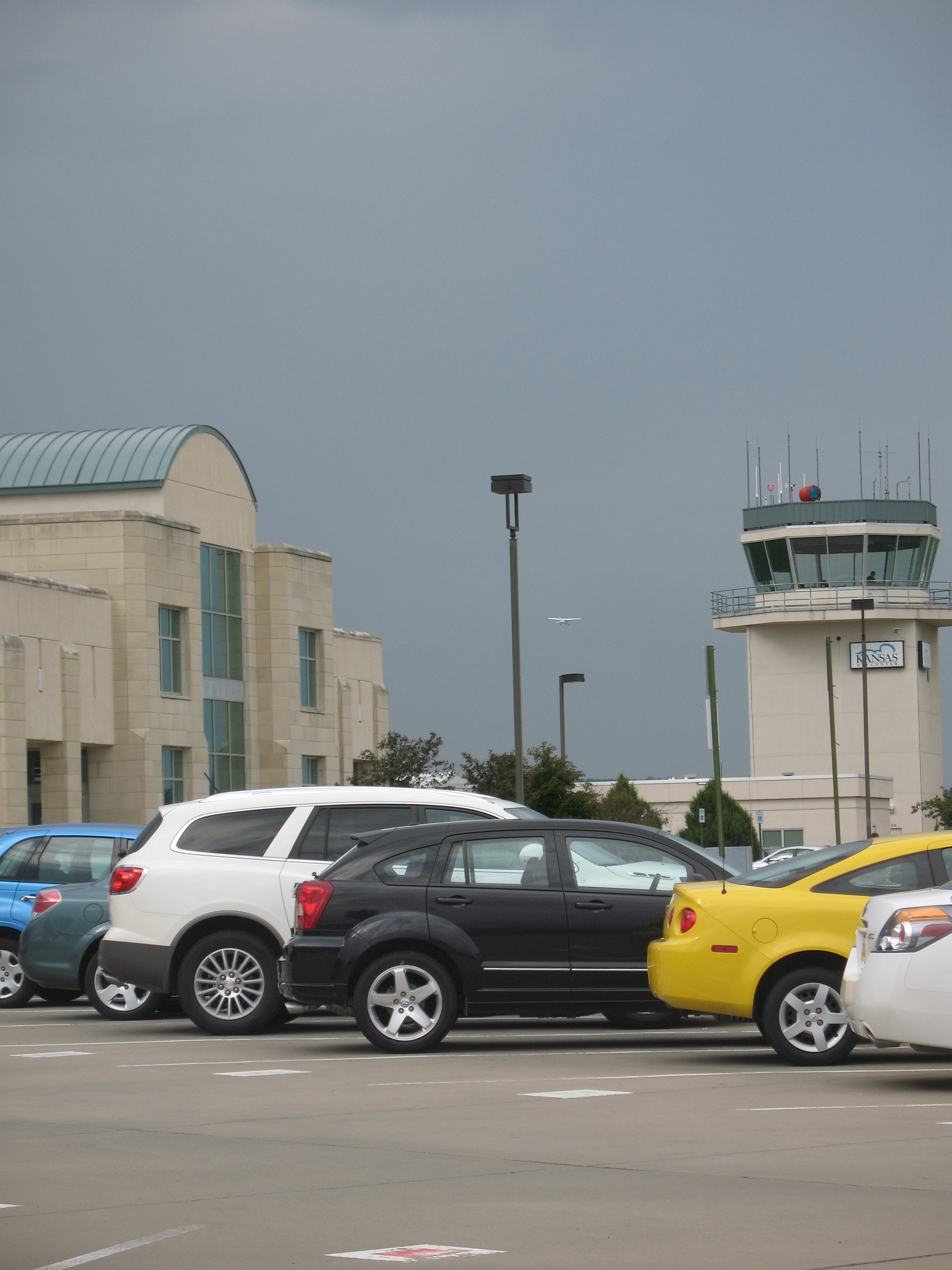
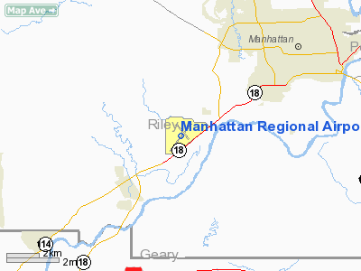
Manhattan Regional Airport (IATA: MHK, ICAO: KMHK, FAA LID: MHK) is a public airport located four miles (6 km) southwest of the central business district (CBD) of Manhattan, a city in Riley County, Kansas, USA. It serves the Manhattan metropolitan area and surrounding areas of North Central Kansas. The airport covers 680 acres (275 ha) and has two runways. One runway is sufficiently long to allow full-sized commercial airplanes to land, in part so that nearby Fort Riley can use the airport when needed. One commercial airline (American Eagle) serves the airport with connections to Dallas/Fort Worth International Airport, and beginning in November 2010, Chicago's O'Hare International Airport. The airport is also used for general aviation. According to the FAA, emplanements at MHK in 2009 totaled 25,074. FacilitiesServicesAn 11,700-square-foot (1,090 m) passenger terminal building, located at 5500 Fort Riley Boulevard, is home to American Eagle Airlines, Hertz Rent-a-Car, Enterprise Car Rental, and other services. This facility has been operational since January 1997.
The FBO facility, adjacent to the passenger terminal, is occupied by Kansas Air Center, which has provided service to the Manhattan Airport since May 1989. It is fully functional with a variety of services provided, including: fuel, charter service, flight instruction, and aircraft rental. An older 4,100-square-foot (380 m) General Aviation terminal building built in 1958 is now home to General Aviation Training & Testing Service, otherwise known as G.A.T.T.S. This facility is located at 1725 South Airport Road, 1 mile (2 km) east of the passenger terminal. Heartland Aviation utilizes an 8,000-square-foot (700 m) stone maintenance hangar, constructed in 1940, located next to the General Aviation terminal building for servicing and repairing aircraft. The Kansas State University Flying Club, an airport tenant for over 50 years, has office space in this facility for instruction and flight planning. Airport facilities also include a fire station, 48 hangars, storage areas, fuel farm, and an air traffic control tower. Airside descriptionThe airside infrastructure includes two runways, five taxiways, and two parking aprons. This infrastructure normally supports aircraft equivalent in size to a DC-9 or Boeing 737, but it can also support the occasional use of commercial aircraft as large as the Boeing 727 or military C-17. Three air navigation systems and multiple lighting systems guide aircraft to the Airport. A city funded air traffic control tower, and two Aircraft Rescue and Fire-Fighting (ARFF) vehicles round out the airside support. Any aircraft with 30 passenger seats or more, or over 110,000 lb (50,000 kg). gross landing weight requires prior permission from the Airport Director to land at Manhattan. Boeing 757's and other larger commercial airliners land occasionally as charters for Kansas State University's sports teams. Expansion
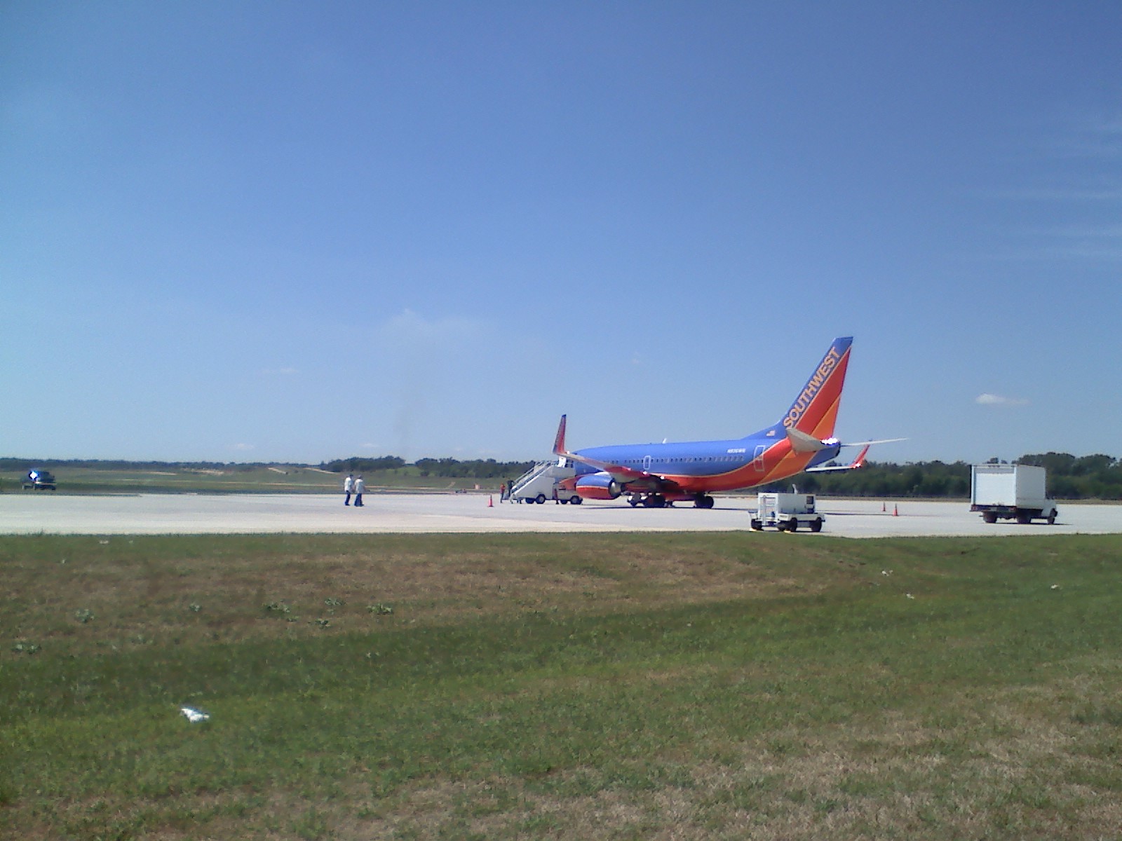
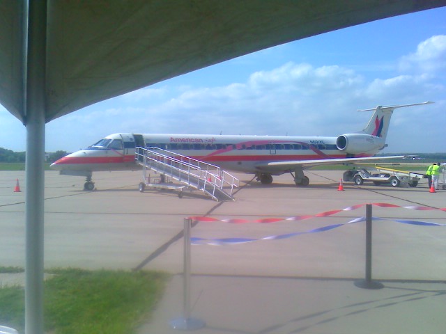
Expansion of the Manhattan Regional Airport is currently underway. First, expansion of the 7,000-foot (2,100 m) runway to 7,400-foot (2,300 m) is in the planning stages. Second, expansion of the 13/31 runway and parallel taxiway (E Taxiway) is underway, and an expansion of the apron to accommodate Fort Riley, General Aviation, and cargo has been completed. The airport terminal has been slightly reformatted to allow for higher-capacity flights with the new American Eagle Airlines services to DFW, and refurbishing the interior of the original 1940's hangar that FBO Heartland Aviation uses and resurfacing and painting of 13/31. After the expansion of runway 3/21 to 7,400 ft (2,300 m) and the widening of the airport's taxiways, the airport will be able to accommodate Boeing 767 and 757-300 variant airliners. A joint Military - Civil Aviation Apron expansion project to expand the airports aircraft handling capabilities has been completed adjacent to the terminal. It was constructed to support larger troop withdrawals and arrivals from nearby Ft. Riley, and included a new service gate for bus access to the tarmac. Airlines and destinationsAmerican Eagle Airlines operates thrice-daily service to Dallas/Ft. Worth International Airport. American Eagle flies the Embraer ERJ 145 family of aircraft on the service.
History
Since the 1960s, a variety of commercial airlines have offered service to Manhattan Regional Airport. Capital Air ServiceCapital Air Service, Inc. (ICAO airline designator CPX), was headquartered in Manhattan from the 1960s until the company went out of business in the late 1980s, after having twice been grounded by the FAA for multiple safety and records keeping violations. Capital Air provided point-to-point air service to cities throughout northeastern Kansas. During the 1970s Capital Air, operating as an air taxi service, suffered two crashes, each with fatalities. During the 1980s the airline suffered having one of its aircraft tipped over by a gust of wind while waiting for take off clearance, and another aircraft, a DCH-6 Twin Otter, clipped the side of a terminal building, both incidents occurring at Kansas City International Airport. At the height of its operations Capital Air served Manhattan; Salina, KS (SLN); Topeka, KS (FOE); Lawrence, KS (LWC); and Kansas City, MO (MCI) using two 20-passenger deHavilland Canada DCH-6 Twin Otter turboprop aircraft and one or more smaller piston-engine aircraft. Frontier AirlinesDuring the mid-to-late 1970s the original Frontier Airlines flew from Manhattan to Salina (SLN); Topeka (FOE); Wichita, KS (ICT); and Kansas City, MO (MKC) using 44-seat Convair CV580 turboprop aircraft. By the early 1980s all of the cities served from Manhattan by turboprop aircraft had been dropped and replaced with a single daily non-stop flight to Denver, CO (DEN) using a Boeing 737-200. The original Frontier Airlines went out of business in 1986. Air MidwestFrom the mid-1980s through the early 1990s, before its sale to Mesa Air Group in 1991, Wichita-based Air Midwest served Manhattan with flights to Salina (SLN) and Kansas City (MCI) using 19-passenger Fairchild Fairchild Metroliner III turboprop aircraft. For several years in the mid-1980s Air Midwest served as an Eastern Air Lines codeshare partner and used 30-passenger Saab 340A turboprop aircraft in full Eastern Airlines livery to fly from Manhattan to Kansas City (MCI). When, on the way to bankruptcy, Eastern Airlines closed their hub at Kansas City (MCI), Air Midwest sold their Saab 340A aircraft and signed a new codeshare agreement with the second incarnation of Braniff Airlines, which had just established a small hub at MCI, and once again began to offer flights to Kansas City on Fairchild Metroliner III turboprop aircraft. Mesa Air Group
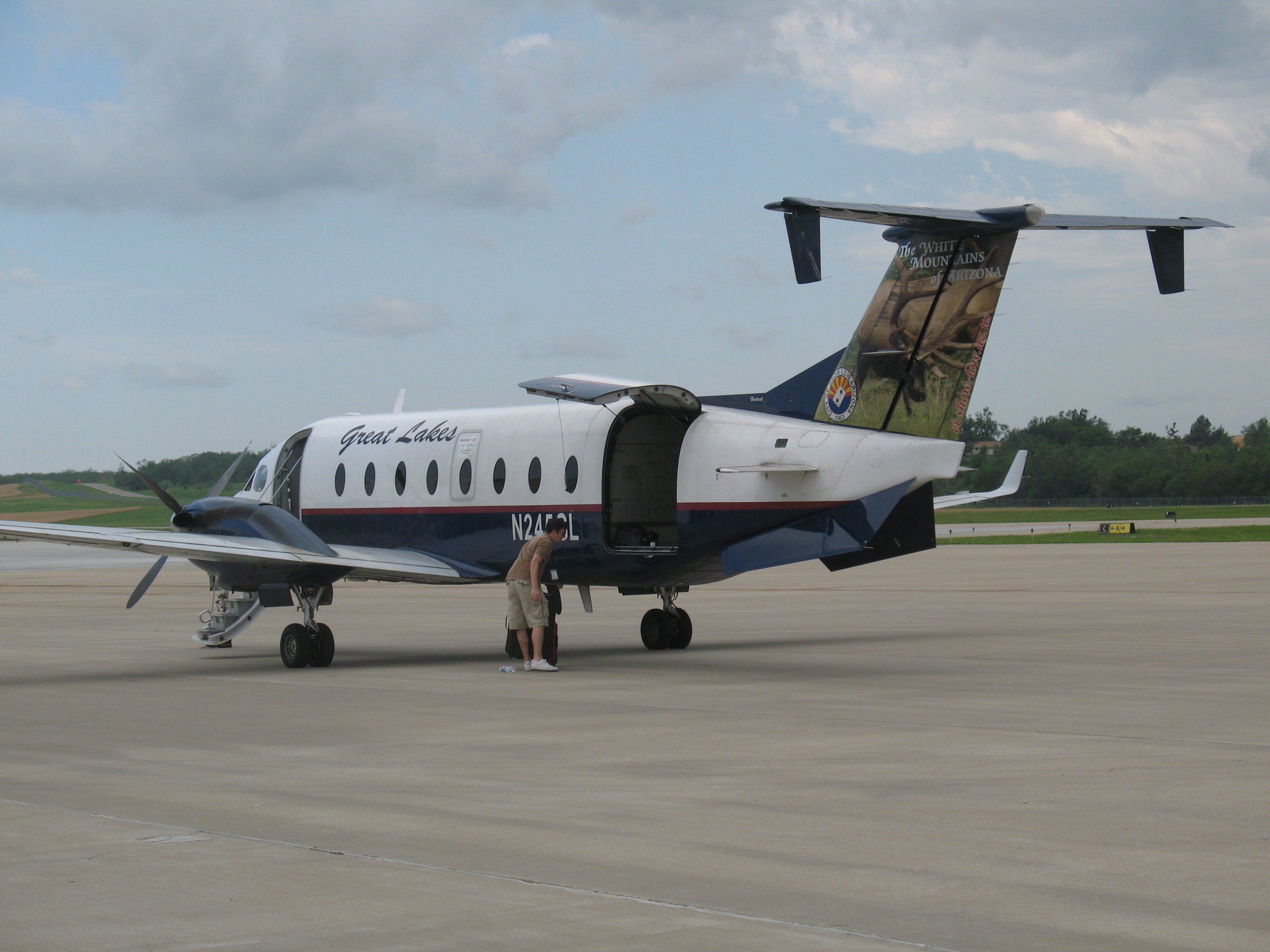
In 1991, Air Midwest was sold to the Mesa Air Group of Nevada. Subsequently, Air Midwest (a Mesa Air Group subsidiary), acting under a codeshare agreement with U.S. Airways and operating as US Airways Express, served Kansas City, Missouri from Manhattan, Kansas with three daily flights using 19-passenger Beechcraft 1900D turboprop aircraft. The service ended with Air Midwest's bankruptcy in 2008, when all Essential Air Service contracts and flights operated by Mesa were closed. Great Lakes AirlinesGreat Lakes operated service to the Manhattan Regional Airport between March 30, 2008, and April 7, 2010, taking over after Mesa left and ending service after American Eagle announced additional expansion. During operations there were three daily flights, most days to Kansas City, and initially two daily flights (with one stop) to Denver. The flights to Denver were later cut back to once daily. Great Lakes utilized Beech 1900d aircraft. The above content comes from Wikipedia and is published under free licenses – click here to read more.
Runway Information Runway 03/21
Runway 13/31
Radio Navigation Aids
Remarks
Based Aircraft
Operational Statistics Time Period: 2007-01-01 - 2007-12-31
Manhattan Regional Airport Address: Riley County, KS Tel: 785-587-2489, 785-587-4565 Images
and information placed above are from We thank them for the data!
We don't guarantee the information is fresh and accurate. The data may
be wrong or outdated.
|
|||||||||||||||||||||||||||||||||||||||||||||||||||||||||||||||||||||||||||||||||||||||||||||||||||||||||||||||||||||||||||||||||||||||||||||||||||||||||||||||||||||||||||||||||||||||||||||||||||||||||||||||||||||||||||||||||||||||||||||||||||||||||||||||||||||||||||||||||||||||||||||||||||||||||||||||||||||||||||||||||||||||||||||||||||||||||||||||||||||||||||||||||||||||||||||||||||||||||||||||||||||||||||||||||||||||||||||||

 |
|
Copyright 2004-2026 © by Airports-Worldwide.com, Vyshenskoho st. 36, Lviv 79010, Ukraine Legal Disclaimer |