 |
|
|
|
|
|
|
Location &
QuickFacts
|
FAA
Information Effective: |
2008-09-25 |
|
Airport
Identifier: |
70K |
|
Airport
Status: |
Operational |
|
Longitude/Latitude: |
097-26-09.1630W/37-45-56.0430N
-97.435879/37.765568 (Estimated) |
|
Elevation: |
1336 ft / 407.21 m (Estimated) |
|
Land: |
20 acres |
|
From
nearest city: |
2 nautical miles SE of Wichita/maize/, KS |
|
Location: |
Sedgwick County, KS |
|
Magnetic Variation: |
07E (1985) |
Owner & Manager
|
Ownership: |
Privately owned |
|
Owner: |
G. V. Rubalcaba |
|
Address: |
8001 W 45th St. North
Wichita, KS 67205 |
|
Phone number: |
316-733-2851 |
|
Manager: |
G. V. Rubalcaba |
|
Address: |
745 Andover Rd
Andover, KS 67002 |
|
Phone number: |
316-733-2851
PHONE AT ARPT 316-722-2690. |
Airport
Operations and Facilities
|
Airport
Use: |
Open to public |
|
Wind
indicator: |
Yes |
|
Segmented Circle: |
No |
|
Control
Tower: |
No |
|
Landing
fee charge: |
No |
|
Sectional chart: |
Wichita |
|
Region: |
ACE - Central |
|
Boundary
ARTCC: |
ZKC - Kansas City |
|
Tie-in
FSS: |
ICT - Wichita |
|
FSS on
Airport: |
No |
|
FSS Toll
Free: |
1-800-WX-BRIEF |
|
NOTAMs
Facility: |
ICT (NOTAM-d service avaliable) |
Airport Communications
Airport Services
|
Airframe
Repair: |
NONE |
|
Power
Plant Repair: |
NONE |
|
Bottled
Oxygen: |
NONE |
|
Bulk
Oxygen: |
NONE |
|
Runway Information
Runway 17/35
|
Dimension: |
2100 x 70 ft / 640.1 x 21.3 m |
|
Surface: |
TURF, Good Condition |
|
|
Runway 17
|
Runway 35
|
|
Traffic
Pattern: |
Left |
Left |
|
Markings: |
None, |
None, |
|
Runway End
Identifier: |
No |
No |
|
Centerline
Lights: |
No |
No |
|
Touchdown
Lights: |
No |
No |
|
Obstruction: |
15 ft road, 50.0 ft from runway, 3:1 slope to clear |
22 ft road, 300.0 ft from runway, 13:1 slope to clear |
|
Radio Navigation Aids
|
ID |
Type |
Name |
Ch |
Freq |
Var |
Dist |
|
IC |
NDB |
Piche |
|
332.00 |
07E |
11.3 nm |
|
EWK |
NDB |
Newton |
|
281.00 |
06E |
19.5 nm |
|
EGT |
NDB |
Wellington |
|
414.00 |
07E |
26.7 nm |
|
EQA |
NDB |
El Dorado |
|
383.00 |
05E |
29.4 nm |
|
MPR |
NDB |
Mc Pherson |
|
227.00 |
06E |
37.0 nm |
|
IAB |
TACAN |
Mc Connell |
112X |
|
07E |
11.8 nm |
|
HUT |
VOR/DME |
Hutchinson |
115X |
116.80 |
09E |
27.4 nm |
|
ICT |
VORTAC |
Wichita |
085X |
113.80 |
07E |
7.1 nm |
|
ICT |
VOT |
Wichita |
|
114.00 |
|
7.7 nm |
Remarks
-
DENSE TREES 70 FT
LEFT AND RIGHT OF RUNWAY CNTRLN
-
CONCRETE RUBBLE &
DEBRIS DUMPING ALONG RY ENDS & EDGES CAN CHANGE RY USABLE LENGTH & WIDTH.
Based Aircraft
|
Aircraft based
on field: |
12 |
|
Single Engine
Airplanes: |
11 |
|
Helicopters: |
1 |
Operational Statistics
Time Period: 2007-05-01 - 2008-04-29
|
Aircraft
Operations: |
45/Week |
|
General
Aviation Local: |
78.3% |
|
General
Aviation Itinerant: |
21.7% |
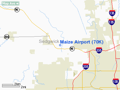
Maize Airport
Address:
Sedgwick County, KS
Tel:
316-733-2851
Images
and information placed above are from
http://www.airport-data.com/airport/70K/
We
thank them for the data!
|
General Info |
| Country |
United
States |
| State |
KANSAS
|
| FAA ID |
70K
|
| Latitude |
37-45-56.043N |
|
Longitude |
097-26-09.163W |
|
Elevation |
1336
feet |
| Near
City |
WICHITA/MAIZE/ |
We don't guarantee the information is fresh and accurate. The data may
be wrong or outdated.
For more up-to-date information please refer to other sources.
|
|


