 |
|
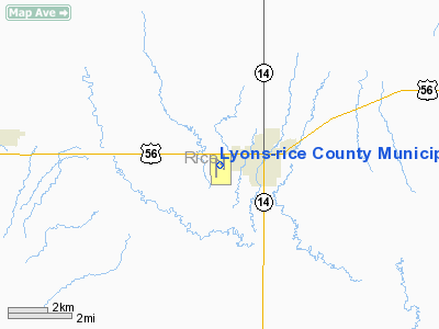
Lyons-rice County Municipal Airport |
|
|
|
Location &
QuickFacts
|
FAA
Information Effective: |
2008-09-25 |
|
Airport
Identifier: |
LYO |
|
Airport
Status: |
Operational |
|
Longitude/Latitude: |
098-13-36.7550W/38-20-34.0120N
-98.226876/38.342781 (Estimated) |
|
Elevation: |
1691 ft / 515.42 m (Surveyed) |
|
Land: |
110 acres |
|
From
nearest city: |
1 nautical miles W of Lyons, KS |
|
Location: |
Rice County, KS |
|
Magnetic Variation: |
06E (2000) |
Owner & Manager
|
Ownership: |
Publicly owned |
|
Owner: |
City Of Lyons And Rice Co |
|
Address: |
1458 W Hwy 56
Lyons, KS 67554 |
|
Phone number: |
620-257-5002 |
|
Manager: |
Bill Hoeffner |
|
Address: |
1458 W Hwy 56
Lyons, KS 67554 |
|
Phone number: |
620-257-5002 |
Airport
Operations and Facilities
|
Airport
Use: |
Open to public |
|
Wind
indicator: |
Yes |
|
Segmented Circle: |
Yes |
|
Control
Tower: |
No |
|
Lighting
Schedule: |
DUSK-DAWN |
|
Beacon
Color: |
Clear-Green (lighted land airport) |
|
Landing
fee charge: |
No |
|
Sectional chart: |
Wichita |
|
Region: |
ACE - Central |
|
Boundary
ARTCC: |
ZKC - Kansas City |
|
Tie-in
FSS: |
ICT - Wichita |
|
FSS on
Airport: |
No |
|
FSS Toll
Free: |
1-800-WX-BRIEF |
|
NOTAMs
Facility: |
ICT (NOTAM-d service avaliable) |
|
Federal Agreements: |
NGY |
Airport Communications
|
CTAF: |
122.800 |
|
Unicom: |
122.800 |
Airport Services
|
Fuel
available: |
100LL |
|
Airframe
Repair: |
MAJOR |
|
Power
Plant Repair: |
MAJOR |
|
Bottled
Oxygen: |
NONE |
|
Bulk
Oxygen: |
NONE |
|
Runway Information
Runway 14/32
|
Dimension: |
1700 x 100 ft / 518.2 x 30.5 m |
|
Surface: |
TURF, Good Condition |
|
|
Runway 14
|
Runway 32
|
|
Longitude: |
098-13-42.0000W |
098-13-30.0000W |
|
Latitude: |
38-20-43.0000N |
38-20-29.0000N |
|
Elevation: |
1690.00 ft |
1680.00 ft |
|
Traffic
Pattern: |
Left |
Left |
|
Obstruction: |
35 ft ant, 700.0 ft from runway, 50 ft right of
centerline, 20:1 slope to clear |
30 ft trees, 1300.0 ft from runway, 43:1 slope to clear |
|
Runway 17L/35R
|
Dimension: |
2550 x 150 ft / 777.2 x 45.7 m |
|
Surface: |
TURF, Good Condition |
|
|
Runway 17L
|
Runway 35R
|
|
Longitude: |
098-13-30.0000W |
098-13-30.0000W |
|
Latitude: |
38-20-51.0000N |
38-20-26.0000N |
|
Elevation: |
1691.00 ft |
1680.00 ft |
|
Traffic
Pattern: |
Left |
Right |
|
Displaced
threshold: |
250.00 ft |
0.00 ft |
|
Obstruction: |
16 ft road, 50.0 ft from runway, 3:1 slope to clear
APCH RATIO 21:1 TO DSPLCD THR. |
, 50:1 slope to clear |
|
Runway 17R/35L
|
Dimension: |
2999 x 50 ft / 914.1 x 15.2 m |
|
Surface: |
ASPH, Good Condition |
|
Weight Limit: |
Single wheel: 4000 lbs. |
|
Edge Lights: |
Low |
|
|
Runway 17R
|
Runway 35L
|
|
Longitude: |
098-13-43.0400W |
098-13-42.7230W |
|
Latitude: |
38-20-43.9170N |
38-20-14.2680N |
|
Elevation: |
1691.00 ft |
1680.00 ft |
|
Alignment: |
127 |
127 |
|
Traffic
Pattern: |
Right |
Left |
|
Markings: |
Basic, Good Condition |
Basic, Good Condition |
|
Obstruction: |
17 ft road, 750.0 ft from runway, 32:1 slope to clear |
, 50:1 slope to clear |
|
Radio Navigation Aids
|
ID |
Type |
Name |
Ch |
Freq |
Var |
Dist |
|
LYO |
NDB |
Lyons |
|
386.00 |
06E |
0.3 nm |
|
MPR |
NDB |
Mc Pherson |
|
227.00 |
06E |
25.4 nm |
|
HIL |
NDB |
Hilyn |
|
338.00 |
08E |
31.9 nm |
|
LQR |
NDB |
Larned |
|
296.00 |
08E |
41.5 nm |
|
PTT |
NDB |
Pratt |
|
356.00 |
07E |
44.6 nm |
|
EWK |
NDB |
Newton |
|
281.00 |
06E |
48.0 nm |
|
HUT |
VOR/DME |
Hutchinson |
115X |
116.80 |
09E |
25.0 nm |
|
SLN |
VORTAC |
Salina |
118X |
117.10 |
07E |
45.1 nm |
|
ICT |
VORTAC |
Wichita |
085X |
113.80 |
07E |
47.1 nm |
Remarks
-
ULTRLIGHT
ACTIVITY ON & INVOF ARPT.
Based Aircraft
|
Aircraft based
on field: |
10 |
|
Single Engine
Airplanes: |
8 |
|
Ultralights: |
2 |
Operational Statistics
Time Period: 2007-08-08 - 2008-08-06
|
Aircraft
Operations: |
231/Week |
|
General
Aviation Local: |
41.7% |
|
General
Aviation Itinerant: |
58.3% |
Lyons-rice County Municipal Airport
Address:
Rice County, KS
Tel:
620-257-5002
Images
and information placed above are from
http://www.airport-data.com/airport/LYO/
We
thank them for the data!
|
General Info |
| Country |
United
States |
| State |
KANSAS
|
| FAA ID |
LYO
|
| Latitude |
38-20-34.012N |
|
Longitude |
098-13-36.755W |
|
Elevation |
1691
feet |
| Near
City |
LYONS
|
We don't guarantee the information is fresh and accurate. The data may
be wrong or outdated.
For more up-to-date information please refer to other sources.
|
|


