 |
|
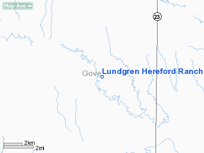
Lundgren Hereford Ranch Airport |
|
Location &
QuickFacts
|
FAA
Information Effective: |
2008-09-25 |
|
Airport
Identifier: |
9KS6 |
|
Airport
Status: |
Operational |
|
Longitude/Latitude: |
100-34-14.5000W/38-48-47.0450N
-100.570694/38.813068 (Estimated) |
|
Elevation: |
2600 ft / 792.48 m (Estimated) |
|
Land: |
0 acres |
|
From
nearest city: |
10 nautical miles SW of Gove, KS |
|
Location: |
Gove County, KS |
|
Magnetic Variation: |
09E (1985) |
Owner & Manager
|
Ownership: |
Privately owned |
|
Owner: |
Larry J Lundgren |
|
Address: |
Gove, KS 67736 |
|
Phone number: |
913-938-4404 |
|
Manager: |
Larry J Lundgren |
|
Address: |
Gove, KS 67736 |
|
Phone number: |
913-938-4404 |
Airport
Operations and Facilities
|
Airport
Use: |
Private |
|
Wind
indicator: |
Yes |
|
Segmented Circle: |
No |
|
Control
Tower: |
No |
|
Lighting
Schedule: |
PHONE REQ
FOR LIRL RWY 16/34 CALL 913-938-4404. |
|
Landing
fee charge: |
No |
|
Sectional chart: |
Wichita |
|
Region: |
ACE - Central |
|
Boundary
ARTCC: |
ZDV - Denver |
|
Tie-in
FSS: |
ICT - Wichita |
|
FSS on
Airport: |
No |
|
FSS Toll
Free: |
1-800-WX-BRIEF |
|
Runway Information
Runway 16/34
|
Dimension: |
2600 x 100 ft / 792.5 x 30.5 m |
|
Surface: |
TURF, |
|
Edge Lights: |
Low |
|
|
Runway 16
|
Runway 34
|
|
Traffic
Pattern: |
Left |
Left |
|
Radio Navigation Aids
|
ID |
Type |
Name |
Ch |
Freq |
Var |
Dist |
|
OEL |
NDB |
Oakley |
|
380.00 |
08E |
21.3 nm |
|
TQK |
NDB |
Scott City |
|
256.00 |
08E |
25.0 nm |
|
JDM |
NDB |
Wheatfield |
|
408.00 |
08E |
47.5 nm |
|
HLC |
VORTAC |
Hill City |
084X |
113.70 |
08E |
31.3 nm |
Remarks
-
E111: PRVDD THAT
THE APCH TO EACH RWY IS MNTND FOR A MNM 20:1 GLIDE SLOPE & THAT THE
TRANSITIONAL SFC BE MNTND FOR A MNM 7:1 SLOPE.
Based Aircraft
|
Aircraft based
on field: |
1 |
|
Single Engine
Airplanes: |
1 |
Lundgren Hereford Ranch Airport
Address:
Gove County, KS
Tel:
913-938-4404
Images
and information placed above are from
http://www.airport-data.com/airport/9KS6/
We
thank them for the data!
|
General Info |
| Country |
United
States |
| State |
KANSAS
|
| FAA ID |
9KS6
|
| Latitude |
38-48-47.045N |
|
Longitude |
100-34-14.500W |
|
Elevation |
2600
feet |
| Near
City |
GOVE
|
We don't guarantee the information is fresh and accurate. The data may
be wrong or outdated.
For more up-to-date information please refer to other sources.
|
|


