 |
|
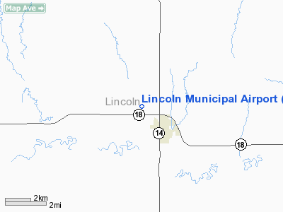
Lincoln Municipal Airport |
|
|
|
Location &
QuickFacts
|
FAA
Information Effective: |
2008-09-25 |
|
Airport
Identifier: |
K71 |
|
Airport
Status: |
Operational |
|
Longitude/Latitude: |
098-10-01.1900W/39-03-29.0230N
-98.166997/39.058062 (Estimated) |
|
Elevation: |
1412 ft / 430.38 m (Estimated) |
|
Land: |
80 acres |
|
From
nearest city: |
2 nautical miles NW of Lincoln, KS |
|
Location: |
Lincoln County, KS |
|
Magnetic Variation: |
07E (1985) |
Owner & Manager
|
Ownership: |
Publicly owned |
|
Owner: |
City Of Lincoln |
|
Address: |
143 E Lincoln
Lincoln, KS 67455 |
|
Phone
number: |
785-524-4280 |
|
Manager: |
Clay Haring
POST ROCK AVIATION; CLAY HARING. |
|
Address: |
Post Rock Aviation, Box 444
Lincoln, KS 67455 |
|
Phone number: |
785-524-5240 |
Airport Operations and Facilities
|
Airport
Use: |
Open to public |
|
Wind
indicator: |
Yes |
|
Segmented Circle: |
No |
|
Control
Tower: |
No |
|
Lighting
Schedule: |
DUSK-DAWN |
|
Landing
fee charge: |
No |
|
Sectional chart: |
Wichita |
|
Region: |
ACE - Central |
|
Boundary
ARTCC: |
ZKC - Kansas City |
|
Tie-in
FSS: |
ICT - Wichita |
|
FSS on
Airport: |
No |
|
FSS Toll
Free: |
1-800-WX-BRIEF |
|
NOTAMs
Facility: |
ICT (NOTAM-d service avaliable) |
Airport Communications
Airport Services
|
Fuel
available: |
100LLA
FOR FUEL AFTER HRS.
CALL
(785) 524-5240. |
|
Airframe
Repair: |
MINOR |
|
Power
Plant Repair: |
MINOR |
|
Bottled
Oxygen: |
NONE |
|
Bulk
Oxygen: |
NONE |
|
Runway Information
Runway 02/20
|
Dimension: |
2700 x 130 ft / 823.0 x 39.6 m |
|
Surface: |
TURF, Good Condition
RODENT ACTVTY ON RY CLOSELY MONITORED BY MGMT.
RODENT ACTVTY ON RY CLOSELY MONITORED BY MGMT. |
|
|
Runway 02
|
Runway 20
|
|
Traffic
Pattern: |
Left |
Left |
|
Obstruction: |
21 ft road, 75.0 ft from runway, 3:1 slope to clear |
18 ft road, 45.0 ft from runway, 2:1 slope to clear |
|
Runway 15/33
|
Dimension: |
2700 x 370 ft / 823.0 x 112.8 m |
|
Surface: |
TURF, Good Condition
RODENT ACTVTY ON RY CLOSELY MONITORED BY MGMT.
RODENT ACTVTY ON RY CLOSELY MONITORED BY MGMT. |
|
Edge Lights: |
Low |
|
|
Runway 15
|
Runway 33
|
|
Traffic
Pattern: |
Left |
Left |
|
Obstruction: |
18 ft road, 39.0 ft from runway, 2:1 slope to clear |
22 ft road, 75.0 ft from runway, 3:1 slope to clear |
|
Radio Navigation Aids
|
ID |
Type |
Name |
Ch |
Freq |
Var |
Dist |
|
CNK |
NDB |
Concordia |
|
335.00 |
06E |
38.2 nm |
|
LYO |
NDB |
Lyons |
|
386.00 |
06E |
42.8 nm |
|
MPR |
NDB |
Mc Pherson |
|
227.00 |
06E |
48.2 nm |
|
SLN |
VORTAC |
Salina |
118X |
117.10 |
07E |
26.7 nm |
|
TKO |
VORTAC |
Mankato |
035X |
109.80 |
10E |
45.2 nm |
Remarks
-
ARPT MAY NOT BE
ATNDD DURG PERIODS WHEN AGRICULTURAL ACTIVITIES ARE NOT CONDUCTED.
-
RODENT ACTVTY ON RYS 02/20 &
15/33.
-
PREDATES ACT.
Based Aircraft
|
Aircraft based
on field: |
6 |
|
Single Engine
Airplanes: |
6 |
Operational Statistics
Time Period: 2007-06-15 - 2008-06-13
|
Aircraft
Operations: |
275/Week |
|
General
Aviation Local: |
69.9% |
|
General
Aviation Itinerant: |
28.0% |
|
Military: |
2.1% |
Lincoln Municipal Airport
Address:
Lincoln County, KS
Tel:
785-524-4280,
785-524-5240
Images
and information placed above are from
http://www.airport-data.com/airport/K71/
We
thank them for the data!
|
General Info |
| Country |
United
States |
| State |
KANSAS
|
| FAA ID |
K71
|
| Latitude |
39-03-29.023N |
|
Longitude |
098-10-01.190W |
|
Elevation |
1412
feet |
| Near
City |
LINCOLN
|
We don't guarantee the information is fresh and accurate. The data may
be wrong or outdated.
For more up-to-date information please refer to other sources.
|
|


