 |
|
|
Location &
QuickFacts
|
FAA
Information Effective: |
2008-09-25 |
|
Airport
Identifier: |
SN68 |
|
Airport
Status: |
Operational |
|
Longitude/Latitude: |
097-18-37.1440W/37-52-45.0430N
-97.310318/37.879179 (Estimated) |
|
Elevation: |
1456 ft / 443.79 m (Estimated) |
|
Land: |
2 acres |
|
From
nearest city: |
6 nautical miles NE of Valley Center, KS |
|
Location: |
Sedgwick County, KS |
|
Magnetic Variation: |
07E (1990) |
Owner & Manager
|
Ownership: |
Privately owned |
|
Owner: |
Bradley K Smisor |
|
Address: |
2321 E 109 North
Valley Center, KS 67147 |
|
Phone
number: |
316-755-3222 |
|
Manager: |
L. Duane Life |
|
Address: |
621 Stone Creek Drive
Newton, KS 67114 |
|
Phone number: |
316-282-2566 |
Airport Operations and Facilities
|
Airport
Use: |
Private |
|
Wind
indicator: |
Yes |
|
Segmented Circle: |
No |
|
Control
Tower: |
No |
|
Sectional chart: |
Wichita |
|
Region: |
ACE - Central |
|
Boundary
ARTCC: |
ZKC - Kansas City |
|
Tie-in
FSS: |
ICT - Wichita |
|
FSS on
Airport: |
No |
|
FSS Toll
Free: |
1-800-WX-BRIEF |
|
Runway Information
Runway 18/36
|
Dimension: |
2300 x 60 ft / 701.0 x 18.3 m |
|
Surface: |
TURF, |
|
|
Runway 18
|
Runway 36
|
|
Traffic
Pattern: |
Left |
Left |
|
Displaced
threshold: |
500.00 ft |
0.00 ft |
|
Obstruction: |
25 ft pline, 25.0 ft from runway |
|
|
Radio Navigation Aids
|
ID |
Type |
Name |
Ch |
Freq |
Var |
Dist |
|
EWK |
NDB |
Newton |
|
281.00 |
06E |
11.3 nm |
|
IC |
NDB |
Piche |
|
332.00 |
07E |
19.4 nm |
|
EQA |
NDB |
El Dorado |
|
383.00 |
05E |
24.2 nm |
|
MPR |
NDB |
Mc Pherson |
|
227.00 |
06E |
33.4 nm |
|
EGT |
NDB |
Wellington |
|
414.00 |
07E |
33.6 nm |
|
IAB |
TACAN |
Mc Connell |
112X |
|
07E |
15.6 nm |
|
HUT |
VOR/DME |
Hutchinson |
115X |
116.80 |
09E |
30.4 nm |
|
ICT |
VORTAC |
Wichita |
085X |
113.80 |
07E |
15.3 nm |
|
ICT |
VOT |
Wichita |
|
114.00 |
|
15.7 nm |
Remarks
-
PROVIDED APCHS
ARE MAINTAINED FOR A 20:1 SLOPE & TRANSITIONAL SURFACES FOR A 7:1 SLOPE.
Based Aircraft
|
Aircraft based
on field: |
4 |
|
Single Engine
Airplanes: |
3 |
|
Ultralights: |
1 |
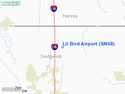
Lil Bird Airport
Address:
Sedgwick County, KS
Tel:
316-755-3222,
316-282-2566
Images
and information placed above are from
http://www.airport-data.com/airport/SN68/
We
thank them for the data!
|
General Info |
| Country |
United
States |
| State |
KANSAS
|
| FAA ID |
SN68
|
| Latitude |
37-52-45.043N |
|
Longitude |
097-18-37.144W |
|
Elevation |
1456
feet |
| Near
City |
VALLEY
CENTER |
We don't guarantee the information is fresh and accurate. The data may
be wrong or outdated.
For more up-to-date information please refer to other sources.
|
|


