 |
|
|
Location &
QuickFacts
|
FAA
Information Effective: |
2008-09-25 |
|
Airport
Identifier: |
45KS |
|
Airport
Status: |
Operational |
|
Longitude/Latitude: |
096-27-12.0300W/37-24-14.1060N
-96.453342/37.403918 (Estimated) |
|
Elevation: |
1250 ft / 381.00 m (Estimated) |
|
Land: |
10 acres |
|
From
nearest city: |
3 nautical miles N of Grenola, KS |
|
Location: |
Elk County, KS |
|
Magnetic Variation: |
06E (1985) |
Owner & Manager
|
Ownership: |
Privately owned |
|
Owner: |
K R Liebau |
|
Address: |
777 Rd 5
Grenola, KS 67346 |
|
Phone number: |
620-358-3486 |
|
Address: |
|
Airport
Operations and Facilities
|
Airport
Use: |
Private |
|
Wind
indicator: |
Yes |
|
Segmented Circle: |
Yes |
|
Control
Tower: |
No |
|
Sectional chart: |
Kansas City |
|
Region: |
ACE - Central |
|
Boundary
ARTCC: |
ZKC - Kansas City |
|
Tie-in
FSS: |
ICT - Wichita |
|
FSS Toll
Free: |
1-800-WX-BRIEF |
|
Runway Information
Runway 18/36
|
Dimension: |
2200 x 100 ft / 670.6 x 30.5 m |
|
Surface: |
TURF, |
|
|
Runway 18
|
Runway 36
|
|
Traffic
Pattern: |
Left |
Right |
|
Obstruction: |
|
20 ft pline, 200.0 ft from runway |
|
Radio Navigation Aids
|
ID |
Type |
Name |
Ch |
Freq |
Var |
Dist |
|
EQA |
NDB |
El Dorado |
|
383.00 |
05E |
28.4 nm |
|
EGT |
NDB |
Wellington |
|
414.00 |
07E |
45.0 nm |
|
PPF |
NDB |
Parsons |
|
258.00 |
06E |
45.3 nm |
|
CFV |
NDB |
Coffeyville |
|
212.00 |
05E |
46.1 nm |
|
PN |
NDB |
Ponca |
|
515.00 |
05E |
46.6 nm |
|
IC |
NDB |
Piche |
|
332.00 |
07E |
48.9 nm |
|
IAB |
TACAN |
Mc Connell |
112X |
|
07E |
41.0 nm |
|
BVO |
VOR/DME |
Bartlesville |
126X |
117.90 |
08E |
40.1 nm |
|
CNU |
VOR/DME |
Chanute |
029X |
109.20 |
05E |
43.1 nm |
|
ICT |
VOT |
Wichita |
|
114.00 |
|
48.8 nm |
Remarks
-
PROVIDED APCHS
ARE MAINT FOR A 20:1 GLIDE SLOPE AND TRSNL SFCS FOR A 7:1 SLOPE; RIGHT HAND
TFC PAT BE ESTABD FOR RWY 36.
Based Aircraft
|
Aircraft based
on field: |
2 |
|
Single Engine
Airplanes: |
2 |
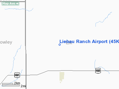
Liebau Ranch Airport
Address:
Elk County, KS
Tel:
620-358-3486
Images
and information placed above are from
http://www.airport-data.com/airport/45KS/
We
thank them for the data!
|
General Info |
| Country |
United
States |
| State |
KANSAS
|
| FAA ID |
45KS
|
| Latitude |
37-24-14.106N |
|
Longitude |
096-27-12.030W |
|
Elevation |
1250
feet |
| Near
City |
GRENOLA
|
We don't guarantee the information is fresh and accurate. The data may
be wrong or outdated.
For more up-to-date information please refer to other sources.
|
|


