 |
|
|
|
|
|
|
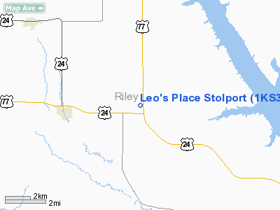
Location &
QuickFacts
|
FAA
Information Effective: |
2008-09-25 |
|
Airport
Identifier: |
1KS3 |
|
Airport
Status: |
Operational |
|
Longitude/Latitude: |
096-45-31.0310W/39-18-14.9870N
-96.758620/39.304163 (Estimated) |
|
Elevation: |
1350 ft / 411.48 m (Estimated) |
|
Land: |
30 acres |
|
From
nearest city: |
3 nautical miles E of Riley, KS |
|
Location: |
Riley County, KS |
|
Magnetic Variation: |
06E (1985) |
Owner & Manager
|
Ownership: |
Privately owned |
|
Owner: |
Flint Hills Flyers Corp |
|
Address: |
6521 West 71st Ave
Manhattan, KS 66503 |
|
Phone
number: |
785-776-5457 |
|
Manager: |
Kent Foster
TREASURER OF FLINT HILLS FLYERS CORP. |
|
Address: |
6521 West 71st Ave
Manhattan, KS 66503 |
|
Phone number: |
785-776-5457 |
Airport Operations and Facilities
|
Airport Use: |
Private |
|
Wind indicator: |
Yes |
|
Segmented Circle: |
No |
|
Control Tower: |
No |
|
Landing fee charge: |
No |
|
Sectional chart: |
Kansas City |
|
Region: |
ACE - Central |
|
Boundary ARTCC: |
ZKC - Kansas City |
|
Tie-in FSS: |
ICT - Wichita |
|
FSS on Airport: |
No |
|
FSS Toll Free: |
1-800-WX-BRIEF |
Airport Services
|
Airframe
Repair: |
NONE |
|
Power
Plant Repair: |
NONE |
|
Runway Information
Runway 04/22
|
Dimension: |
1000 x 30 ft / 304.8 x 9.1 m |
|
Surface: |
TURF, |
|
|
Runway 04
|
Runway 22
|
|
Traffic
Pattern: |
Left |
Left |
|
Runway 11/29
|
Dimension: |
1100 x 30 ft / 335.3 x 9.1 m |
|
Surface: |
TURF, |
|
|
Runway 11
|
Runway 29
|
|
Traffic
Pattern: |
Left |
Left |
|
Radio Navigation Aids
|
ID |
Type |
Name |
Ch |
Freq |
Var |
Dist |
|
MQD |
NDB |
Mc Dowell Creek |
|
391.00 |
06E |
12.7 nm |
|
CVY |
NDB |
Cavalry |
|
314.00 |
06E |
16.8 nm |
|
CYW |
NDB |
Clay Center |
|
362.00 |
07E |
19.3 nm |
|
DBX |
NDB |
Morrison |
|
212.00 |
06E |
30.5 nm |
|
MYZ |
NDB |
Marysville |
|
341.00 |
06E |
33.5 nm |
|
HRU |
NDB |
Herington |
|
407.00 |
06E |
36.8 nm |
|
CNK |
NDB |
Concordia |
|
335.00 |
06E |
44.1 nm |
|
FRI |
VOR |
Fort Riley |
|
109.40 |
06E |
20.6 nm |
|
MHK |
VOR/DME |
Manhattan |
039X |
110.20 |
06E |
10.4 nm |
|
SLN |
VORTAC |
Salina |
118X |
117.10 |
07E |
46.2 nm |
Remarks
-
E111 OPNS TO &
FROM WALTER ARPT SHALL BE CONDUCTED N OF HWY 24 & TO THE EAST OF THE
NORTH/SOUTH CTY ROAD ON THE WEST SIDE OF LAND SECTION 33 & 4; APCH TO EACH RWY
IS MAINTD FOR A MIN 20:1 GLIDE SLOPE & TRANSITIONAL SFC MAINTD FOR A 7:1
SLOPE.
Based Aircraft
|
Aircraft based
on field: |
1 |
|
Single Engine
Airplanes: |
1 |
Leo's Place Stolport
Address:
Riley County, KS
Tel:
785-776-5457
Images
and information placed above are from
http://www.airport-data.com/airport/1KS3/
We
thank them for the data!
|
General Info |
| Country |
United
States |
| State |
KANSAS
|
| FAA ID |
1KS3
|
| Latitude |
39-18-14.987N |
|
Longitude |
096-45-31.031W |
|
Elevation |
1350
feet |
| Near
City |
RILEY
|
We don't guarantee the information is fresh and accurate. The data may
be wrong or outdated.
For more up-to-date information please refer to other sources.
|
|


