 |
|
|
Location &
QuickFacts
|
FAA
Information Effective: |
2008-09-25 |
|
Airport
Identifier: |
SN03 |
|
Airport
Status: |
Operational |
|
Longitude/Latitude: |
100-00-55.4600W/39-37-46.0150N
-100.015406/39.629449 (Estimated) |
|
Elevation: |
2373 ft / 723.29 m (Surveyed) |
|
Land: |
45 acres |
|
From
nearest city: |
1 nautical miles NW of Lenora, KS |
|
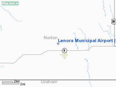
Location: |
Norton County, KS |
|
Magnetic Variation: |
08E (1985) |
Owner & Manager
|
Ownership: |
Publicly owned |
|
Owner: |
City Of Lenora |
|
Address: |
Lenora, KS 67645 |
|
Manager: |
Raymond Heikes |
|
Address: |
Box 331
Lenora, KS 67645 |
|
Phone number: |
913-567-4860
OR 913-567-4482. |
Airport Operations and Facilities
|
Airport Use: |
Private |
|
Wind indicator: |
No |
|
Segmented Circle: |
No |
|
Control Tower: |
No |
|
Landing fee charge: |
No |
|
Sectional chart: |
Wichita |
|
Region: |
ACE - Central |
|
Boundary ARTCC: |
ZDV - Denver |
|
Tie-in FSS: |
ICT - Wichita |
|
FSS on Airport: |
No |
|
FSS Toll Free: |
1-800-WX-BRIEF |
|
Federal Agreements: |
1 |
Airport Services
|
Airframe
Repair: |
NONE |
|
Power
Plant Repair: |
NONE |
|
Bottled
Oxygen: |
NONE |
|
Bulk
Oxygen: |
NONE |
|
Runway Information
Runway 08/26
|
Dimension: |
2400 x 148 ft / 731.5 x 45.1 m |
|
Surface: |
TURF, Good Condition |
|
|
Runway 08
|
Runway 26
|
|
Traffic
Pattern: |
Left |
Left |
|
Obstruction: |
17 ft tree, 425.0 ft from runway, 70 ft left of
centerline, 25:1 slope to clear |
5 ft fence, 0.0 ft from runway, 74 ft right of centerline |
|
Runway 15/33
|
Dimension: |
2010 x 190 ft / 612.6 x 57.9 m |
|
Surface: |
TURF, Good Condition |
|
|
Runway 15
|
Runway 33
|
|
Traffic
Pattern: |
Left |
Left |
|
Obstruction: |
2 ft hill |
2 ft hill, 0.0 ft from runway |
|
Runway 17/35
|
Dimension: |
2285 x 260 ft / 696.5 x 79.2 m |
|
Surface: |
TURF, Good Condition |
|
|
Runway 17
|
Runway 35
|
|
Traffic
Pattern: |
Left |
Left |
|
Obstruction: |
5 ft fence, 130 ft left of centerline |
2 ft hill, 0.0 ft from runway |
|
Radio Navigation Aids
|
ID |
Type |
Name |
Ch |
Freq |
Var |
Dist |
|
MCK |
FAN MARKER |
Mc Cook |
|
|
11E |
41.1 nm |
|
NRN |
NDB |
Norton |
|
230.00 |
08E |
14.8 nm |
|
OIN |
NDB |
Oberlin |
|
341.00 |
09E |
27.0 nm |
|
PHG |
NDB |
Phillipsburg |
|
368.00 |
08E |
34.0 nm |
|
CSB |
NDB |
Harry Strunk |
|
389.00 |
08E |
41.1 nm |
|
JDM |
NDB |
Wheatfield |
|
408.00 |
08E |
48.4 nm |
|
OEL |
NDB |
Oakley |
|
380.00 |
08E |
48.4 nm |
|
ADT |
NDB |
Atwood |
|
365.00 |
09E |
49.2 nm |
|
MCK |
VOR/DME |
Mc Cook |
100X |
115.30 |
08E |
43.6 nm |
|
HLC |
VORTAC |
Hill City |
084X |
113.70 |
08E |
24.3 nm |
Remarks
-
DEER ON & INVOF ARPT.
-
NO LINE OF SIGHT
BTN RY ENDS 08/26 OBSTD BY RISE IN CNTR OF RY.
-
HOLES 25 FT & 310
FT FM THR RY 17.
-
2 FT RISE AT CROP
LINE IN SIDES OF RYS.
-
EXISTED PRIOR TO 1959.
Operational Statistics
Time Period: 1995-09-05 - 1996-09-03
|
Aircraft
Operations: |
1/Month |
|
General
Aviation Itinerant: |
100.0% |
Lenora Municipal Airport
Address:
Norton County, KS
Tel:
913-567-4860, 913-567-4482
Images
and information placed above are from
http://www.airport-data.com/airport/SN03/
We
thank them for the data!
|
General Info |
| Country |
United
States |
| State |
KANSAS
|
| FAA ID |
SN03
|
| Latitude |
39-37-46.015N |
|
Longitude |
100-00-55.460W |
|
Elevation |
2373
feet |
| Near
City |
LENORA
|
We don't guarantee the information is fresh and accurate. The data may
be wrong or outdated.
For more up-to-date information please refer to other sources.
|
|


