 |
|
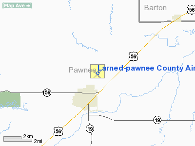
Larned-pawnee County Airport |
|
|
|
Location &
QuickFacts
|
FAA
Information Effective: |
2008-09-25 |
|
Airport
Identifier: |
LQR |
|
Airport
Status: |
Operational |
|
Longitude/Latitude: |
099-05-09.5000W/38-12-30.9000N
-99.085972/38.208583 (Estimated) |
|
Elevation: |
2011 ft / 612.95 m (Surveyed) |
|
Land: |
198 acres |
|
From
nearest city: |
2 nautical miles N of Larned, KS |
|
Location: |
Pawnee County, KS |
|
Magnetic Variation: |
08E (1985) |
Owner & Manager
|
Ownership: |
Publicly owned |
|
Owner: |
Larned & Pawnee County |
|
Address: |
Box70
Larned, KS 67550 |
|
Phone
number: |
620-285-8500 |
|
Manager: |
Gary Shelton |
|
Address: |
Rr#1 Box 145b
Larned, KS 67550 |
|
Phone number: |
620-285-8580 |
Airport Operations and Facilities
|
Airport
Use: |
Open to public |
|
Wind
indicator: |
Yes |
|
Segmented Circle: |
Yes |
|
Control
Tower: |
No |
|
Lighting
Schedule: |
DUSK-DAWN
ACTVT MIRL RY 17/35; PAPI & REIL RYS 17 & 35 - CTAF. |
|
Beacon
Color: |
Clear-Green (lighted land airport) |
|
Landing
fee charge: |
No |
|
Sectional chart: |
Wichita |
|
Region: |
ACE - Central |
|
Boundary
ARTCC: |
ZKC - Kansas City |
|
Tie-in
FSS: |
ICT - Wichita |
|
FSS on
Airport: |
No |
|
FSS Toll
Free: |
1-800-WX-BRIEF |
|
NOTAMs
Facility: |
ICT (NOTAM-d service avaliable) |
|
Federal Agreements: |
NGY |
Airport Communications
|
CTAF: |
122.800 |
|
Unicom: |
122.800 |
Airport Services
|
Fuel
available: |
100LLA
FUEL AVBL 24 HRS WITH CREDIT CARD. |
|
Bottled
Oxygen: |
NONE |
|
Bulk
Oxygen: |
NONE |
|
Runway Information
Runway 04/22
|
Dimension: |
3176 x 170 ft / 968.0 x 51.8 m |
|
Surface: |
TURF, Good Condition |
|
|
Runway 04
|
Runway 22
|
|
Longitude: |
099-05-24.6723W |
099-04-56.5203W |
|
Latitude: |
38-12-14.9250N |
38-12-37.1013N |
|
Elevation: |
2009.00 ft |
2008.00 ft |
|
Alignment: |
45 |
127 |
|
Traffic
Pattern: |
Left |
Left |
|
Obstruction: |
15 ft road, 250.0 ft from runway, 16:1 slope to clear |
300 ft tower, 7000.0 ft from runway, 23:1 slope to clear |
|
Runway 12/30
|
Dimension: |
3083 x 180 ft / 939.7 x 54.9 m |
|
Surface: |
TURF, Good Condition |
|
|
Runway 12
|
Runway 30
|
|
Longitude: |
099-05-26.4072W |
099-04-59.2153W |
|
Latitude: |
38-12-36.7759N |
38-12-15.1293N |
|
Elevation: |
2006.00 ft |
2006.00 ft |
|
Alignment: |
127 |
127 |
|
Traffic
Pattern: |
Left |
Left |
|
Obstruction: |
6 ft fence, 100.0 ft from runway, 16:1 slope to clear |
11 ft road, 200.0 ft from runway, 18:1 slope to clear |
|
Runway 17/35
|
Dimension: |
4201 x 75 ft / 1280.5 x 22.9 m |
|
Surface: |
CONC, Good Condition |
|
Weight Limit: |
Single wheel: 12500 lbs.
Dual wheel: 12500 lbs. |
|
Edge Lights: |
Medium |
|
|
Runway 17
|
Runway 35
|
|
Longitude: |
099-05-06.3668W |
099-05-06.2932W |
|
Latitude: |
38-12-59.0176N |
38-12-17.4884N |
|
Elevation: |
2010.00 ft |
2012.00 ft |
|
Alignment: |
127 |
127 |
|
Traffic
Pattern: |
Left |
Left |
|
Markings: |
Non-precision instrument, Good Condition |
Non-precision instrument, Good Condition |
|
Crossing
Height: |
40.00 ft |
36.00 ft |
|
VASI: |
2-light PAPI on left side |
2-light PAPI on left side |
|
Visual
Glide Angle: |
3.00° |
3.00° |
|
Runway End
Identifier: |
Yes |
Yes |
|
Obstruction: |
, 50:1 slope to clear |
14 ft road, 520.0 ft from runway, 22:1 slope to clear |
|
Radio Navigation Aids
|
ID |
Type |
Name |
Ch |
Freq |
Var |
Dist |
|
LQR |
NDB |
Larned |
|
296.00 |
08E |
0.3 nm |
|
HIL |
NDB |
Hilyn |
|
338.00 |
08E |
12.5 nm |
|
PTT |
NDB |
Pratt |
|
356.00 |
07E |
33.3 nm |
|
LYO |
NDB |
Lyons |
|
386.00 |
06E |
41.4 nm |
|
HYS |
VORTAC |
Hays |
041X |
110.40 |
10E |
39.4 nm |
|
DDC |
VORTAC |
Dodge City |
019X |
108.20 |
08E |
48.6 nm |
Remarks
-
INTXN RYS 04/22 &
12/30 SOFT WHEN WET.
-
RY 04/22 HAS
SEVERAL VARMIT HOLES AND MOUNDS
-
RY 12/30 HAS
SEVERAL VARMIT HOLES AND MOUNDS
Based Aircraft
|
Aircraft based
on field: |
14 |
|
Single Engine
Airplanes: |
13 |
|
Multi Engine
Airplanes: |
1 |
Operational Statistics
Time Period: 2007-08-08 - 2008-08-06
|
Aircraft
Operations: |
229/Week |
|
General
Aviation Local: |
59.7% |
|
General
Aviation Itinerant: |
40.3% |
Larned-pawnee County Airport
Address:
Pawnee County, KS
Tel:
620-285-8500,
620-285-8580
Images
and information placed above are from
http://www.airport-data.com/airport/LQR/
We
thank them for the data!
|
General Info |
| Country |
United
States |
| State |
KANSAS
|
| FAA ID |
LQR
|
| Latitude |
38-12-29.148N |
|
Longitude |
099-05-09.863W |
|
Elevation |
2011
feet |
| Near
City |
LARNED
|
We don't guarantee the information is fresh and accurate. The data may
be wrong or outdated.
For more up-to-date information please refer to other sources.
|
|


