 |
|
|
|
|
|
|
Location &
QuickFacts
|
FAA
Information Effective: |
2008-09-25 |
|
Airport
Identifier: |
36K |
|
Airport
Status: |
Operational |
|
Longitude/Latitude: |
101-15-19.3000W/37-58-10.2000N
-101.255361/37.969500 (Estimated) |
|
Elevation: |
3077 ft / 937.87 m (Estimated) |
|
Land: |
170 acres |
|
From
nearest city: |
2 nautical miles N of Lakin, KS |
|
Location: |
Kearny County, KS |
|
Magnetic Variation: |
09E (1985) |
Owner & Manager
|
Ownership: |
Publicly owned |
|
Owner: |
Kearny County |
|
Address: |
Lakin, KS 67860 |
|
Phone number: |
620-355-6422 |
|
Manager: |
Clifford Randolph |
|
Address: |
Box 479
Lakin, KS 67860 |
|
Phone number: |
620-355-7512 |
Airport
Operations and Facilities
|
Airport
Use: |
Open to public |
|
Wind
indicator: |
Yes |
|
Segmented Circle: |
No |
|
Control
Tower: |
No |
|
Lighting
Schedule: |
DUSK-DAWN |
|
Beacon
Color: |
Clear-Green (lighted land airport) |
|
Landing
fee charge: |
No |
|
Sectional chart: |
Wichita |
|
Region: |
ACE - Central |
|
Traffic
Pattern Alt: |
823 ft |
|
Boundary
ARTCC: |
ZKC - Kansas City |
|
Tie-in
FSS: |
ICT - Wichita |
|
FSS on
Airport: |
No |
|
FSS Toll
Free: |
1-800-WX-BRIEF |
|
NOTAMs
Facility: |
ICT (NOTAM-d service avaliable) |
|
Federal Agreements: |
N |
Airport Communications
Airport Services
|
Fuel
available: |
100LL |
|
Airframe
Repair: |
NONE |
|
Power
Plant Repair: |
NONE |
|
Bottled
Oxygen: |
NONE |
|
Bulk
Oxygen: |
NONE |
|
Runway Information
Runway 02/20
|
Dimension: |
2600 x 90 ft / 792.5 x 27.4 m |
|
Surface: |
TURF, Poor Condition
ROUGH & UNEVEN. |
|
|
Runway 02
|
Runway 20
|
|
Longitude: |
101-15-20.0000W |
101-15-01.5800W |
|
Latitude: |
37-58-01.3400N |
37-58-22.5100N |
|
Traffic
Pattern: |
Left |
Left |
|
Obstruction: |
, 50:1 slope to clear |
32 ft pline, 420.0 ft from runway, 100 ft left of
centerline, 13:1 slope to clear |
|
Runway 14/32
|
Dimension: |
3400 x 40 ft / 1036.3 x 12.2 m |
|
Surface: |
ASPH, Good Condition
ROUGH & UNEVEN. |
|
Edge Lights: |
Medium |
|
|
Runway 14
|
Runway 32
|
|
Longitude: |
101-15-35.4600W |
101-15-16.2700W |
|
Latitude: |
37-58-23.8300N |
37-57-53.8300N |
|
Traffic
Pattern: |
Left |
Left |
|
Markings: |
Nonstandard, Fair Condition
14/32 NSTD MARKINGS; INCORRECT SPACING, FADED & NARROW WIDTH.. |
Nonstandard, Fair Condition |
|
Obstruction: |
, 50:1 slope to clear
15 FT ROAD 50 FT FROM THLD. |
10 ft road, 250.0 ft from runway, 5:1 slope to clear
PVT ROAD 50 FT FM THR CONTROLLED BY ARPT. |
|
Radio Navigation Aids
|
ID |
Type |
Name |
Ch |
Freq |
Var |
Dist |
|
ULS |
NDB |
Ulysses |
|
395.00 |
09E |
23.0 nm |
|
GC |
NDB |
Pieve |
|
347.00 |
09E |
26.6 nm |
|
JHN |
NDB |
Bear Creek |
|
341.00 |
10E |
30.3 nm |
|
TQK |
NDB |
Scott City |
|
256.00 |
08E |
35.2 nm |
|
HQG |
NDB |
Hugoton |
|
365.00 |
09E |
48.8 nm |
|
GCK |
VORTAC |
Garden City |
080X |
113.30 |
11E |
25.3 nm |
Remarks
-
PUBLIC PHONE AVBL 24 HRS
620-355-6775.
-
EXISTED PRIOR TO 1959.
Based Aircraft
|
Aircraft based
on field: |
6 |
|
Single Engine
Airplanes: |
5 |
|
Ultralights: |
1 |
Operational Statistics
Time Period: 2006-08-23 - 2007-08-22
|
Aircraft
Operations: |
77/Week |
|
General
Aviation Local: |
87.5% |
|
General
Aviation Itinerant: |
12.5% |
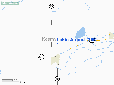
Lakin Airport
Address:
Kearny County, KS
Tel:
620-355-6422, 620-355-7512
Images
and information placed above are from
http://www.airport-data.com/airport/36K/
We
thank them for the data!
|
General Info |
| Country |
United
States |
| State |
KANSAS
|
| FAA ID |
36K
|
| Latitude |
37-58-10.070N |
|
Longitude |
101-15-19.610W |
|
Elevation |
3077
feet |
| Near
City |
LAKIN
|
We don't guarantee the information is fresh and accurate. The data may
be wrong or outdated.
For more up-to-date information please refer to other sources.
|
|


